« October 2017 | Main | December 2017 »
November 30, 2017
Day 18 [Thr 11/30/17] - Cucuyagua, Copan, Honduras to Tegucigalpa, Honduras
Update: I am alive and well and resting peacefully in the Excelsior Hotel in Tegucigalpa, Honduras.
Starting Odometer: 9,241
Ending Odometer: 9,512
Distance Traveled Today: 271 miles
Distance Traveled This Trip: 4,909 miles [9,512 - 4,603]
0......Cucuyagua, Honduras
216 Tegucigalpa, Honduras (5h 48m)
My trip today looks something like this.
I'm not clear how accurate the time estimates are on google maps, but it shows the first leg as 5h 48m, and the second leg as 2h 16m. So, maybe I can compare my time at the end of the day.
In the morning, I wake up at the hotel, and the guy next to me is playing something really loud. It always sounds like some guy on meth talking 100 miles a minute and who knows what he's saying. Noone knows and no one cares and I've about had enough of this shit. I go knock on his door and yell "silencio! silencio!" and after about 30 seconds, the racket stops.
And I go get back in my bed. I got enough sleep this morning. I woke up early, but was able to go back to sleep a couple of times. I need a lot of sleep. Not too much, mind you, but more than I have been getting.
I do my expenses in the morning, and then I start packing up to flee the scene. I look outside, and it's wet and rainy.
"Does it always rain like this?" I ask her.
"It's supposed to rain for 5 days," she replies.
LIke...great. I mean, it's not like I have any rain gear or anything. I really don't. Usually, when it rains, I just stop for lunch or drive up to a stranger's house, etc. But since this isn't the rainy season, I really hadn't planned on rain. Also, my Garmin Montana is waterproof, but my cell phone certainly isn't.
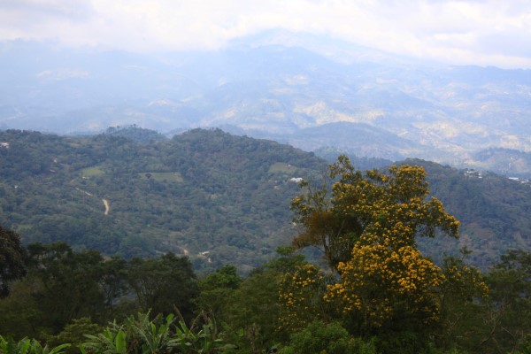
At approximately 11:20 a.m., local time, I'm driving through the mountains of Honduras and I see all of these trucks are stopped. Now I've seen this before. Just this long line of parked 18 wheelers, and who knows why this is? It's not my country. I have no idea what goes on here.
So I just start passing all of the trucks parked on the side of the road. As I get closer, I see National Guard types of soldiers with machine guns. Local police. I'm still thinking that what we have is a car crash. And, if I get up here to the front, I'll get some good photos.
I have my helmet cam rolling. And I'm getting closer and closer to the cause of this traffic jam.
Finally, I get to the heart of it. There's a civil protest under way. There's a fire burning in the streeets. People are marching about. Chanting. Waving flags. It's a fucking revolution, and I'm right in the heart of it.
I'm filming, of course, with my GoPro.
Someone notices this and screams, "hey camera...camera"
And I just keep riding. Like...I never stop. I just keep going.
But, I think that, at any second, the mob is going to turn on the gringo. Like...I was clearly bypassing their spontaneous roadblock.
But I just keep rolling and I think....what in the fuck is going on down here? I guess that, I always heard that the mountains were sort of where the revolutionaries hung up, but these people are stirred up, and they have me rattled in a huge way. I've never seen anything close to this in my life.
So I just keep rolling. Like...nothing is stopping me now. I'm seriously in fear for my life. So I just keep going, praying that I'll get away from this mob, and that no one has called ahead and said "stop the guy on the motorcycle with a helmet cam...don't let him off the mountain"
I'm seriously thinking this as I'm flying down the moutain, trying to escape this revolution that's unfolding around me.
But, after I've ridden for some time, I decide that I'll stop for lunch. I dunno where I am. In the middle of nowhere. And I stop and tell the woman...I don't what what I want...what do you have? And she ends up serving me some fried chicken with noodles. I didn't really like the noodles, but the fried chicken was delicious.
Also, she only had Pepsi to drink. So this is my lunch. Then, I get back on my bike and take off again. You understand that I'm still afraid for my life.
I'm still running in fear.
Now, the road to Tegucigalpa is pretty clear. I'm supposed to be following the highway.
But at some point, Waze tells me to turn around...I'm going the wrong direction. But I'm pretty sure I'm going the right direction. And, sure enough, Waze has fucked me again. It's routing to me some other Tegucigalpa (I'm not making this up), so I just turn it off and follow the road to Tegucigalpa. Fuck Waze.
Now, I come to a toll road, but the police wave me off, and won't let me enter the toll plaza. I assume that they're wanting to search me. Maybe someone called ahead from the revolution and told them to stop me. This is not fun. It's very scary dealing with these armed contingents when you're not used to dealing with them in the USA. Very intimidating. I pull over to the far right, and prepare to be searched. Why am I not wearing my money belt?
But, eventually, I realize that they just want me to ride on. The problem is that, in Honduras, the toll roads are free for motorcycles. But they don't want to you enter in one of the car lanes. You're supposed to just go around on the far right. OK. Got it.
Now, as I'm driving by this large lake, I see two other motorcycles stopped with saddle bags (panniers), which is extremely rare in Central America.
So, I immediately turn around and go back and look at the bikes. 2 BMW's with New Mexico license plates. WTF? Like...seriously...what are you people doing here?
So I just go into the restaurant and sit down and start talking to this couple (Michelle and M'hamed - mjebb@yahoo.com). They seem nice, and they've sort of dropped out and are doing an long slow ride through central america. I'm very surprised to see them. This is a gem. As rare as hen's teeth.
I explain to them about my experience with the near revolution this morning. Apparently, there was an election in Honduras this week, and it was very close. So close that the election results are being contested. So that's what I was seeing. They were protesting the election results this morning up in the mountains. That's why they had the road closed down.
They seem nice so, after lunch, they say they're heading to Tegucigalpa and I'm like..."Mind if I tag along?" Like...if you don't have a plan, then following people who do isn't a bad start.
So we leave, and when we come to the next toll booth, I just go around it to the right like I own the place. It takes them a minute to catch on, but eventually they follow me. Easy peasy.
We ride for some time...an hour or two...and the sun sets and now we're riding in the dark. Descending from the mountains into Tegucigalpa. But now there is a problem. The police have closed all of the roads into Tegucigalpa, except for one. Somehow, my riding comrades determine this from talking to a taxi driver. But he says he knows where the hotels are, and will lead us there.
There is a God.
So, we are now following this taxi driver through the streets of Tegucigalpa, towards some hotel, with fireworks going off. and police everywhere. Streets are shut down.
Finally, we pull up to this hotel....The Excelsior Hotel, and this place is fancy. Crazy expensive. Like $60 a night. Insane.
We park our motorcycles in the valet parking section at the front fo the hotel and they tell us to move them, but my new buddy says he's not moving his. Like...this is how he plays it. They tell him to move it and he never does. So, I go down and move mine so that it's not blocking any vehicles, and then we just leave the bikes there all night.
"Y'all come get me and we'll go for dinner or drinks...I'm in room 123," I tell them. And then I start getting cleaned up for dinner.
Posted by Rob Kiser on November 30, 2017 at 7:10 AM : Comments (7) | Permalink
November 29, 2017
Day 17 Photos [Wed 11/29/17] - Chiquimula, Guatemala to Cucuyagua, Copan, Honduras
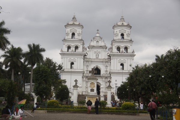
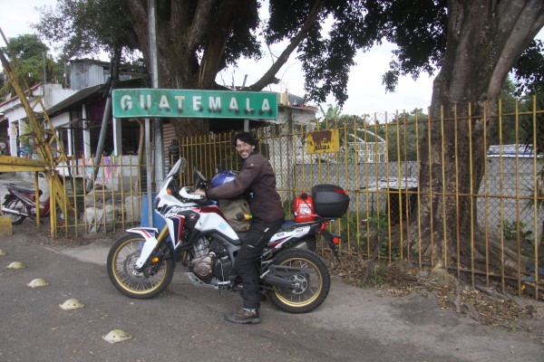
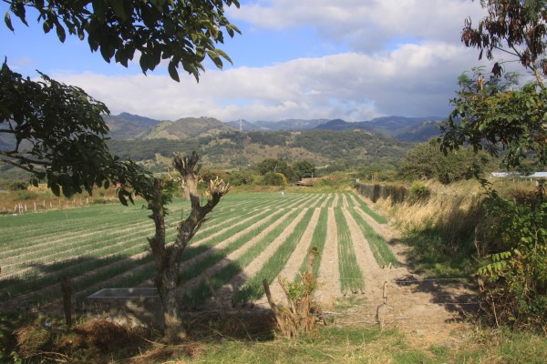
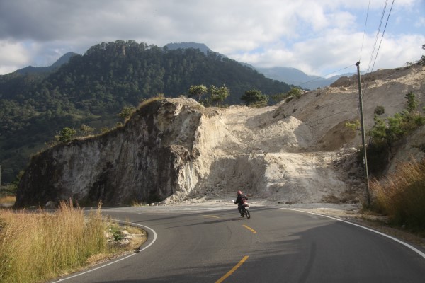
Additional photos in the extended entry.
Posted by Rob Kiser on November 29, 2017 at 6:52 PM : Comments (1) | Permalink
Day 16 Photos
More photos in the extended entry.
Continue reading "Day 16 Photos"
Posted by Rob Kiser on November 29, 2017 at 10:14 AM : Comments (0) | Permalink
November 28, 2017
Day 17 [Wed 11/29/17] - Chiquimula, Guatemala to Cucuyagua, Copan, Honduras
Starting Odometer: 9,159
Ending Odometer: 9,241
Distance Traveled Today: 82 miles
Distance Traveled This Trip: 4,638 miles [9,241 - 4,603]
0........Chiquimula, Guatemala
82......Cucuyagua, Honduras
189....Pito Solo, Honduras
My trip today looks something like this.
Day Something - Guatemala to Honduras
In the morning, my alarm goes off, and I just turn it off. Like, I'm not doing this any more. It's too much. I've dropped my motorcycle twice in the last 2 days. I'm not getting enough sleep. I need to be going 150 miles a day instead of 300. Crossing borders takes at least 1/2 of a day.
I wake up, upload my photographs. The method that I use to do this is very complicated, but not worth describing. And, oddly, even though I do it every day, I'm not getting any more proficient at it. Which is alarming, obviously.
I record my expenses. Not because it matters, really. Just because I feel like I need to. I want to create a trail of where I've been, as much as anything.
Continue reading "Day 17 [Wed 11/29/17] - Chiquimula, Guatemala to Cucuyagua, Copan, Honduras"
Posted by Rob Kiser on November 28, 2017 at 9:57 PM : Comments (2) | Permalink
November 27, 2017
Day 15 Photos
Additional photos in extended entry.
Continue reading "Day 15 Photos"
Posted by Rob Kiser on November 27, 2017 at 10:03 PM : Comments (0) | Permalink
Day 16 [Tue 11/28/17] - Ciudad Tecun Uman, Guatemala to Chiquimula, Guatemala
Update: I am alive and well and resting peacefully in the Vista Hermosa Hotel in Chiquimula while a car alarm repeatedly goes off right outside the front of the hotel and no one says a word or does anything about it.
Starting Odometer: 8,849
Ending Odometer: 9,159
Distance Traveled Today: 310 miles
Distance Traveled This Trip: 4,556 miles [9,159 - 4,603]
0......Ciudad Tecun Uman
150...Guatemala City
149... Esquipulas (299)
149....... Chiquimula(299)
My trip today looks something like this.
It's really strange to wake up and realize that I'm not in Mexico any more. That I'm not on the coast anymore. That I have a whole new currency to deal with. That there won't be any more Pemex stations. Now, I'll have to look for Shell. I wonder if they have ATM's in their gas stations down here? That would be nice.
The guy last night that was helping me across the border with my papers kept insisting that "you don't have to worry...this is guatemala...this is not mexico...you are safe here". And I kept thinking...you know....I've never once in my life heard someone say, "Mexico is a dangerous place, but if you ever get the chance to go to Guatemala, it's like paradise". I've never heard anyone say that. Ever. Not once.
In the morning, I get up and record my expenses. I meticulously record them every day, in different currencies, so that I have some idea of how much this trip is costing me. Also so that I can remember where I've been, etc.
Every morning, I go through my maniacal ritual of checking out, You have to be very meticulous or you'll leave something behind. One thing you do is make your bed, roughly. Like...make sure that you can find something in the bed if it's there. I found a USB cable I nearly left at one point doing this. Check all of the outlets (for camera battery chargers). Check every room. Leave no stone left unturned. All of this matters.
Last night, the hotel clerk ordered my dinner for me, and when she brought it to me, I had $10,000 in U.S. currency spread out on the bed. (I was drying it out). She didn't say a word.
Chicken soup with rice - Maurice Sendak
Decide to check my tire pressure at the hotel. Realize that the pressure gauge I have is not for tire pressure. Probably for fork pressure or something specialized like that. So I'll pick up a tire pressure gauge today. But this is after I put the tire pressure gauge on the tire, and let some air out. So now, my tire is even lower.
When I leave town, the roads in Guatemala are just the worst I've ever seen in my life. Like, literally the worst paved road I've ever driven down in my life. Much worse than the Dalton Highway. You're driving down the road, and the potholes are like 9"-12" deep, and they're everywhere. So, ideally, you follow another motorcycle, because he probably knows the road better than you, and you can see a path through the potholes.
But now, as I'm taking off across Guatemala, it occurs to me that not having enough air in my front tire is just an invitation to get a bent rim on the worst paved road in Central America. So, I'm riding down the road, and I see a place that does car tires on the side of the road. So I turn in, and start trying to explain to them that I want them to check my tire pressure. Dude isn't sure what I want, so he starts to wipe my front tire with a wet soapy rag, presumably to look for leaks. But I'm like...no...alto...And I go get the air pressure hose, and point it at the front tire.
Finally, he grasps what I want to do. I check the sticker on the frame, and it shows the front tire pressure should be 33 (I think?). This is a trick I learned from Adam at B&B Cycles. Many thanks, Adam!
So, he checks the pressure, and it says it's 27. So, he adds air in it until it's 33 psi.
And he won't take any money for it. Nicest guy on the planet.
I pull out and, at some point, in Tecun Uman,I see a fairly large store and, in Mexico, I came to realize that these larger businesses generally have ATM machines, aka "cajero automatico", which the Oxxo stations never have. So I pull up to the store and ask a man standing there if it has a cahero automatico. He says it does, and I go in and withdraw 1,000 Quetzal. So, now I've got some local currency at least.
Now, I'm driving down the road again, but at least my front tire is aired up. For the first 70 miles, it was the worst paved road I've ever driven on in my life. But occasionally, it would get better for like...a mile or two...then back to potholes. Finally, once I get close to Guatemala City, there's a toll road, and I pay the toll, and then, it was smooth sailing.
It really makes you marvel at how nice Mexico's roads are. They are WAY better than the roads in Guatemala. I wonder where they get the money?
Once I get to the outskirts of Guatemala City, I reprogram Waze to route me to Esquipulas today, however, Waze fucked me yet again. When I got to Guatemala City (they call it just "guatemala"), I punched in "Esquipulas", and started following the directions. The problems with Waze are just too many to go into, but let's start with this...it's not locked, at the time of installation, with North up. So, it's really a navigational tool for women, who don't grasp the concept of "North is up", and couldn't point north if you paid them on any given Sunday. So, this is the problem with Waze. It's designed for women.
Why does it matter, you ask? It fucking matters because you can spin waze around 180 degrees, so that South is Up and North is Down, which makes no fucking sense, but when you're lost in a 3rd world country, driving 150 miles the wrong direction would really, really suck.
And that's what very nearly happed to me today for a couple of reasons. 1) I don't have the maps for Guatemala loaded into the Garmin Montana 600. I figured that out after I crossed the border into Guatemala, and started riding. There just are no maps at all in the Garmin, and it's still world's above Waze. I kept my Garmin on all day because, even without maps, it says this: "Driving East". Which is WAY more information that I get out of that woman's toy called Waze.
So, at some point, I realize that a) it should only be 150 miles to Esquipulas, not 200 miles. So, the Esquipulas that Waze is routing to me is not the right Esquipulas. It's 200 miles west instead of 150 miles east. And because Waze has South pointing up, I very nearly rode 200 miles in the wrong direction.
Like...it's really weird because, Guatemala doesn't appear to have a road that follows the Pacific Coast. And so I'm just sort of bee-lining it for Panama City. I don't really have a game plan for how to get there. So, I spend some time eating lunch, and trying to figure out where I need to go next to get out of Guatemala, and into Honduras.
And for a while, my cell coverage goes out. And, when this happens, I'm pretty much screwed because, 1) I don't have any maps in my Garmin Montana 600 for this country and 2) Waze won't work if I don't have cell coverage.
So, Waze is kind of intermittent while I eat lunch, but eventually, I'm able to reprogram Waze to take me to Chiquimula instead of Esquipulas (the two towns are not very far apart, and this one Waze seems to know how to get to, and it's in the right direction. Thanks for that, Waze.)
After lunch, I decide to gas up before I leave Guatemala City because I'm low on fuel, and it's time for me to fill up and I also have nothing to drink on the bike because I drank all of my Jumex.
So I ride to a Shell station (no Pemex here) and gas up. I go inside and realize that they don't have Jumex and nearly break down in tears. (I love Jumex).
Then, as I'm leaving to get on the highway, I manage to drop the bike again. 2nd time in 2 days. I wasn't moving really. I was sort of trying to get onto the highway, and it just fell over. A guy rushed over from the gas station and helped me stand it up. I wasn't hurt, it's just because I'm so tired from riding all day I think.
So I ride all day, following Waze, but verifying with Garmin that I am, in fact, headed East.
I can tell that I'm going to be riding in the dark again, because Waze tells me what time I'll get there. So I'm really pushing it, trying to get to Chiquimula before dark.
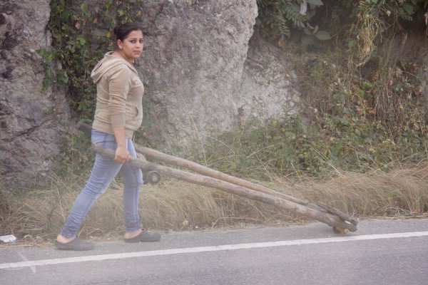
I didn't really shoot much at all today, because I was focused on getting in my 300 miles and I knew it would be close because the roads were so bad. But I saw a lot of people carrying bundles of sticks on their heads all day long.
And it's really fascinating to me that these people are even on the same planet with us. Like...I write software for a living, and these people carry sticks around to make a fire to cook their lunch. I'm reasonably sure that their life is better than mine. Maybe I should move down here.
Finally, it is solidly dark, and everyone is flashing their bright lights at me. They turn their brights on, then I turn my bright light on, and we pass each other. It's not fun, but it's where we are.
Finally, I roll into town, and it's dark.
I can't find a hotel room, and no one can understand my Spanish. So I write it down..."Donde hotel?" Like...I don't grasp why people could understand me in Mexico, but in Guatemala, they don't get one word of what I'm saying. Very frustrating.
A few people point me this way or that way. I'm completely lost and driving around, the wrong way down a one way street. Finally, I find a hotel. It doesn't have Air Conditioning, so I ask where the other hotels are. He tells me that this is, in fact, the only hotel in town. Then, I remember that I switched my target city from Esquipulas to Chiquimula because Waze is so fucking stupid, so I ended up in a town with just one motel, I think.
I ask her how much it is.
She quotes me a rate of 85 Quetzal. ($12 a night.) It's a little more than I'd wanted to spend, but OK. I have internet, and no A/C, but it's cool enough and I have 2 fans in the room.
When it's solidly dark, and surprisingly cool, I ride out into town wearing nothing but my swimsuit and tshirt. I look at the hotel carefully when I leave, so I can recognize it when I come back. It's easy for me to get disoriented in unfamiliar surroundings.
Ride down the road about a block and find a taco stand that's still open. Order the Hawaiian Tacos which comes with pineapple and a regular cocacola. Total cost is 25 Quetzal. ($3.00)
Posted by Rob Kiser on November 27, 2017 at 8:42 PM : Comments (0) | Permalink
November 26, 2017
Day 14 Photos
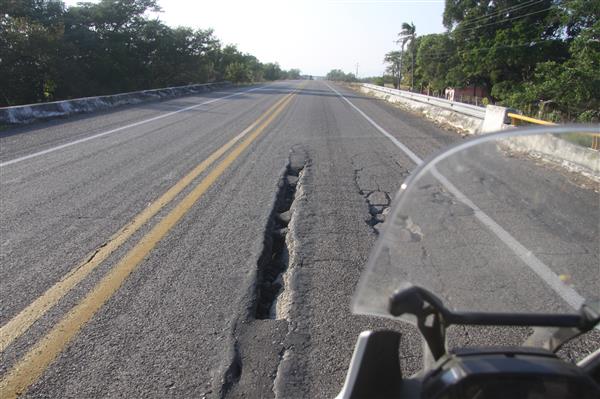
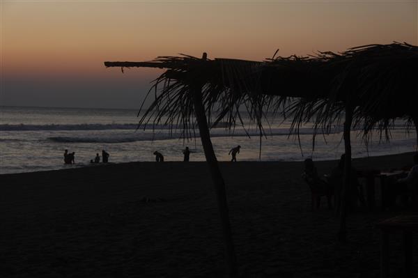
More photos in the extended entry.
Continue reading "Day 14 Photos"
Posted by Rob Kiser on November 26, 2017 at 10:34 PM : Comments (0) | Permalink
Day 13 Photos
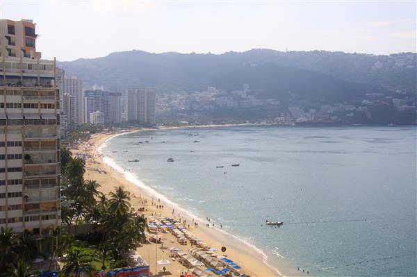
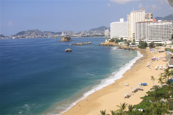
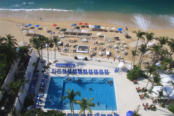
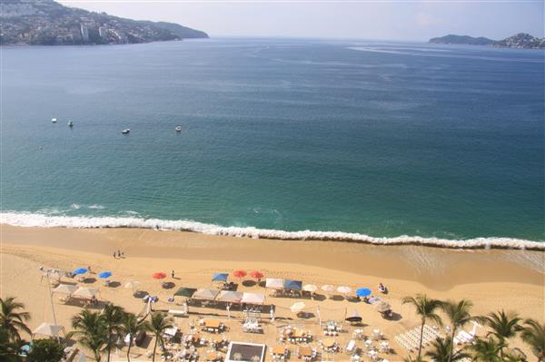
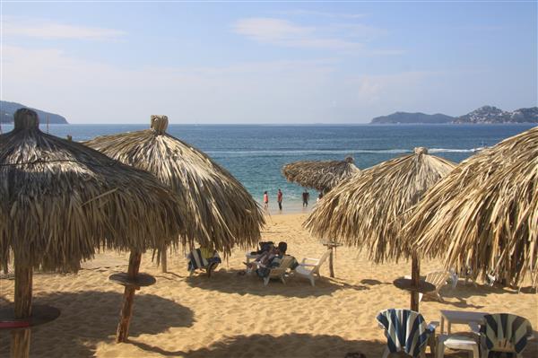
More photos in the extended entry...
Continue reading "Day 13 Photos"
Posted by Rob Kiser on November 26, 2017 at 9:12 PM : Comments (0) | Permalink
Day 15 [Mon 11/27/17] - Puerto Arista, Oaxaca to Ciudad Tecun Uman, Guatemala
Starting Odometer: 8,663
Ending Odometer: 8,849
Distance Traveled Today: 186 miles
Distance Traveled This Trip: 4,246 miles [8,849 - 4,603]
0........Puerto Arista, Oaxaca (0)
144....Tapachula, Chiapas (144)
42......Ciudad Tecun Uman(186)
My ride from today looks something like this.
Lord I feel like I should just cancel my trip, go home and take remedial spanish, and then come back should I ever learn the language. But I digress...
I wake up this morning, early. My alarm is set for 6:00 a.m. now, so I get up, get out of bed, and walk down to the beach. This is my morning ritual. And I kind of like it.
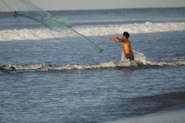
I'm down on the beach, watching the kids play, and a fisherman cast his net. The restaurants are all closed up now. The sun has just come up about maybe 30 minutes to an hour ago. But I am OK with this. It's not a competition. Just me trying to get a little more riding time in during the daylight hours, and getting an earlier start seems like a logical place to start.
It's sort of funny what you can do when you try. When you really put your mind to it. I think that, to me, that goes a long way to explaining what this journey is about. It's about seeing what you can do if you really try, instead of just laying around in bed like I usually do.
I remember when I started commuting. It never occured to me that it was even possible to get up at 4:00 a.m. to catch a flight. But once you start doing it, it's really not that hard. I'm not saying it's fun, or it's easy, or it's a great idea, but it is possible. And that's sort of what I'm trying to do on this trip, really. To see what is possible, if you really put your mind to it.
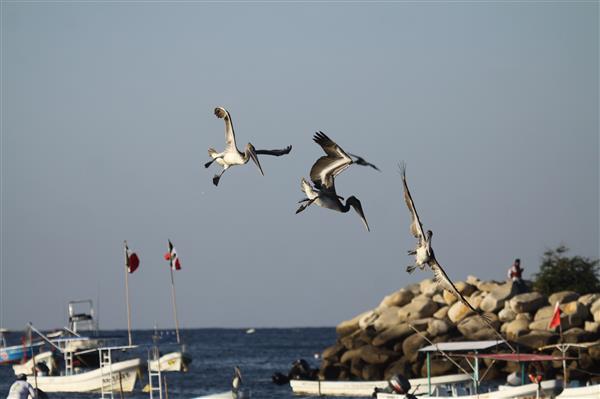
So I walk around on the beach some, shooting the pelicans and the sunrise. It's a beautiful beach. And you'll never talk to anyone that's even heard of this place. But it's beautfiul. Nothing wrong with it at all.
The fisherman casts his net, catches a bunch of fish that he wasn't intending to catch, it seems. And he pulls them from his net and just leaves them to die in the sand. The kids run about trying to put the fish back into the ocean. And when I walk past, I toss back in all of the fish that I can find. I have no qualms about eating meat, but killing fish just for the sake of doing it seems somewhat cruel.
I go back and check out of my hotel. Now I'm on the road again, and I get away fairly early.
Today, the winds are strong again, so strong that it seems too dangerous to ride a motorcycle in. A smarter person would stop, but I just ride on, chin down on the gas tank to lower my profile to the winds.
I gassed up the bike last night, so that's not an issue this morning. I just get up and run the bike and, after some distance, the winds finally die down, and now I focus on running the bike at 80 mph. I think that I chose 80 mph because less than 80 is too slow, and faster than 80 is too fast - too dangerous. And 80 seems like a good speed so that I can get some miles in today.
All day, I'm dodging potholes, chickens, goats, vultures, iguanas, wild pigs, street dogs, cows, horses...you name it. If you lose focus for one second, you're going to die. You have to constantly stay alert because, you start sort of focusing on something else for 1 minute, and suddenly you're going into a hairpin turn with a herd of goats in the middle of the road.
People always say that Mexico isn't safe, but it's not the drug lords you have to be afraid of. They're not after the tourists. It's the road hazards you have to watch out for. That, plus the traffic patterns down here are totally different.
When there is a shoulder, the traffic is much more complicated, and you have to constantly be watching for people to come into your lane, because this is how they drive down here.
By noon, I've gone over 100 miles. In fact, I've gone nearly 150 miles. So that means that I get to stop for lunch. That's my little carrot I put out there for myself. And it works well. It helps me stay focused.
It's really hard to describe the poverty down here. The saving grace is that the people are not starving. It's hard to fathom how they managed to build the roads. Who funded it and where did the money come from?
Every day, I see men clearing brush on the side of the road with machetes. And they often burn the brush on the side of the road, including trees. Because they're fighting an unwinnable war with the foliage, that is constantly threatening to overtake the roadways.
Occasionally, they'll have a mower that they can tilt and chop away at the trees with, but more often than not, they're just swinging machetes like it was 1840 again.
At some point, I come to a fake military check point.
There's a guy there, and he motions for me to stop, which is extremely unusual. They never ask me to stop. Never. But this guy motions for me to stop, and asks for me to present my Temporary Vehicle Import Permit, which I have, beacuse I'm in the country legally this time. So I show it to him. Then, he starts talking about how, when I get to the border, I have to turn this in to Aduana, and then they'll refund me the deposit that I put down when I got the permit to bring the bike into the country. And, he's right about this. That is how it works, and I'm glad he reminded me.
Then, he tells me that he needs to ride with me to the border, to process the paperwork. And I'm like....you're out of your fucking mind. That's certainly not going to happen. And I just pack up all of my papers and leave. So, that is sort of odd, and it's one of the strangest things to happen on this trip. He's reading from a piece of paper, and I ask him to show it to me so I can take a photo of it. And I have a photo of his little note card. Saying he wants to ride "in my car with me to the border", 45 minutes further down the road, and I'm on a motorcycle. Not a fucking chance, dude. Now I realize he's not anyone. He has no authority, and I get the fuck out of there. Very strange that this happened. Does not give me a warm fuzzy.
Just before I get to Tapachula, I stop for carne asado tacos in some little place in a town called Viva Mexico, in the Mexican state of Chiapas.
Paradas Continuas
As I'm eating lunch, these vans keep pulling up and stopping, and letting people out, and taking people in. The back of these vans says "Paradas Continuas" (Continuous Parade). And you can't fathom how many people they cram into a van. I can't imagine what it must be like inside of there.
My lunch of Carne Asado tacos and CocaCola (sin Azucar) cost me a total of $60 pesos. ($3.45 USD).
After lunch, I ride into Tapatchula and gas up.
I stop at some point and a woman is selling chilled cantaloupe juice on the side of the road. Delicious, but they're all drinking beer, and I feel like they're laughing at me, which I've never had happen on this trip, so I leave.
I'm now preparing to cross the border into another country, for the first time since I crossed into Mexico on Friday November 17th. So, I've been in the country for 11 days, I think.
But before I get to the crossing, I see a woman selling something on the side of the road, and I'm really thirsty today for whatever reason. I stop, and she's selling Hibiscus juice. Though that's not what she calls it. That's what they called it when they served it to us in Piste, earlier this year. Delicioso.
I get to the Mexican border town of Ciudad Hidalgo (or just 'Hidalgo'). My two GPS units are giving me wildly different directions on where to go. Finally, I realize that the Garmin is not trying to send me to even the right city, so I start following the Waze app, and eventually, I find the border crossing and go inside to Aduana. I hand him my Temporary Vehicle Import Permit, and he does some paperwork, and eventually says that my deposit will be refunded to me via my debit card. I'm not clear if that's true or not, but he says it will be refunded to me in a day or so.
I dunno what will happen really, but it's hard to call him a liar to his face.
So I leave, and try to drive into Guatemala. But they stop me at the border, and want to spray my bike with DDT. I remember this from the last time I was down here. So they spray my bike tires with DDT for whatever reason.
There's a money changer here at the border. The bible talks about these people. I have plenty of pesos, but no Guatemalan currency. I can't even remeber what it's called.
He quotes me a rate of 7:1, and I'll need the currency to get through Immigracion and Customs, apparently. I google it real quick, and his rate seems fair. So I hand him $50 USD, and in theory, I was supposed to get 350 Quetzal, but I think he only gave me 300. I dunno. I was so tired and hot I couldn't even speak, hardly. It's easy to make mistakes under these conditions.
Then, they ask to see my Passport, but I don't have an exit stamp from Mexico. So now, I've got to go back to Mexico, and as for an exit stamp.
So I go back across the river to Mexico and ask them to give me an exit stamp. I hand my passport to the guy, and he gives me some form to fill out, and I fill out the form sort of half-heartedly. He keeps asking quesiton and question and finally, gives me a bunch of paperwork, and then points to where I need to go to get the exit stamp that I need in my passport to get into Guatemala. So I drive up to the stop sign, get out, go up to an office, and finally I get the exit stamp that I need to get into Guatemala.
So now, I go back across the river into Guatemala, and I show them my exit stamp, and they've already sprayed my bike so it doesn't get sprayed again. Now, this guy starts telling me what all I need to get into Guatemala. Copies of my driver's license, registration, insurance, vehicle title, etc. So, I park my bike, and I go with this guy, and he takes me to a copy store where the guy makes copies of everything. (Many of these things I already have copies of, some I do not.) So we have copies of everything, and now this guy tells me where to go. Now, we have to go to another building. I've managed to get past Immigracion, but now I have to get through Aduana with all of this paperwork.
So, I go to turn my bike around and go about 1/2 a block, but it's so hot and I'm so tired, that I drop the bike. I'm not even moving. It just falls over, as I'm so exhausted I can hardly hold it up. Several people come rushing over to help stand the bike back up.
Now, I go into the next building (Aduanas) hand them my paperwork, and sit there for what seems like hours. I'm not sure how much time I wasted there, but it seems like Kafka's "The Trial". Like...you're just sitting there thinking....seriuosly people....WTF? It's 2017. What in the fuck could you possibly be doing.
And I'm so hot, there just aren't words. I'm sweating like a whore in church. Like...no one with any sense would try this. Smarter people fly into some destination, stay a week or two, and then fly home. Sadly, I am not this smart. So I'm sweating and it's so hot I could die.
Eventually, I realize that they're probably going to close the office before they've completed my paperwork, and I'll have to come back tomorrow. But finally, he gives me my paperwork that I need, and a sticker for the motorcycleta. I remember this sticker from my KTM....I knew I got it on that trip, and I always thought it was from Guatemala, but I was never sure. Also, this is where they do a serious VIN inspection, and it's the only country that they check the VIN in, as I recall.
So, by 5:30 p.m., they're finally done and I get on my bike and now, I'm legally in Guatemala, in the town of Ciudad Tecun Uman and I'm rolling through town at dusk, royally pissed that it took me half a day to get through these idiots' paperwork trap.
Now....Guatemala is markedly different than Mexico because, suddenly, I'm surrounded by countless little motor-scooters driving through the city of Tecun Uman so that I'm very concerned about crashing. Like...you thought it was dangerous in Mexico...you ain't seen nothing yet. Like fucking Mad Max on acid. There are scooters everywhere, moving unpredictably, like flies at a picnic. Mexico was nothing like this. Mexico was a cake walk compared to this.
And I head out of town, but the sun is about to set, and I really don't have time to make the next town, and I really hate how people flash their bright lights at me when I ride at night. So I turn back, and circle through the town looking for a hotel. But I can't really find one. I'm lost and tired and frustrated, and I stop and see a man on the side of the road, and he says he knows where there's a hotel in town with internet service.
And, I can't understand what he's saying at all, but he runs inside his apartment, comes back out, gets on his bike, and motions for me to follow him. So I'm following this guy on a bicycle, on my 2017 Honda Africa Twin, and he leads me to this hotel in town, the Hotel Arabe, and they have a room for the night, and they don't have hot water showers, but they have internet and A/C and I'm like....Good enough. Quanto Es?
200 Quetzal. I'm so exhausted that I can't do the math, so I get a calculator, and 200 Quetzal is about $29 USD, so I'm like....Good enough. I'm all in.
Now, I turn to my buddy who rode his bike down here to show me the hotel, and I hand him a 100 Quetzal note, about $14 USD. And he thanks me and rides home on his bicycle.
I go inside, do my laundry in the shower, and collapse into my hotel room (with three beds for some reason). Lord. Now I know why other people don't do this. Because they're smarter than me.
Posted by Rob Kiser on November 26, 2017 at 7:36 PM : Comments (1) | Permalink
Day 14 [Sun 11/26/17] - Puerto Escondido, Oaxaca to Puerto Arista, Oaxaca
Update: I am alive and well and resting peacefully in the Hotel El Dulcito on the shores of the Pacific Ocean in the seaside village of Puerto Arista, Chiapas, Mexico.
Starting Odometer: 8,345
Ending Odometer: 8,663
Distance Traveled Today: 318 miles
Distance Traveled This Trip: 4,060 miles [8,663 - 4,603]
0........Puerto Escondido (0)
157....Salina Cruz (157)
165....Puerto Arista (322)
Today my ride today looked something like this.
I'm lying here in bed at the Hotel El Dulcito, drinking Pinafiel fresa, eating fresh sliced mangoes from a street vendor. I bought Cruce del leche ($10 p) and Palanqueta de cagauate from a beach vendor here just now. Earlier today, I stopped for a coco fria (drinking the milk from a cold coconut hacked open with a machete by a street vendor). This morning, I bought something from a woman off the beach... a cup of warm milk (leche) con coco...sort of had like a sweet warm oatmeal at the bottom. It was the best.
So, all of this, is what I sort of do every day. I just dive in head first, eating and tasting everything around me, because we just don't get this in the United States. Or if we do, I'm not clear where.
And you should have seen me the first time I ever crossed the border into Mexico. i was so scared that I'd be killed there aren't words. The media had me so consumed with fear. But now, I'm all in. Like....deal the cards. i'm all in.
Today's ride was 100x better than the last two days. Today, I decided to do things differently, in a few ways. 1) I set my alarm clock for a lot sooner. I set my alarm for 6:00 a.m. because, if I'm going to have to ride all day, I may as well do it while the sun is up. And obviously, I was wasting a lot of daylight hours lying in bed in the mornings. 2) I rode inland instead of following the coast, and the roads inland were much faster.
So, this morning, I got up earlier, and I rode my bike down to the beach wearing pretty much nothing but my bathing suit. No helmet. No boots. No riding gear. Just barefoot, no helmet, riding the bike down to the beach. Park it, and see that the sun has just come up. And, big surprise, if you're into photography, the sunrise is just as good as the sunet.
All of these boats are on the beach, and there's a bazaar of sorts going on, where locals walk from boat to boat, checking out their catch. Apparently, they were out fishing all night, or very early this morning. And they pull their boats onto the beach, and the locals are walking around, buying fish from the fishermen.
And of course, I'm in the middle of it, walking around, shooting like a lunatic.
Like...why have I been missing this? How long have I been asleep?
I buy this warm milk drink from a woman on the beach. I'm not clear what it is. But it's like warm milk with coconut meat in it, and it's sort of like a warm sweet oatmeal at the bottom of the drink. Insanely good.
So I shoot some, eat some snacks from the vendor, and then wade back to the beach across a small lagoon of sorts.
Then ride back to the hotel. Everything looks different in the daylight, and I have a little concern that I won't be able to find my way back to my hotel, but I manage to drive back to it no problem.
I get all packed up, and finish up on tracking my daily expenses. A few things like this. And then I roll out of town, stopping at a Pemex and fill up the bike. When I gas up the bike, it is 9:26 a.m. I'm pretty sure that's a record for me on this trip.
Get up. Get out of bed. Get moving early. I'm going to have to do this if I'm going to have a chance of making Ushuaia.
In the morning, as I'm riding through the jungle, the air is very cool. And it makes me realize how stupid I've been to keep starting every day so late, that I've missed the best time to be riding...in the cool morning air. I could kick myself. It's so nice out this morning.
Now, for whatever reason, today the Waze app on my iPhone 6S Plus is as useless as tits on a bull. It won't give me directions to Puerto Arista. It says "oops something went wrong."
Waze...you fucking morons. Could you be a little more vague? "Something went wrong?"' I'm an adult. I can take it. Tell me what the fuck went wrong. I'm in a 3rd world country here with no maps. Fucking idiots.
Fortunately, I have my Garmin Montana 600, and he's solid. So, when the Waze app is useless, I follow the Garmin Montana, and he's steering me inland today.
So, I follow the route which doesn't really follow the coast today, at all really. Basically, I go inland, and then turn and run roughly south and east all day. The nice thing is that I'm now on a road where I can actually ride faster than 34 mph all day. So now, I just open the throttle and run at pretty good speeds all day...60-80 mph.
I try to get in my 100 miles before noon, but miss it by just a few minutes. So, this sort of pushes me back to not getting lunch until I've gone 150 miles. It's just some silly rules that I made up, but it does help me to get more miles in the day.
My first fillup after leaving Puerto Escondido is at the town of Salina Cruz. So I gas up, but decide to just keep riding, as I'm making good time, and I'm supposed to ride over 300 miles today, and I really don't want to finish in the dark again. I hate that everyone starts flashing their bright lights at me. Bastards.
Today, as we went inland, the winds picked up dramatically. The winds were blowing so hard that it nearly blew me off the road, and I'd have to duck down as low as I could get on the bike, with my chin nearly on the gas tank, just so I wouldn't get blown off the road. At times, I thought it might be too dangerous to continue, but of course I rode on.
At one point, I ride through this massive windmill farm. The largest I've ever seen in my life. And there are signs everywhere showing the winds blowing an 18 wheeler off the road, or tipping it over, warning the truckers of high winds.
I go through one town, at some point, and the guy is selling Coco Frios (Cold coconuts), and I'm like...."yeah...ok...let's try this".
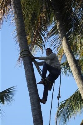
And he chops it open with a machete, and hands me a straw and a coconut. I think it was 15 pesos. And I drank the cold coconut milk. And, I mean, it's good. It's not quite as amazing as I'd hoped it would be. I certainly finished it all, but it's not like I'd died and gone to heaven or anything.
I was riding somewhere, this afternoon, and something either bit me, or stung me, on the back of my neck. I thought i was going to die. The closest thing I can think of owuld be if a wasp stung you on the back of your neck. Very painful, but I survived the encounter.
I look at all of the road signs, and I wonder what the mean. I take photos of a bunch of them, intending to document them in a separate post, and hopefully learn their intended message.
The Waze app never did really clue into what was going on. Not clear what was the issue with him. But the Garmin app was sold, and gave me good directions all day long. At some point, late in the day, we turned and headed back out to the coast, through the mountains, twisting unconscionably through the hills. But at least, all day, I was able to run at a good pace, instead of doing 30 mph all day like yesterday.
Also, by starting earlier, I was able to get to my destination before dark. So that was a HUGE plus.
I roll into the little seaside town of Puerto Arista and park at the first hotel I see.
I ask if he has a room for the night, but when I tell him it's for only one person, he says that he only has rooms for 2 people available. I sort of look around for my ghost to help out.
"Quanto es?" I ask him.
The double room is $400 pesos. So, that's about $20 USD.
"Done. I'll take it."
Now, I walk down to the beach.
Now, it goes without saying that no one you know has ever even heard of this beach. People that l talked to along the way have never even heard of it. But it's a nice, remote beach, and I walk down to the shore. There are kids playing. Eating dinner. Boats racing around. This is the Mexico that you're supposed to be afraid of.
And, of course, I'm just walking around, shooting like a lunatic. Shooting the setting sun. Today, I timed my ride perfectly. Much better ride than it has been the last few days.
So I guess the trick is to get up earlier. But that means I'm going to have to go to sleep sooner also, because otherwise, I'm going to fall asleep riding the bike and die.
"Where should I park my bike?" I ask him.
"Just pull it in here..." he offers.
So I just ride my bike into the hotel lobby like I own the place. No joke. I fucking love this country. If you rode your bike into a hotel lobby in the USA you'd be incarceraged. But here, it's just a friendly gesture.
"No hay problema, amigo?"
"No hay problema."
Finally, I'll also point out one of my observations on how locals greet each other down here. Normally, you would say "buenos dias" (good morning), or "buenos tardes" (good afternoon), or "buenos noches" (good evening). But I hear a lot of people down here just saying "bueno", an abbreviated version of "hello". And I've also heard people saying "bueno bueno". The nice thing about these abbreviated greetings is that you can say the same greeting all day long...it doesn't change with morning, afternoon, or night.
I think I'll start using this.
Posted by Rob Kiser on November 26, 2017 at 7:37 AM : Comments (0) | Permalink
November 25, 2017
Day 13 [Sat 11/25/17] - Acapulco, Guerrero to Puerto Escondido, Oaxaca
Update: I am alive and well and resting peacefully in the Habitaciones Villa on the shores of the Pacific Ocean in the seaside village of Puerto Escondido, Oaxaca, Mexico.
Starting Odometer: 8,084
Ending Odometer: 8,345
Distance Traveled Today: 261 miles
Distance Traveled This Trip: 3,481 miles [8,345 - 4,603]
(0 miles) Acapulco, Guerrero
(155 miles) Pinotepa Nacion (155 miles total)
(87 miles) Puerto Escondido, Oaxaca (242 miles total)
My ride today will look something like this.
Fools Rush In
In the morning, when my alarm goes off, I just turn it off and go back to sleep. I've decided that I'm not leaving. After spending a restful night in the nicest hotel room I've ever seen the inside of, I've decided that I'm not going anywhere. I'm tired of racing through the jungles all day. I've decided I want to swim in the ocean.
The room is unbelievable. I've never seen anything remotely like it. It's two stories, with both rooms facing the beach one side, and facing the mountains on the other side. So, from either level, you have panamoramic views of either the mountains or the ocean.
I put on my swimsuit and head down to the beach with nothing but a towel and my room key.
I put the room keys and my towel in one of the lounge chairs, and go for a swim in the ocean. The temperature is perfect. Not too hot. Not too cold. Just right.
The waves are a little bit rough. The bay is almost completely enclosed by land, but the waves are about equal to San Jose Del Cabo, IMHO. But I was able to get in and out of the ocean without drowning.
I check with the front desk, and they tell me that they're booked solid and don't have a room for me for tonight. Great. I'm in a world-famous resort community, on a Saturday, and somehow they're all booked up and I don't have a reservation. These are the perils of traveling by the seat of your pants. I never make reservations in advance, and for good cause. But this is the downside.
My problem with this journey is that I can't ride more than 300 miles a day. It's nearly impossible. The reason is that between the towns, the roads are, at times, winding, poorly maintained, or infested with livestock. Add to that the fact that you're going through some tiny town with massive speed bumps every 12 km, and you start to get the picture. The country is beautiful, in its own way, but it's nearly impossible to drive across.
After my swim, I return to my Penhouse Suite (PH2), dry off, and then start my daily tasks. Record my expenses, upload my photos, all of my silly daily tasks, and there are many. Then I go down to the bike, and oil the chain in the parking lot. I do this by riding in circles while spraying the chain with my left (clutch) hand. Somehow, I manage to do this without crashing.
Then, I have an issue to deal with. The cigarette lighter adapter that I ordered off of the internet for $10.00 stopped working yesterday. And, I'm not clear why. But, without it, my cell phone and my Garmin Montana GPS won't work all day. They'll only work for a few hours, then they stop working. Which is an issue, obviously.
So, I root around in my CC Filson tank bag and find 2 other cigarette lighter-to-USB adapters. (Don't say I didn't come prepared.) But when I plug these in, I get the same results. Nada. I know what the cigarette lighter adapter came with an inline fuse, so I decide to check the fuse. Lo and behold...it's gone. So, apparently this little plastic "box" that once had a fuse in it now no longer has a fuse. So I root around for my spare fuses and, yes I have several, so I put a fuse in and we're back in business. Problem solved.
A couple comes out into the parking lot. They are on the BMW motorcycle in front of mine. I tell them that I rode down from Colorado, and the dude nearly chokes.
Now, I'm so far from home that it starts to be fun to tell people where you're from. Like...very few people would ride a motorcycle 3,500 miles from home to come to some little tiny village in Mexico. They're both laughing.
Chain oiled. Fuse issue resolved. Now I head out of town, but as I'm leaving town I think, "Fuck....I forgot to gas up." LIke...this really is a journey for someone smarter than me. It really is. I'm clearly operating well beyond the normal boundaries of my abilities. Just because I'm attempting this journey doesn't mean that a) I'm qualified or b) it's a good idea to begin with. But this is where we are.
So I stop at the next Pemex I come to and I tell her, " Lleno rojo, por favor." This is what I say when I'm thinking clearly. It means "fill it up with premium". If you say "Lleno rojor" or "Lleno verde" and they know what to do. But when I'm really tired, I say "Rojo verde", which is literally "red green", because I'm so stupid I mix it up sometimes.
So I get away very late, due to the fact that I thought I was going to spend another night here.
I've planned a somewhat shorter route today of about 242 miles just because I'm so exhausted from riding every day. As usual, the first 50 miles is really slow with lots of curvy roads and lots of little towns. But after about 50 miles, it finally opens up some and I'm running about 70-80 mph whenever I can...between towns, of course.
Sometimes the road is really nice. Sometimes the road is really bad. I've seen potholes that would take the wheel off of a car.
In the town of Pinotepa
Because I got away so late, I won't stop until I've gone at least 150 miles. So, at Pinotepa, I've gone 160 miles, so I stop for gas. I now know how to ask for a receipt. "Recebo por favor". (Not clear the spelling is right, but that's what they say...Reseeboe).
So I get my receipt and then take off for Puerto Escondido. I can already tell that I'm not going to get there before dark, so I don't bother with eating breakfast or lunch. To be honest, I really don't eat much. At all. Ever.
So I'm screaming across the Mexican mainland. Skint back, going as fast as the road conditions allow.
But then, I slow down when I come into towns. In one town, this morning, God as my witness, I saw a man bend over and start drinking water from a puddle in a muddy/dirt road like a dog. I have never before seen this in my life. Not exactly uplifting, as it were.
I'm shooting occasionally, but not a lot. And I packed away my 100mm-400mm lens today. The reason is that there's not really room for them on my CC Filson tank bag, and one or the other keeps falling off. They don't go anywhere because they're strapped around my neck, but after juggling them all day long yesterday, it pissed me off enough that today, I packed away the 100-400. I hardly shoot it anyway, especially from the saddle.
Now, because I'm running so fast all day long, I try not to stop and take photos. I try to shoot form the saddle while I'm going down the road. And, at this one location, I see some nice palm trees, and I'm shooting from the saddle, riding with no hands, and when I look back in front of me, I'm in the wrong lane, and a car is about to hit me head on. Somehow, I move over a frew feet. He moves over a foot or two. And we miss each other by inches.
That scared me pretty good. I've been justifying my rolling photography in thinking that I'm saving time by not stopping, but it's certainly not worth dying over. So, either I'll have to stop more to take photos, or else I will just have to take less photos.
One other issue with the bike is that it seems to have a "coon hunting" headlight. Meaning, the headlight shines up too high, and once it gets dark, lots of poeple will flash their brights at me. At which time, I show them the fury. Like...you think that's bright....here....let me show you bright, sparky.
So, I really don't like riding at night because 1) it's dangerous and 2) my headlight is too bright. I will look online and see if there is an adjustment I can do to lower the headlight beam before I leave in the morning.
It also occurs to me that I need to start getting up earlier. At the equator, the sun rises and sets every day at 6:00 a.m. So, one solution is for me to get up at 6:00 a.m. and start getting ready for my day's ride, so that I can get away by 8:00 a.m. instead of 12:00 noon. That's one potential solution.
Now, we cross into the Mexican state of Oaxaca, and I notice that each state is different. The last state I was in they had signs everywhere saying "Curva Peligrosa", but now, there's really no signs at all to speak of. So now, you really have to pay attention because, if you're going into a curve, it might be a very sharp curve with no signage at all.
So I run skint back all day, and then it's solidly dark by 6:30 p.m., and I've still got about 30 minutes to go. So I ride in the dark for 30 minutes, although it's not something I like to do. It's not like I have a whole lot of options. I could stop in one of these smaller towns, and certainly they have rooms available, but I'm really wanting to see Puerto Escondido, because I had a couple tell me that it was a really cool place and I would like it. Some people I met on the road said this.
Finally I roll into town and I'm never real sure where to go, but I'm rolling around, looking for the giant hotels on the beach like in Acapulco, because I'd like to have another penthouse suite tonight. But I don't see any hotels like that really. I roll through town for a bit, and then I cross over a bridge, and I see a big hotel on the right (near the water), so I pull in and ask for a room for the night. $750 pesos. Ouch. That's almost $40 USD. Hmmmm. OK. I'll take it. Sold.
So I check in, and then roll around looking for dinner on my bike. What I find is an outdoor bazaar....or fair...not really sure what to call it. But there's a LONG sort of outdoor market where they sell all sorts of trinkets to tourists. This is like....one street off of the beach. Pretty cool little market. I walk down the length of it, and I see one guy is selling shirts that say "Puerto Escondido". I wnat to buy one, but everyone down here is 5'2" tall, and they've never even heard of a size "Extra Large".
I park my bike and sit down for dinner at a restaurant near this market.
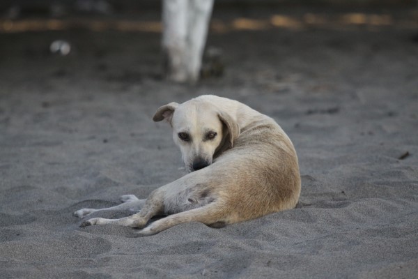
Stray dogs and homeless Mexicans come into the restaurant off the street to beg for food.
Some gringos walk by, and I call them out...."Like...how in the hell did Americans find out about this place?" I ask.
"We're Canadians," they reply.
"Oh....I'm sorry...I didn't know."
"We're from British Colombia," they offer.
I have met lots of Canadians from British Colombia on this trip. My theory is that they're so far north, it makes sense for them to winter down here. I see scads of them.
Then, this one guy starts telling me that they have this recycling program where they're recycling everything now and I'm like..."dude....I just rode my motorcycle 3,000 miles across Mexico, and they're burning piles of trash on the side of the road in every town I rode through. They're not recycling shit...unless you call "burning" - "recycling", which I guess in a way it is, but not a very pleasant one.
Then, the one guy starts telling me that I need ot be careful and all of this nonsense. And basically, what I say is this: "I'm fucking this bull...you just hold the horns." Like, I don't need white people painting their fears into me. I really don't. I've ridden my motorcyle alone through every country in Central America without a map - without a cell phone - and somehow I came out alive. And guess what? I don't need you telling me that I shouldn't be here...or shouldn't have my laptop....or my cell phone. Just STFU. Seriously. I'm doing just fine. I'm riding through the most dangerous states in Mexico and guess what? I'm going to make it. So, thanks for your concern, now STFU.
One of the Canadians says he's going to drive down to Costa Rica. I tell him that he'll be fine, just not to drive at night.
And he thanks me, and they leave.
Posted by Rob Kiser on November 25, 2017 at 10:11 AM : Comments (0) | Permalink
November 24, 2017
Day 12 Photos
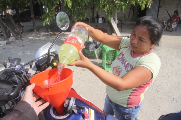
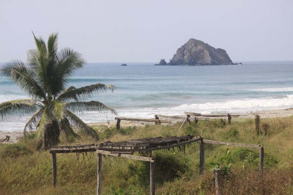
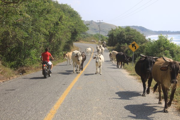
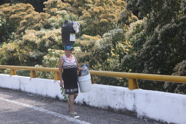
Continue reading "Day 12 Photos"
Posted by Rob Kiser on November 24, 2017 at 11:00 PM : Comments (0) | Permalink
Day 11 Photos
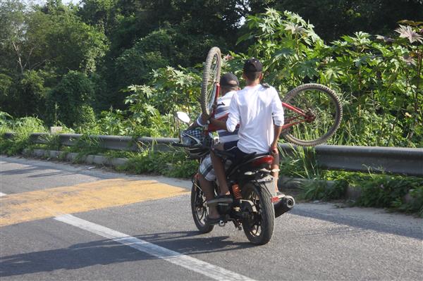
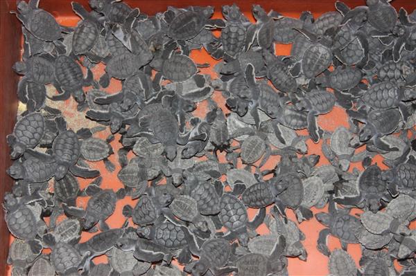
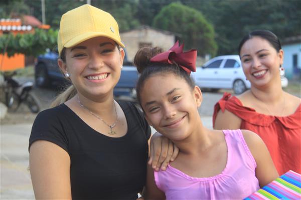
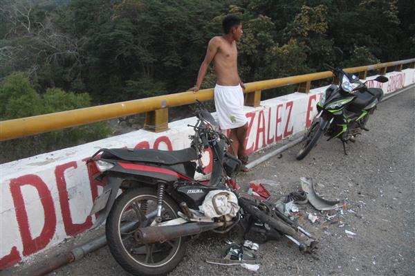
Additional photos in the extended entry.
Continue reading "Day 11 Photos"
Posted by Rob Kiser on November 24, 2017 at 8:06 AM : Comments (0) | Permalink
Day 12 [Fri 11/24/17] - Colola, Michoacán to Acapulco, Guerrero
I am alive and well and resting peacefully in the penthouse suite of the Hotel Elcano Acapulco in Acapulco, Guerrero, Mexico.
Starting Odometer: 7,753
Ending Odometer: 8,084
Distance Traveled Today: 331 miles
Distance Traveled This Trip: 3,461 miles [8,084 - 4,603]
(0 miles) Colola, Michoacán
(111 miles) Lázaro Cárdenas, Michoacán (111 miles total)
(61 miles) Zihuatanejo, Guerrero (172 miles total)
(158 miles) Acapulco, Guerrero (330 miles total)
My ride today will look something like this.
In the morning, the mosquitos carry me away from my cabana/cabinero/cabina. There's no air conditioning, which isn't a problem. But the mosquitoes are insane. So you sleep with this veil drooped over the bed to keep the bugs out. All night, they were waiting for me to wake up and serve them breakfast by moving the veil.
I get up and prepare to roll out of town.
Victor is rolling through town on his painted motorcycle. Always he is there, somehow.
I ask Victor....donde gasolina, amigo?
And he takes me around town, looking for the illicit locations that sell gasolina.
But the first one is closed. And the second one is out of gasoline.
Now, I'm about to roll out of town with about one gallon of gasoline in the tank (but still my 2.2. gallons of reserve in the red gas canister riding shotgun).
But then, Victor tells me this. In the next town you come to...in about diez o quince minutos....they have places that sell gasoline also. You will find them.
Do they have signs? Commo se llama signs?
Annuncions. No. No signs. But you will find them.
So, I take off for the next town, somewhat anxious about my gas situation. Yesterday, there were open Pemex stations everywhere, but now, there are none to be found.
At the next town, I see a sign that says "Gasolina"
And I pull over. I ask her to put in 14 liters, if I'm not mistaken.
So, she disappears into her little roadside shed and emerges with some plastic jugs and proceeds to pour the contents into my gas tank.
I turn on my bike, to see how full it is, and tell her to put in 2 more liters.
In the end she charged me $252 pesos for 14 liters of gasoline. So, I got 3.7 gallons of gas for $13.26,
So, she charged me $3.58 a gallon, which is a great deal when you consider the alternative....running out of fuel in a third world country known for drug smuggling.
But now the problem is that I'm following the coast, and just can not get over 30 mph. The road twists and turns and I'm never going to make it to Acapulco today at this rate. Not ever.
I try to remember what the signs mean as I ride. It would be nice to know what they say. What they're trying to warn me about. I understand them much better today than I did the first time I went through the Baja.
A herd of cows is walking down the highway, so I find myself driving through a herd of cows, and not a small one. Like..about 50-80 cows walking down the middle of the road, and bulls with horns, and I'm trying to figure out how to ride through them without getting killed. Somehow, I make it through, but it was not easy.
I see an abandoned Pemex station, and I stop to make some adjustments to my gear in the shade. This is what happens, it seems. They just abandon them and trash piles up in the place like a horror movie. In the USA, it would be torn down or a replaced by a new business. But not here. Just ghosts of failed ventures that live forever in perpetuity on the shoulder of the road.
At some point, I see a road leading down to the beach, and I roll down it to get some shots. It's a man's house, and I tell him I'm just taking photos. He tells me he used to work in the USA, but now he lives here. It's a stunning place. The police robbed him, recently. He says they broke into his house and stole $350 USD from him.
Hard to grasp how broken things really are down here. That's sad. Tragic.
But he tells me I can stay as long as I want and shoot. Or spend the night. It's no problem. But I ride on.
For some time, I have no cell coverage. So Waze is just sort of lost. But my GPS actually works fine, and shows the roads as I follow the coast. So, the Garmin is better when there's no cell coverage. And Waze is better when there is cell coverage.
After about 50 miles, the road gets somewhat better. And after I've gone about 80 miles, the road really opens up. Now, I can run triple digits, and I'm finally making some time. I decide not to stop for lunch at 100 miles, as I normally do, as I'm so far behind for today. Instead, I keep riding and decide to stop at 150 miles for the day's ride.
So I stop for carne asada at a roadside shack in some little town in the middle of nowhere. I'm on Mexico 200, following signs for Ixtapa Zihuatanejo. The town I'm in is Los Llanos de Temalhuacan. Lunch was less than $100 pesos ($5 USD). Coca Cola and carne asada for....survey says.....$70 pesos. So...$3.50 USD. Nice.
OK. I have to keep riding. 3:19 p.m.
[I mean...I'm not riding right now, obviously...I wrote this (above) at lunch. Am just trying to update my notes now. I'm going to get a shower because I'm absolutely filthy and seriously considering burning my clothes at this point.]
So basically, I ride all day. And the thing that gets me is that, in the United States, I could go 300 miles in 3 hours if I really wanted to. Just get on the interstate, open the throttle. In Utah, the speed limit is 85. So going 100 mph is just a rounding error, really.
But in Mexico, I'm stopping in every little town because of those fucking speed humps. Sometimes there are signs warning of them. Sometimes not.
And there are people crossing the road. So, you have these countless small towns, that impede your progress, and make what should be a simple goal of riding 300 miles a day nearly impossible. Nearly unobtainable.
I'm watching the clock, and watching the sun. I know I'm going to run out of daylight before I go 300 miles. I always do. Maybe I need to start getting up earlier. That's one option to consider.
My deeper concern is that I'm not going to be able to make it down to Tierra Del Fuego / Ushuaia before summer is over. If I can't even go 300 miles a day across Mexico, then I don't have a chance of making it down to Ushuai.
And my backup plan of running 1,000 miles a day if I get bored with the trip seems completely impossible now. Just a delusion, really.
Towards the end of the day, I'm able to open the throttle a little as we left the coast at some point. So I'm running balls-out trying to get to Acapulco before dark.
Before I get to Acapulco, for some reason, my cigarette lighter adapter quits working. It has a little blue light on it, that has gone dark for some reason. And now, my Garmin Montana 600 GPS is running only on batteries, and my cell phone dies completely.
My cell phone is dead, which means I can't use Waze. And I can't send texts. Or look for hotels on hotels.com. Or...anything, really.
I run out of daylight before I get to Acapulco. Finally, I roll into Acapulco when it is solidly dark, and start looking for hotel rooms. But guess what? It's Friday night.
And my cell phone won't work because it's dead from running Waze all day without getting recharged.
I stop at one hotel. No rooms. They send me across the street. No rooms.
I roll down to another hotel. No rooms. But now, I have a cab driver on my side. Oscar. Oscar is on the case. He knows where we can go and they will find me a hotel. So, one of the cab drivers offers to store my stuff in his trunk while we walk to a building to make a hotel reservation. I pass at the offer and carry my gear with me.
We walk in, and they talk for some time....Eventually, Oscar says....they won't let you stay in this one hotel that we looked at, because they want only people who are staying two nights. So, we can get you into this other hotel It is about 2 bocks away. They can put you in the Penthouse Suite.
"Quanto es?" I ask.
It is about $1,300.00 for the night.
"I'm like....fair enough. Let's get it." Like...sure....$65 a night sounds like a lot of money for a penthouse suite, but I'm exhausted from riding all day and I just want a place to crash for the night. Anything will work at this point.
So, the room is $1,300.00 for the night, but then I have to pay some $600 fee scam, so it ends up costing me about $100 for the night.
Oscar is trying to tell me that tomorrow, he wants me to take a different route instead of following the coast. It's faster and safer. And, I'm sure he's right. I haven't made a decision on my route tomorrow yet.
When we go to check in to the hotel, I tell him to come with me to find the place and help me check in. I'm so tired I don't even know what planet I'm on. So he helps me get checked in, and then I tell him that we need to go get me a Coca Cola light. And he's a cab driver, so we go to a nearby OXXO and we get drinks, which I gladly pay for.
He hands me his card and says to call if I need anything tomorrow.
And this is one of the greatest things about traveling. Finding people who will help you navigate through a foreign country. Huge help for him to get me a room, get me checked in, and take me for a Coca Cola light. He offers me lots of other things...women..etc, and I'm like....Oh no. I'm good. I'm going to crash for the night. I'll call you tomorrow if I need anything
Then, I get to the room. Top floor. Ocean facing. Huge penthouse suite on two levels. Really stunning. A home run.
I really don't want to get back on the bike tomorrow. I feel like I need to take a day off and check out Acapulco.
Posted by Rob Kiser on November 24, 2017 at 7:19 AM : Comments (0) | Permalink
November 23, 2017
Day 11 [Thur 11/23/17] - Puerto Vallarta, Jalisco to Colola, Michoacán
Update: I am alive and well and resting peacefully in a private cabaña in the seaside village of Colola, Mexico.
Starting Odometer: 7,455
Ending Odometer: 7,753
Distance Traveled Today: 298 miles
Distance Traveled This Trip: 3,150 miles [7,753 - 4,603]
Refueled: Rosamorada, Nayarit.
Odometer: 7,259
11.897 Liters
$196.06 pesos
1:35 p.m.
$16.479 Pesos per Liter
$3.34 US Dollars/Gallon
Today, I'll ride down the coast to Colola, Michoacan.
0 miles Puerto Vallarta.
100 miles - Chamela.
113 miles - (213 total) Tecoman
63 miles - (276 total) Colola
Ride looks something like this.
So, what's funny is how this ride worked out because, at the start of the day, I just sort of look for a place 300 miles down the coast to stop and spend the night.
So, I bring up a map of Mexico, and I see that Colola is about 300 miles (mas o menos) from Puerto Vallarta. And, I'm like, good enough. That works for me.
Also, I look for a town where I can refuel along the way. It sort of works out well if I can find a town that's 150 miles from where I start. I can fill up there, and then ride another 150 miles and stop for the night. So, ideally, I gas up every morning, and then I only have to stop one time for gas during the day. That's sort of how it works out, in an ideal situation.
But you understand that I really don't know where the Pemex stations are, necessarily. But I pass a lot of them every day, and it doesn't seem to be much of an issue, now that I'm oin the mainland, as opposed to the deserts of Baja.
Continue reading "Day 11 [Thur 11/23/17] - Puerto Vallarta, Jalisco to Colola, Michoacán"
Posted by Rob Kiser on November 23, 2017 at 7:38 AM : Comments (1) | Permalink
November 22, 2017
Day 10 [Wed 11/22/17] - Photos - Mazatlan, Sinaloa to Puerto Vallarta, Jalisco
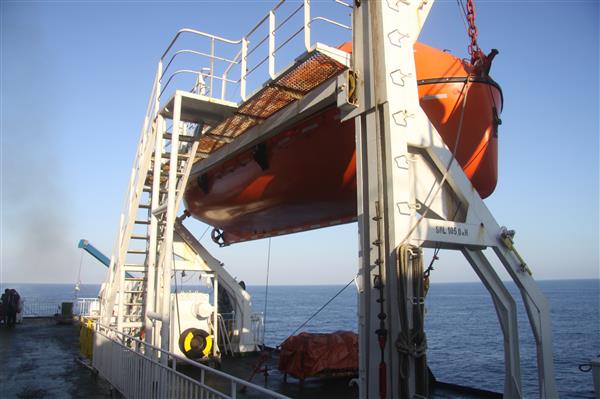
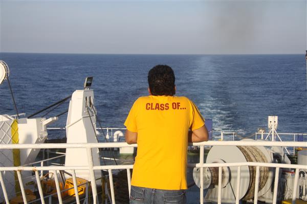
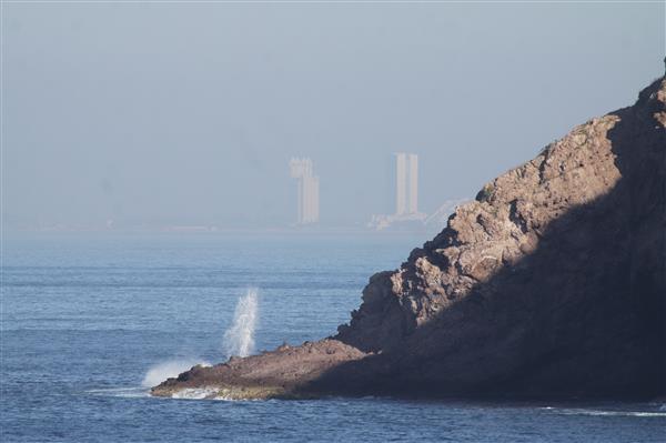
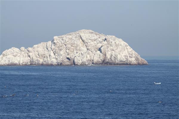
Additional photos in the extended entry.
Continue reading "Day 10 [Wed 11/22/17] - Photos - Mazatlan, Sinaloa to Puerto Vallarta, Jalisco "
Posted by Rob Kiser on November 22, 2017 at 11:49 PM : Comments (0) | Permalink
Day 9 [Tuesday 11/21/17] - Photos - La Paz and Baja Star
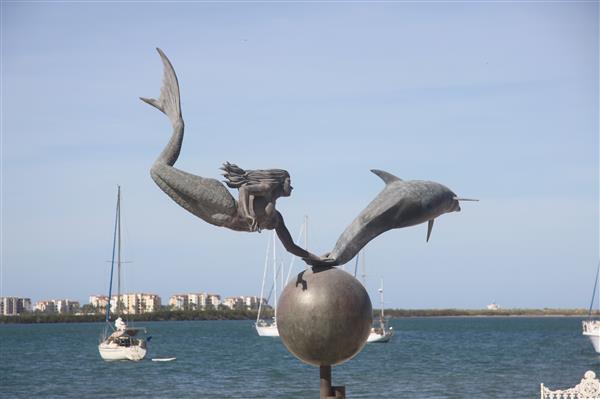
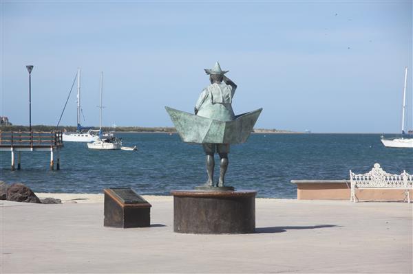
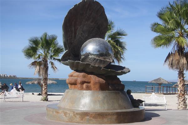
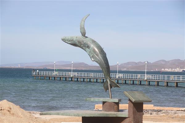
Additional photos in te extended entry.
Continue reading "Day 9 [Tuesday 11/21/17] - Photos - La Paz and Baja Star"
Posted by Rob Kiser on November 22, 2017 at 10:57 PM : Comments (0) | Permalink
Day 10 [Wed 11/22/2017] - Mazatlan, Sinaloa to Puerto Vallarta, Jalisco
I am alive and well and resting peacefully in the Comfort Inn on the shores of the Pacific Ocean in Puerto Vallarta, Mexico, in the Mexican state of Jalisco.
Starting Odometer: 7,131
Ending Odometer: 7,455
Distance Traveled Today: 324 miles
Distance Traveled This Trip: 2,852 miles [7,455 - 4,603]
Refueled: Rosamorada, Nayarit.
Odometer: 7,259
11.897 Liters
$196.06 pesos
1:35 p.m.
$16.479 Pesos per Liter
$3.34 US Dollars/Gallon
OK. So, the ferry ride across the Sea of Cortez was nice. And, by that, what I mean is that, once the ship got out of the harbor (yesterday evening) at Pichilingue, it started to rock just every-so-slightly which sort of made you think, "I'm on a boat, baby!"
The the ferry is a very cool place because, all of these adrenaline-junkie adventure riders are sort of throttled through this one chokepoint. And all of the motorcyclists have to wait to board after the cars and trucks board. So, we're all corralled out there in the parking lot, and all of these loose groups of Mad-Max-style adventure riders are sort of trading in the Baja ride for a ride on the mainland.
And, what's fascinating is that, all of these people are just like brothers, right? I mean...they don't all even speak the same languages. Some are from Europe. Some are from the mainland of Mexico. Some from Canada. Some from the USA. So, people from all over the world, park their bikes on Level C, tie them down with their tie-downs (cinchos). (Thanks Home Depot. So glad I had that trick figured out.)
And, now, dinner is served, and so we all meet up in the dining room, and paper maps are pulled out, and the conversation begins. Everyone is drawing out routes through Copper Canyon and across the longest bridge in North America. Routes through Monterey, Mexico City, Guadalajara, etc.
And, this is the best part, right? All of these adrenaline junkies are drinking CocaCola Light or beer, and pouring over maps. "No...this route is better here....Through the mountains...this is the best route. Beautiful scenery on this one here...."
And, you're just dying, right? Like...fuck yeah... I'm all in. Let's go..
And some poeple ask me to ride with them, but the problem is that it's really not the direction I'm heading. My plan is to follow the coast, and I'd really like to do that. So, I'm not against doing Copper Canyon, but it's not really going to fit into my trip this year. I'm going South. (And east). But not North.
So, I turn down the invitations to ride with some of the groups, though it was greatly appreciated, and would have been fun. I decided to continue on my own.
The problem is that everyone is sort of shoe-horned onto the same boat, but everyone is heading in roughly different directions once we disembark, it seems.
But the ideas that are floating around in this room are just amazing. Everyone brings different ideas and suggestions. My one buddy has a book called the Lonely Planet Travel Guide for Mexico, I think. And it shows you everything to do in the country. It's a thick book, but very cool in that it tells you what to do, instead of just sort of riding through like I do.
Another guy has installed some software called Google Drive, which allows him to see all of his documents from any computer. (iphone, laptop, etc.)
Every person I talk to has WhatsApp installed. Apparently, I'm the last person on earth not to be using it.
But, it's brilliant because, you're coming together with all of these other people and there's just this fusion of ideas and planning and problem solving, occurring in the dining room over dinner.
Really a lot of fun. Hard to describe, adequately.
I talk to one person on the ferry that's been from Deadhorse to Ushuaia (Tierra Del Fuego).
He pointed out that, once you get to Ushuaia, you then have to backtrack 1,800 miles to get to Santiago or Buenos Aires. Great. Thanks for that bit of information. Chin up, right boss?
So last night, I slept like a baby, and then got up this morning. Walked up on top, and took some photos as we came into port at Mazatlan.
Now, one of the reasons I'm folling the Pacific coast of Mexico on this trip is because I wanted to see if it was more like jungles, or more like Baja. I mean, sure, you could look at a map, but where's the fun in that.
As it turns out, initially, the Pacific coast was prety close to the deserts of Baja that we'd just left. But then, as I go south, it gets greener and greener and by the time I get to Puerto Vallarta, it's like a freaking jungle with canopy growing over the roads and forming little tunnels and such.
So, that's one of the things I was curious about.
Now...back to Mazatlan....as I'm driving out of Mazatlan, and riding south on Mexico 15, I think that I have a suggestion for Mexico. Pick one day a year, when there won't be any open fires burning in the desert. Just to see what it smells like in the rest of the world, without constant flames and clouds of smoke everywhere you go. You should try it. Just one day a year without fires. See if you like it when the air is not choked with smoke 24/7. Just as an experiment.
Now, it's very hot at this point. So, I'm wearing less and less clothing. I'm putting sunscreen on the backs of my hands and on my nose/cheekbones. Because you could get a nasty sunburn down here very easily.
Eventually, I put on my gloves (these are the gloves that go inside of my new Artic gloves/mittens, as I lost of my of my North Face gloves on the trip.)
So, I'm trying not to get sunburned, and I'm rolling down Mexico 15 towards Puerto Vallarta.
Now...I will point out that my mother-fucking Waze app on my iPhone 6S Plus will not route me to Puerto Vallarta. Why? I couldn't tell you. But there are at least 6 different Puerto Vallarta's in Mexico (good job fucking morons....maybe be a little more creative next time?)
So, I can NOT get the Waze app to route me to Puerto Vallarta. Eventually, I get it to route me to Sayulita, which is at least in the same Time Zone. Nice job, Waze. Seriously. Fuck. You.
I've only gone about 80-100 miles when I find myself rolling through this little town named El Rosario where they're grilling chickens on the street, just like in Piste. So, I decide to stop for lunch at Escuinapa de Hidalgo in El Rosario.
Then, I'm off again, heading down Mexico Highway 15. THis road doesn't really follow the coast, per se. It's more a road that runs inland. I'm not clear that there is a road that follows the coast really, and I just stay on this road and try to run about 75-85 mph all day, really.
Like, 300 miles a day doesn't sound like it's that hard, but it's a lot of driving. The whole time, you're dodging stray dogs, goats, cows, horses, chickens....you name it.
Plus, the traffic patterns in Mexico are completely different than anything you've ever experience the United States. Like...if a guy is coming at you, and he gets into your lane, instead of thinking "Why is this jackass getting in my lane," you need to start thinking "Why is he coming into my lane?" Because, in Mexico, there can be dozens of reasons he's getting into your lane. Maybe:
1) Because there are speed bumps on his side of the road that will take the frame off of your car if you're going over 10 mph.
2) Maybe there's an animal crossing the road that is about to be in your lane.
3) Maybe he needs to pass someone
So, there are lots of reasons that drivers perform differently down here. You need to adapt to the new traffic patterns, not stay rooted in your old ways.
I turn off of Mexico Highway 15 and follow the signs for San Blas. San Blas is also the name of some islands off the coast of Panama. But here, it's a coastal town, apparently.
I follow the road down to the coast and pass a little park, of sorts. So, I double back to see what the park is about, and it turns out it's a park full of crocodiles.
Then, I double back because I missed my turn when I stumbled onto the crocodile habitat. Now, I'm following the signs to Sayulita and Puerto Vallarta.
At this point, the road gets a lot more interesting. Now, it's just a 2-lane black topped road, and it does somehwat follow the coast now, but it's twisting and turning and going up hill and downhill and now through dense jungle canopies and the land starts to look a lot like Hawaii.
But, every 5 miles is a new little town or village with the dreaded speed humps and then twisting mountain roads so that it's impossible to drive over 50 most of the time.
You wouldn't think that driving 300 miles a day would be that hard, but down here, it's pretty hard to do because the roads are not interstate grade highways like in the USA. Instead, it's just little town after town and lots of speed bumps and slow moving vehicles I have to pass.
Finally, about sunset, I come to this town, and it's another fucking parade and I'm like....God damned no wonder your fucking economy is in the shitter. Have you ever thought about putting down the freaking trumpets and getting to work? Like...who knows that they're celebrating now....there's this HUGE parade going all through this town and people holding balloons....countless balloons, and a guy comes by in a truck and starts handing me candy...and I'm like...WTF? Where am I?
And I see some people that look like Americans and I ask them...."Where are we? What town is this?" Like...I'm just beyond hope at this point. Exhausted. "Is this Puerto Vallarta?" I ask.
"No....this is Sayulita," he explains. "And we're not Americans. We're Canadians."
My GPS was taking me to Sayulita, so that was my confusion, I think. I still had like 30 km to go.
I'm so exhausted. It's hard to believe that it takes all day to go 300 miles, but the roads down here aren't great. Ugh. So tired. Ugh.
So, I roll into Puerto Vallarta and it's solidly dark, and I go into a curve, and manage to get into a line of those little speed humps that nearly sends me crashing to the ground. It's dark. I'm too tired to be riding. It's a miracle I didn't crash on their hidden speed hump traps.
I see a sign that says Comfort Inn and I pull in for the night. Ugh.
She wants 1,118 pesos for the night and I'm like..."Done". Make it happen. It's like....$60 USD a night.
Posted by Rob Kiser on November 22, 2017 at 6:57 PM : Comments (2) | Permalink
November 21, 2017
Day 9 [Tuesday 11/21/17] - La Paz, BCS to Mazatlan, Sinaloa Mexico
I am alive and well on the Baja Star ferry from La Paz, BCS to Mazatlan. The ferry sails overnight for about 13 hours. I have a private cabin with an ocean view. Could life get any better?
Not real sure how many miles i rode today but not a lot and i have no access to my bike at this point
Posted by Rob Kiser on November 21, 2017 at 6:55 PM : Comments (0) | Permalink
Day 9 [Tuesday 11/21/17] - La Paz, BCS to Mazatlan, BCS
So, in the morning, I decide to go down to the local Baja Ferry office in La Paz and purchase my tickets for the ferry ride to Mazatlan.
I put the address into my GPS and ride down there without any problem, but Waze routes me through downtown La Paz, as opposed to taking the Malecon.
There's an art to surviving in Mexico, and it isn't easy to master. In Mexico, no one stops at the stop signs, including the policia. Every time you come ot an intersection, it's basically a showdown of machismo. You're challenging the others as to who will go first. All the time, dodging stray dogs, people on scooters and ATV's, potholes. It's a very dangerous game.
The building opens at 8:00 a.m., and I get there at 8:04 a.m. They tell me to take a number, so I take a number There are 2-3 people ahead of me when I get there.
This is, possibly, the worst part about Latin America. They can't do anything fast down here. So, I'm waiting and waiting for about 30 minutes while she processes the people ahead of me. In the United States, this would take 7 seconds, and you could do it online, as an alternative.
But here we are.
Finally, it's my turn. So, I go up there and tell her I want to go to "Mazatlan hoy" (today), y tambien uno motocycleta, y tambien uno cabina. Eventually she gets it, but then she starts asking me questions in Spanish. I just can't get it. Another girl walks outside, looks at my bike, and says "Honda". Also, she asks me another question...."placque". Eventually, I get that she wants my license plate. So, I go out there and take a photo of it for her.
When I come back inside, she's helping the next woman behind me, so I sit down, but I'm furious.
"Que significance del numero? Por que?" Like...why did you tell me to take a number, and then help someone that came in after me? I've already been in this shit-hole for nearly an hour. I'm pissed.
Eventually, she tells the woman to have a seat and she goes back to processing my tickets.
Eventually, she gives me 3 different tickets. One for the motocycleta. One for the cabin. One for the ferry. She tells me to be at the ferry in Pichilingue at 5:00 p.m.
So, I take my tickets and get on the bike and head back to the hotel.
On the return route, I take the Malecon, and I notice that our restaurant is open today. It was closed yesterday due to November 20th, a national holiday celebrating the overthrow of José de la Cruz Porfirio Diaz Mori.
The restaurant is the Terraza La Choperia. I think this is it anyway. I plan on going down there for lunch after they toss me out of this place, La Posada Hotel.
This guy has a pretty good write-up on catching the ferry to Mazatlan.
I go down and ask for a late checkout. He says the latest I can stay without additional charge is 2:00 p.m. And I'm like....woohoo! 2 pm? Score!
Then, I'm like...where are all the gringos? Why are there not more people here?
He says "actually, this is our busy season. We're 100% booked this weekend. But most people come here on the weekends, not during the week."
And I'm thinking....sucks to be them them, huh amigo?
So today, I've got to stock up on food and drinks for the time we will spend loading onto the ferry. Apparently, the motorcycles load last, and there is a lot of waiting. Also, I might need some tie-downs for the ferry trip.
So, this afternoon, maybe I'll see if I can find the following for the trip:
1) motorcycle gloves
2) tie-downs
3) food/drink for the wait at Pichilingue
I already purchased sunscreen today. I need to put it on my face and hands, as they seem to get the most sun.
Camera says 129 videos successfully imported into MacBook Air. Woohoo!
Now, let's see if they deleted from the GoPro camera.
OK. So, I imported all of my videos from the GoPro Hero 5 and deleted them all. So, at least I don't have to worry about my GoPro filling up at this point.
Now, off to lunch, and for motorcycle gloves, if I can find them.
Posted by Rob Kiser on November 21, 2017 at 9:57 AM : Comments (1) | Permalink
Copying Files off of GoPro Hero 5
OK. I'm just following my notes from last time I did this (10 days ago):
To turn it on, you press and hold the Mode button on the side of the camera and it comes on. Automatically detects that the USB cable is detected and goes into a USB mode.
The photos and videos automatically show up in Photos on MacBook Air in Photos.
Click 'Delete After Import'.
Click 'Import All New Items'.
It says:
New items (129 items)
Started import at 9:42 a.m. -
x Items Successfully Imported.
Posted by Rob Kiser on November 21, 2017 at 9:32 AM : Comments (0) | Permalink
Day 8 - Photos
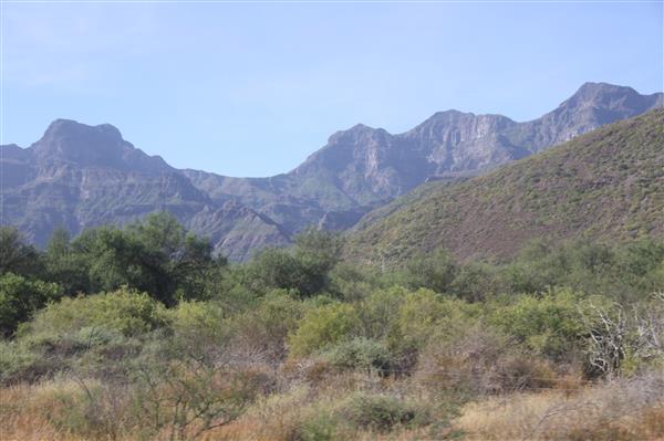
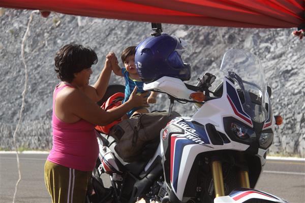
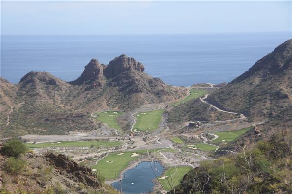
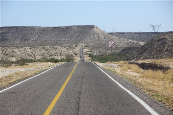
Continue reading "Day 8 - Photos"
Posted by Rob Kiser on November 21, 2017 at 12:04 AM : Comments (0) | Permalink
November 20, 2017
Day 8 [Monday 11/20/17] - Loreto, B.C.S. to La Paz, B.C.S.
I am alive and well and resting peacefully in the La Posada Hotel, in La Paz, Baja California Sur.
Starting Odometer: 6,837
Ending Odometer: 7,111
Distance Traveled Today: 274 miles
Distance Traveled This Trip: 2,508 miles [7,111 - 4,603]
Here's roughly what my ride looked like for today.
So, I wake up this morning, and there's a freaking marching band parading down the street outside my bedroom window. For some reason, it's a Monday, but these kids aren't in school. Instead, they're all dressed up and marching up and down the street, in step, out of step. Someone's blowing a whistle.
The best that I can get is that it's November 19th, and that is cause for some celebration. But I'm not clear who, exactly, they overthew on November 19th. No one else seems to know for sure either.
I get up, check out of the hotel, and then when I go to start my bike, I can't find my keys. I have an extra set, but I'm kind of freaking out because they're not in my riding pants pocket where they should be. The maid comes and lets me back into my bedroom, and I go in there, empty my pockets on the bed, and then I find my keys were in my blue jeans pocket, instead of my riding pants.
I'm relieved, and I go back outside, oil my chain in the parking lot, and then start riding down to the Route Uno store, to buy a Mexico Route 1 sticker. The band is just breaking up, and when I get to Route Uno, the store is still closed today, same as yesterday.
OK. That's it. So, I'm heading out now for Ciudad Constitucion.
But first, I'll stop by the Pemex across the street to top off my tank before rolling out into the deserts of Baja. You can't be too paranoid about running out of gas. It's a very serious risk.
So, I gas up the bike, but now I can't find my wallet. It's only like 6 liters, because I went south of town about 30 miles yesterday, and then returned. So, I put in about 6 liters, but my wallet isn't where it should be. It should be in my right riding pants pocket, but it's not there. I start frantically looking through all of my belongings, but I can't find it. There's this little girl, sitting there at the Pemex gas pumps...I'm guessing her mom is the one pumping the gas, and she's watching me come unglued. It isn't pretty.
Like, if I'm so stupid that I can't make this trip without losing my wallet, then maybe I don't need to be on this trip. Maybe I need to be in a "home" somewhere.
Finally, I ask to pay in U.S. dollars, because I have plenty of cash on me. She says it's $6.00 USD, so I hand her six dollars. Now, I'm really freaking out. I decide to go back to the hotel and look for it there.
When I pull up, the maid comes out waving my wallet. Apparently, when I went back into the room to look for my room keys, I took my wallet out, looking for the keys, and then left it on the bed when I took off.
She hands me my wallet back. I take out a $50 bill (USD) and hand it to her.
Now, I get on my bike and ride off into the deserts of Baja.
The gloves I nromally wear are North Face ski gloves that I bought up in the Yukon, in White Horse, Yukon Territory, Canada.
They say North Face "Hy Vent". And, I take them off because it's hot in the desert, and I put them under my CC Filson handbag as I'm racing across the desert.
In the desert, basically I just open the throttle and run triple digits because I've got no time for these deserts. I've seen enough cactus to last a lifetime. I'm done with this. I want to get to La Paz.
So, I'm running triple digits through the desert and, at some point, I realize that I've only got one glove. The other one must have fallen off. Oh well.
I do have a backup set of gloves in the rear Givi Case. At some point, I put on my other gloves just so my hands won't get too sunburned.
So, today hasn't been a great day.
I stop and refill the bike in Ciudad Constitucion (my internet sucks so bad I cen't get it to draw me a map of where I went today).
Then, I see a store in Ciudad Constitucion that looks like a large enough store to have an ATM, so I go in there, find the ATM, and take as much out of it in Pesos as it will allow. I think it was $5,000 pesos? I'm tired of not having pesos in this country. I was almost completely out.
Now, I have another 130 miles of open desert to cross before La Paz. And no fuel stops along the way.
I'm just running through the desert at 100 mph for some time when I realize that I'm really getting very poor gas mileage by driving so fast. That sucks.
But somehow, I make it out of the desert and come rolling down the hill to my old trusty Pemex station that I recall well from last time.
I go look for the restaurant that Jennifer and I liked so much, only to find that it is closed.
I think that our restaurant is called Terraza La Choperia, but it's closed due to November 19th celebration.
Then, I go looking for our hotel, and I do manage to find our hotel, La Posada hotel at Nueva Reforma 115, Universidad Autónoma de Baja California Sur, 23090 La Paz, B.C.S.
So, good enough. I found my hotel. And I found our restaurant. It's right next door to the Whale Museum at Paseo Álvaro Obregón 1, Central, 23000 La Paz, B.C.S.
I go into the La Posada Hotel and ask for a room for the night. He quotes me $100 USD a night. I take him down to $90 USD a night. It's a lot, but the hotel is crazy nice and looks out over the bay as well.
I rest for an hour or two, then decide to go out to Pichilingue and make sure I know where the ferry leaves from, how long it till take me to get there, etc.
First, I go to the ferry building in La Paz, as it's closer. The address is Ignacio Allende 1025, Zona Central, 23000. But when I get there, it's about 4:30 p.m., but they're closed, of course, in observance of November 19th.
So then I decide to go to the ferry building in Pichilingue, to find out where I need to be, and at what time. She says to be there at 5:00 p.m., but allows that I can get there early, if I want to.
She tells me I need to have all of my paperwork, but I assure her that I have everything I'll need.
Then, i head back towards La Paz, but stop at the restaurant on the beach my return. It's about sunset, but they seat me anyway and I sit and eat dinner as the sun sets across the bay.
Jennifer and I stopped here and shot photos last time. This girl walks up to me, and asks..."were you shooting over there, before?" and she points to the other side of the beach where Jen and I were shooting last time.
"I was shooting over there before....do you recognize me? I was shooting over there, but it was back in July..."
But, apparently, she was referring to someone else that was shooting over there earlier today. "Oh no....not me....sorry."
La Paz is a really beautiful town, but I think not many people know about it really.
I roll back into town in the dark, and now I stop at our little ice cream store. It's called Michoacana. I park my bike, go inside, order my ice cream, and then go outside and sit on a bench to eat my icecream. At some point, I realize I don't know where my helmet is. I go inside the ice cream place, and I've set it down on a table, apparently, and walked away from it. I'm not sure I'm going to be able to finish this trip. I'm pretty sure I'm losing my mind.
I decide to go get some more currency, since I'm in La Paz, and I know where the stores are that have ATM's (cajero automatico). I go back down to our grocery store (Chedraui) and park in a handi-capped spot. Some woman comes out and starts running her mouth, but this is not the United States. Mexico is world's ahead of us in this regard. I just walk inside like I own the place. Like...what are you going to do, woman? In the USA, they'd tow your car and write you a $500 citation. But in Mexico, they can't really do anything. I walk inside the store, she's already tried to get about 3 other security guards to make me move my bike, but they just ignore her.
"Donde cajero automatico?" I ask.
They point me to the ATM, and I go down and take as much cash as it will give me....about $7,000 (pesos), I think.
Then, I walk outside. The upset housewife is nowhere to be seen. I get on my bike and ride to the nearest OXXO. Go inside, buy some Jumex (Mango) and some snacks, and then head back to the La Posado hotel for the night. Crazy tired. Not sure how much longer I can keep up this adventure. I'm completely exhausted.
I'm hoping that I can get a private room on the ferry tomorrow.
So, the ferry looks like this:
1 Adult $1,068.97 (Pesos)
1 Moto $1,017.24 (Pesos)
1 Cabina $990.00 (Pesos)
With taxes, the total is $3,410.00 (Pesos).
So, basically, it's $200 (USD).
And the ferry leaves at 8:00 p.m., and gets to Mazatlan at 9:00 a.m. So yeah...I for sure need a private cabin.
So then, my ride tomorrow (Tuesday November 21st), will be me riding to Pichilingue.
Then, my ride on Wednesday November 22nd, will be me riding from Mazatlan to Puerto Vallarta.
Posted by Rob Kiser on November 20, 2017 at 3:05 PM : Comments (1) | Permalink
November 19, 2017
Day 7 - Photos
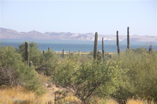
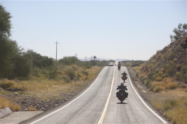
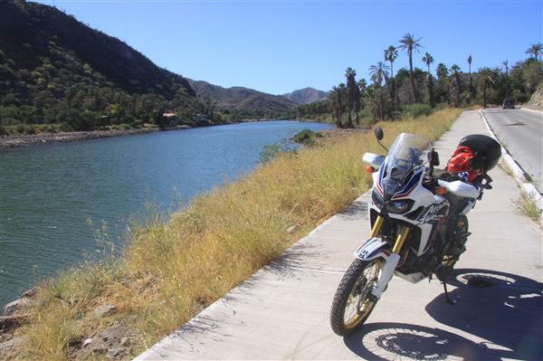
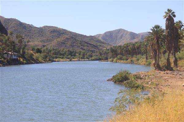
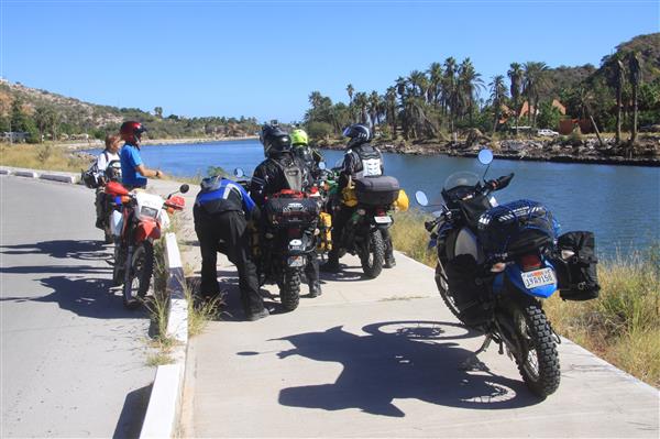
More photos in the extended entry.
Continue reading "Day 7 - Photos"
Posted by Rob Kiser on November 19, 2017 at 10:11 PM : Comments (0) | Permalink
Day 7 - Santa Rosalia, B.C.S. to Loreto, B.C.S.
I am alive and well and resting peacefully in the Hotel Salvatierra on the shores of the Sea of Cortez in the village of Loreto, Baja California Sur.
Starting Odometer: 6,633
Ending Odometer: 6,837
Distance Traveled Today: 204 miles
Distance Traveled This Trip: 2,214 miles [6,837 - 4,603]
Here's roughly what my ride looked like for today.
To do list:
change time on cameras and on bike.
log expenses for the day
log gas mileage for the day
charge cameras
charge gps and iphone
make fuel plan for tomorrow's ride
post photos
look at ferry schedule
clean visor on helmet
clean visor on motorcycle
oil chain on bike
This morning, we wake up in Santa Rosalia, B.C.S. We've all agreed to go to breakfast at 8:30 a.m. So we get up and walk to breakfast. Jorge has been through this town before, two years ago. I finally go back and look it up and it was 8 years ago that I was here.
So we go to breakfast and order and, of course, everything is deliciouso. After breakfast, we ride our bikes to the Pemex station and everyone gets gas for the ride today. Then, we ride down to Mulege.
Mulege is exactly as I remember it. It has a large wall with a gate that you ride through that says Mulege. So, it's a dramatic entrance when you go into town. Then, we follow the river down to the ocean.
Someone in their group has a drone, and he breaks it out and starts trying to shoot some video of the group riding, but the drone's not performing correctly, it seems. So I go and ride around the river and through town. I cross the river and go get some ice cream at a store just south of town. When I return, they've ridden down to the beach, so I ride my bike down to the beach also.
"Did you have any trouble getting your bike out here to the beach?"
"Dude...I've been riding for 30 years." Like, I really prefer not to take this bike off-road because it's not geared for it, but it's not like I'm incapable of riding off-road. That's not the issue.
At some point, we finally leave and roll south and stop at the Pemex station just south of town.
"I just filled up 30 miles ago. I really don't need to gas up again," I explain.
But, it seems that they're going to be riding off-road today. So I'm like..."Fair enough. Y'all have fun. I'm rolling south on Mexico 1"
But they tell me when I get into Loreto, if I go down the main drag towards the Malecon, I'll see a store on my right called "Routa Uno", or "Route Uno". And, in this store, they sell stickers for my motorcycle that say Mexico Route 1, which is the road we're on.
This, I think, is the most fun of traveling. Talking to strangers. Pumping them for information. Everything gleaned is an enhancement of your journey. Everything you hear from other travelers on the road is a gift from God.
Yes. Of course I want a Mexico 1 sticker on my bike. It has almost zero stickers on it right now. Ugh.
So I wave goodbye and take off heading south on Mexico 1. I'm not really clear how far I'll go today. I don't really need to be in La Paz until Monday or Tuesday. And today is Sunday. So, that basically means I have at least a day to kill.
I roll south and get to Loreto. The truth is that I really never went into Loreto last time. I mean, we rode past it, but we never went down to the malecon in Loreto, as I recall.
But this time, I have an assignment so, as I get to Loreto, I start driving up and down the various streets in Loreto, looking for a store that says "Routa Uno", apparently. But the first roads I turn down aren't even paved, so it hardly seems like they would be the "main road" if it wasn't even paved. So I keep sort of awkwardly rolling around through town, past stray dogs, cars with speakers on top blaring who-knows-what to the masses.
Eventually, I do find the malecon, but I certainly don't recall this from last time. Last time, we definitely skipped Loreto. We rode right past it.
I ask several people, and finally they point me to where the Route Uno store is. And, sure enough, I find it. But it's closed. Because it's Sunday, probably. Great. Brilliant.
Now, I'm not sure what to do. I could try to drive down to La Paz, but that's a fairly long ride. It's another 150 miles or so. And the sun is getting somewhat low on the horizon. I start rolling south, unsure of what to do at this point.
South of town, I see the restaurant that we stopped at last time I was riding down here. I'm almost certain it's the restaurant when I drive past it. But I keep going south, looking for something. I'm sort of looking for some places I recall seeing...some nice beaches where people were camped out. I roll south for about 30 miles, but then the road turns west and starts to cross the Baja peninsula again. So I double back. I really don't want to go any further tonight. I double back and stop at the restaurant that I passed earlier. I'm almost certain that it's the same place we ate at last time.
I remember specifically that there was a boat with a cactus in it. And a giant turtle carcass hanging on the wall inside the place. And, when I sit down, I do see a boat with a cactus in it. Then, I walk inside. "Didn't ya'll use to have a turtle in here?" I ask.
"Yes...but....I don't know how to say in English....It broke," he offers.
So, yeah...this is the place. So, I eat dinner, and then head back north to Loreto. There's a huge hotel with an enormous sign advertising rooms for $500 (pesos) a night, but this is Mexico, and when I ask, of course their rooms are $1000 (pesos) a night, not $500. So, I keep riding, because there's no way in hell I'm paying $50 USD a night for a hotel.
I end up checking into the Hotel Salvatierra for $25 USD a night, which is more what I was expecting to pay.
Posted by Rob Kiser on November 19, 2017 at 7:16 PM : Comments (0) | Permalink
Day 7 - Fuel Planning
Fuel Stops Day 7:
Trip Meter.........Town
0 miles.......Santa Rosalia.
122 miles......Loreto
93 miles......Ciudad Constitucion (215 miles total)
131 miles.....La Paz (346 miles total)
Posted by Rob Kiser on November 19, 2017 at 12:47 AM : Comments (0) | Permalink
November 18, 2017
Day 6 - Photos
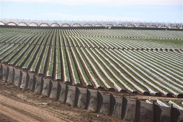
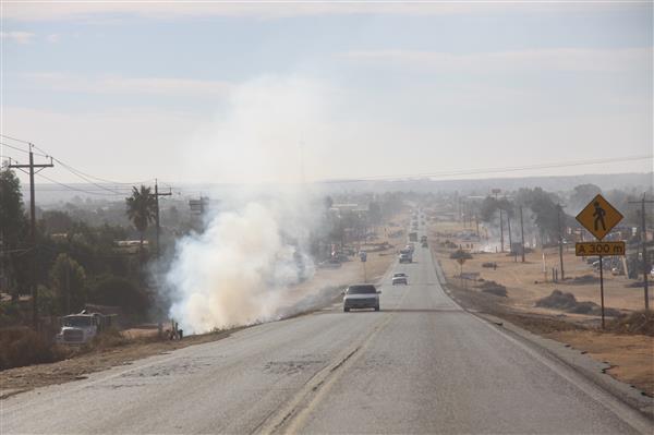
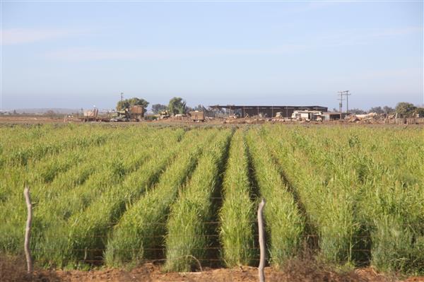
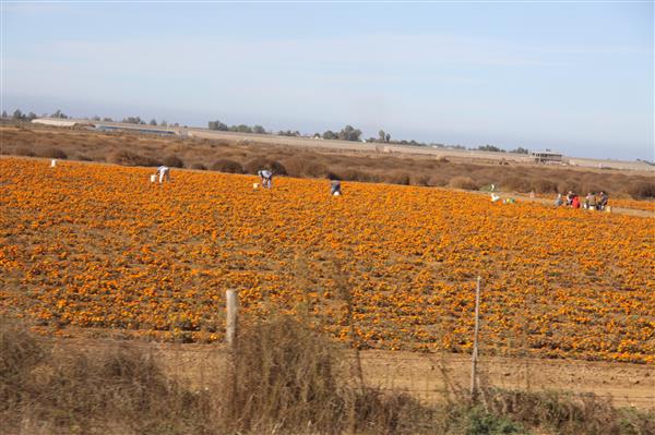
More photos in the Extended Entry...
Continue reading "Day 6 - Photos"
Posted by Rob Kiser on November 18, 2017 at 11:56 PM : Comments (0) | Permalink
Day 6 - Camalu, BC to Santa Rosalia, BCS
I am alive and well and resting peacefully on the shorts of the Sea of Cortez in Santa Rosalia, Baja California Sur. The hotel I'm staying in says " Hotel La Industrial Carr Transpeninsular NTE SN Centro".
Starting Odometer: 6,201
Ending Odometer: 6,633
Distance Traveled Today: 432 miles
Distance Traveled This Trip: 2,010 miles [6,633 - 4,603]
This is roughly what my ride looked like today.
In the morning, I wake up in the Hotel California in Camalu, BC. This section of the Baja is sort of strange because, we're right by the coast, but there doesn't appear to be any access to the coast. As though ocean-front property were well within reach, but not desirable. Very peculiar. I try to drive down to the beach, but the dirt road is very rough, and I turn back without making it to the beach. I can see the ocean, but I didn't ever get down to it.
So I gas up the bike and roll out of town heading south.
This section of the baja is very strange. The road is completely straight - ramrod straight - for some distance south of Camalu. It runs in a perfectly straight line heading south. We pass through small towns, at odd intervals. Seems to be some sort of irrigated farming in some areas. But we just keep going south. Straight as an arrow. Lots of Pemex stations. That is never an issue. Just keep rolling south. Shoulder to the wheel.
The locals appear to be gathering up vines/grass and burning them in piles on both sides of the road, for reasons known only to them. So, basically, you're riding south through a desert where they're burning the only thing that grows in great piles on both sides of the road.
The economic desperation here is difficult to comprehend. I'd hate to guess what they per capita income is in this area, but it can't be much.
Just before El Rosario, the road leaves the coast and turns inland. Now, it's heading inland, with cacti on both sides of the road. This is where I turned back last summer. This is where I turned back and said "oh hell no....I'm not going into the Punta Prieta desert again without a full tank of gas. Not this time. Hell no. Never again..."
And I turned back and back-tracked for 20 miles to the last Pemex station I passed. But this time, all is planned out. All is well. El Rosario is coming up. I'll refuel there.
I stop and refuel when I come into El Rosario. I remember this town perfectly. I stop at the Pemex station and fill up with Roho.
Now, I'm rolling through town, looking for a place to eat. I go through town a few times before settling on a place and sitting down for lunch. You just can't believe how cheap the food is down here, but it's something like $1 per taco, and a CocaCola Light next door goes for $15 pesos. It's really hard to imagine, but this is the truth.
So I eat lunch, and as soon as I get started, some Americans come rolling up with a dune-buggy on a trailer. They say that they just came in 5th in the Baja Mil race. But I don't really care. I didn't come down here to hang out with gringos. Not really my thing. I hate that people have discovered the Baja through Trip Advisor and Yelp and such.
I finish my tacos and roll south out of town. As soon as you leave El Rosario, you cross this large optimistic bridge across an irrigated field. They always build these bridges acorss these creek beds, but it's hard to imagine when it ever rains here. I've never seen it rain at all down here. Ever.
And south of town, the road leaves the coast and now starts winding precariously through the hills, and there are enormous cacti everywhere. Now, we're moving into the heart of the Punta Prieta desert.
What's so funny is that, this time, I'm like super careful with my fuel. And the first time I came down here, I was so unprepared there are no words. I was on a kick-start dirt bike, Honda XR650R, and I rode off into the Punta Prieta desert without even bothering to fill up at the gas station in El Rosario. They told me, "this is the last gas station for 225 miles," and I ignored them. Laughed at them. And rode off into the desert alone, with a half a tank of gas. Like... so stupid there aren't words. That I survived is a testament to....something. Dumb luck I guess? God watches out for fools and children.
But this time is different. This time, I've planned my fuel stops very carefully. This time will be different. This time, I fill up in El Rosario. This time, I know every location in the Punta Prieta desert where people are selling gas on the side of the road.
The first stop south of El Rosario is at Catavina. At Catavina, there is a place on the side of the road where a man sells gas with a little hand-painted sign that says "PEMEX". Obviously, it's not a PEMEX, and when I stop, he isn't there. But someone hits a car horn and he comes walking across the road.
I've only gone 75 miles since I filled up in El Rosario, and he is only offering to sell me 1 full gallon (4 liters) at a time. So I buy 4 liters (1 gallon) from him for $100 pesos ($5.00 USD).
Now, I take off south again, following Mexico 1, always. Always south. Now, 75 more miles until the exit to Bahia de Los Angeles (Angel Bay).
Now, this valley looks very familiar. I remember this place. This place where I almost died last time. We're exactly in the center of the Baja peninsula now. There is, on each side, a mountain range. Each range is about 15-20 miles away from me, roughly paralleling the coasts. I'm in this bowl, full of nothing but cactus, as far as the eye can see.
This is where I hit reserve last time. So stupid there aren't words. I'm not about to hit reserve this time. Even if I did, I'm carrying 2.2 gallons of rojo (premium) gasolina. So, there's zero chance of me running out of gas in this desert this time.
Now, I'm at the exit to Bahia del Los Angeles. Here is the 2nd fuel stop in the desert where a shady character is selling gas on the side of the road.
I'm not sure how much fuel I need, really. I'm thinking maybe I need 2 gallons. I mean, it's not like you have a good clear picture of how much fuel you're getting really. He pours some amount of gasoline into a red, steel 5 gallon jerry can from a 55 gallon drum in the back of a pickup truck. Then, he pours the contents of that into my motorcycle tank. How much fuel did I get, it's hard to know, but my LED lights on the Honda did indicate the tank was full. That cost me $200 pesos, which would be $10 USD for 2 gallons of gas, let's say.
Now, I'm riding south again. Always south. Like, at some point, you just think....I want to escape from this desert. And now, I start running triple digits. I want to go 430 miles today. So I'm just screaming through the baja desert.
There is not a lot of traffic on this road. There never is. Only I do see a bunch of trucks of people riding north from the Baja race. They're carrying dunebuggies on trailers heading north. I see a lot of those guys.
I ride all day, as fast as I can go. I manage to get the bike up to 120 mph. Once the road leaves the coast, I just open it up and run as fast as I can. I've got to make it 430 miles today. In theory, you would think that you could just go 100 mph for 4 hours and you'd be there, but that's not how it works for whatever reason.
I run 100 mph for hours at a time, but hardly seem to get anywhere. The deserts of baja seem to be without equal. They're practically impenetrable. Unconquerable.
Eventually, I make it to Baja California Del Sur, and cross the border at Guerro Negro. There is a Pemex station, so I stop to gas up again. You just can't grasp how vital gas is when you're crossing a 200 mile desert. It's a scary thing to attempt alone.
Now, I fill up again in Guerro Negro. Exactly as I remember it.
"How far is it to Mulege," I ask the woman at the Pemex station.
"Dos horas, mas or menos," she offers.
Right outside of town, anothe rmiltary checkpoint. I remember this one well. This is where I started riding with my friend last time. After nearly dying in the desert, I decided it might be a good idea for me to ride with someone with a brain.
I just roll through the military checkpoints now. I don't even hardly slow down. I figure, if they want to shoot me, they can shoot me, but I never stop. I just roll through like I own the place.
Now, I'm really running wide open. Just skint back, running as fast as possible. Wide open. Trying to get to Mulege before dark. And somehow I've still got two more hours to ride Christ.
So I'm just flying across the desert like a lunatic. Running triple digits. I have to get these pineapples through to Hawaii.
I'm having a hard time remembering some of the details. I recall that we ended up spending the night in Mulege, but it also seems like we went through Santa Rosalia, first. But it's been so long I can't remember clearly.
I get to San Ignacio, and it's roughly like I remembered it. Well irrigated and green. Like a jungle in the middle of the desert, somehow.
But now, still rolling across the Baja. Running triple digits. At some point, I pass a few guys on Kawasaki KLR 650's. But I have no time to be social. I'm flying. The sun is getting lower. I don't want to be riding in the dark.
Today, I rode through several cows grazing on the sides of the road. In places where grass actually grew, there were free-range cows grazing. And you think about how dangerous that is to a motorcycle. It's insanely dangerous. I'm flying down the road at 120 mph, and there are cows chewing grass just 3'-6' away from my bike. This is suicidal.
But I'm a low flying plane. Rolling pretty much due east straight across the peninsula. Heading for the sea of cortez. This is almost like I remember it. I remember climbing away from the sea of cortez. This all looks familiar. And now, the sun is setting and I stop to shoot a few photos. And now rolling down the hill into Santa Rosalia.
I see another motorcyclist. He's on a KLR 650. I stop and speak to him briefly.
"There is a good hotel in town, just on the right once you pass the hardware store. Just up the hill a little," he offers. These are pearls of wisdom. These gems are gifts from strangers on the road. I'm extremely grateful for his help to try to find a room, but I'm so exhausted I'm sure I will never find it.
I'm just totally wiped out. So tired I can hardly open my eyes. He says he's waiting for his friends to come down the hill, so I roll on. Alone. Always alone.
But presently, I see my buddy, and he comes by me on his KLR 650, and I recognize him, and now I see that he's leading me to the hotel. Holy Christ. Thank the Lord. He shows me the hotel, then goes back to find his buddies. This was a gift from God.
I go in and ask how much a room is. It's $500 pesos for the night. ($25 UD). Hotel has airconditioning, hot water showers, internet. Ding. Ding. Ding. We have a winner. Can you imagine getting a hotel room for $25 USD a night in the USA? Exactly.
I'm checking into my hotel, when my friend returns, with his friends. There are 4 or 5 guys on motorcycles now, and I tell them, "Sorry man, I just got the last room", and then they realize I'm joking and everyone is laughing. Now, we go to dinner. Somehow, they know this town, and we're walking to this little taqueria that they like. We all order tacos, and they buy me dinner and won't let me pay.
After dinner, we go back and, in the parking lot, they're doing maintenance. Cleaning their chains. Clearning their air filters. Etc. I'm just like...."yeah....I don't do that stuff".
They pick up their bikes and spin the rear tires with assistance to oil their chains.
"Yeah...I just spray mine while I'm riding it," I reply.
"Seriously?"
"Yeah. I'll show you in the morning."
And with that, I turn in for the night. One tired gringo loco.
Posted by Rob Kiser on November 18, 2017 at 6:27 PM : Comments (0) | Permalink
Day 6 - Fuel Planning
Fuel Stops Today:
Trip Meter.........Town
62 miles.......El Rosario - Pemex.
76 miles......Catavina (138 miles total) Guy selling gas on the side of the road.
64 miles......Exit to Bahia de los Angeles (202 miles total) Guy selling gas on the side of the road.
93 miles.....Guerro Negro. (295 miles total) Pemex
137 miles....Mulege (432 miles total)
I awake to the sound of crowing roosters and stray dogs fighing in the streets. Paradise.
Today, I'll cross the Punta Prieta desert alone. I've crossed this desert four times in my life. It's not something you take lightly.
When I was in Rosarito, yesterday, I saw vehciles coming north on Mexico one that had crossed the deserts of Baja. You don't look at them and wonder. You know. These machines that have crossed the desert have not made it by chance. They made it by careful planning. And as they roll north, you see the dust. The countless jugs of gasoline that they carried with them just in case.
The deserts are cruel and unforgiving. In the desert, life is focused around gasoline, water, sunscreen, and chapstick. Without these, there is death and pain.
And I'm watching this parade of madness coming north out of the deserts of Baja. Such an insane parade. Machines of all types. Trucks pulling trailers with buggies that were racing across a thousand miles of deserts last week.
The riders I met yesterday told me of a place they were going, on their motorcycles. THey were going to ride up to the top of a mountain, that would be freezing cold, with ice forming at night, where they could see the pacifica and the sea of cortez.
But I was never clear where they went. I didn't feel like getting off road that far. So I went on.
They are planning to take the ferry at La Paz to Mazatlan also, so I'll ride on today and maybe I'll meet up with them again.
This desert crossing is a serious matter. I've done it many times before, but never without serious consideration. I've seen men stranded in this desert. Women also. And I cannot stop to help them. Because a man in the desert is desperate. He'll do anything to survive, including kill me to take my bike. So you cannot help these people.
And if I cannot help them, then I cannot expect that they would help me.
Now....Into the Punta Prieta Desert. :)
Posted by Rob Kiser on November 18, 2017 at 8:39 AM : Comments (0) | Permalink
November 17, 2017
Photos from Day 5
.jpg)
.jpg)
.jpg)
.jpg)
More photos in the extended entry.
Continue reading "Photos from Day 5"
Posted by Rob Kiser on November 17, 2017 at 10:39 PM : Comments (0) | Permalink
Day 5 - San Diego, CA to Camalu, Baja California (Norte), Mexico
I am alive and well and resting in the Hotel California in Camalu, BC, Mexico.
Starting Odometer: 6,025
Ending Odometer: 6,201
Distance Traveled Today: 176 miles
Distance Traveled This Trip: 1,598 miles [6,201 - 4,603]
OK. So, I didn't have a big day in terms of mileage, I'll admit that. Right? I can't deny that. But is the whole trip really about mileage? Really?
OK. So, where to begin?
This morning, I get up, and while I'm taking a shower, I pull the bathroom door closed, and then it won't open. Like...I'm in this shittly little no-tell motel in San Diego, and the freaking door-knob does nothing. And, I can't get out of the bathroom. And I don't have me cell phone. I'm royally screwed. I could be in here for days. Years. Fuck. This is going to suck.
I fiddle with the door knob, and, eventually, it opens. I have never seen this in my life. They should be sued for zillions. Christ.
So I get out of there, and check out of the hotel. Gas up at the first gas station. Now, the only thing I need is insurance. So I stop at the Instant Mexico Auto Insurance place. Just about the last U.S. exit. They'll right me a policy for 2 weeks, without legal coverage, for $150 for two weeks. I'm like...good enough. Let's go.
So they write me a policy and hand it to me. I hop back on the interstate and head across the border.
As I get to the border crossing, I turn to the night to look for Immigracion/Aduana, and some guy comes after me. He's got a machine gun, and he's telling me that I need to go through the light.
So, I apologize, and I pull up and go through the light. THe light is green, which means go, so I roll forward, and they motion for me to pull forward into secondary screening. Like, I'm so stupid I've screwed up the simplest border crossing on planet earth, and now I'm about to get a body cavity search from Juan.
I explain to them that I need to get my FMM Mexican Tourist Card/VISA stamped. The guy tells me, in perfect English, to pull forward and park up ahead, and then to go into that big building over there.
So I do, and then I walk into this large building. There's not a lot of people in it, mind you. And they're all sort of bored and disinterested in my presence. Finally, I find a guy that's willing to process my paperwork. He takes it, stamps it. Stamps my passport, and in about 2 minutes, I'm walking out of the building. Completely legal.
This is odd because, I'm reasonably certain that I've never ridden my bike into Mexico legally before today. It's a peculiar feeling.
Also, it's kind of fun. Like an adrenaline rush, to be crossing into another country, with guards waving machine guns at you. I'm not clear what part of my body needs this, but now I'm drowing in adrenaline, as I'm rolling through Tijuana, trying very carefully not to screw up following the road to Mexico 1D. I've been this route many times, but my success rate for following the correct road isn't good, and it's well marked.
There's 3 jackasses on Harleys. Like...Harley rides need more attention than a teenage girl, and they ride down the road, racking their throttles with their absurdly loud pipes. "Look at me. Look at me." Go fuck yourself, faggot homo harley riders with loud exausts. WTF? Seriously?
So I let the loud fucks pass me, and they all rack their throttles as they do. Faggots.
Now, we're at the Mexico 1D toll road, and they're so fucking stupid they can't figure it out. I hand the guy a dollar and he waves me through.
"Mucho frio, amigo," I whine. "Por que?"
"Es Novembrio," he replies. Like, this surprises me. I've never been down here that it's been this cold, and I've been down here several times. But I guess this is later in the year. But it's cool.
So now, I'm rolling south on Mexico 1D, and it feels so good to be in Mexico again. So happy to be down here. Now, I know....most of you don't "get" mexico. I understand. But to me, it's awlays been about having an adventure off of the beaten path. And Mexico is perfect for that.
In about 20 miles, I'm in Rosarito, so I exit, but I always exit too soon, and on the North end of Rosarito, there's not a bunch of places where you can get down the beach. I roll further south, more into downtown Rosarito, and then cut down to the beach. Sure enough, they're serving drinks and meals on the beach. Renting horses. Donkeys. Ponies. Riding ATV's. This is the Rosarito that I remember.
I ride my bike down to the beach, park it, and then walk to a table with all of my gear. Sit down at the table, and now they're bringing me CocaCola Light and shrimp cocktail. This is the life. It's hard to imagine how it could get much better.
They're playing american music over the radio. A bunch of oldes from the 70''s. And these Mexican bands are walking around offering to play for me, but I really don't want them to mess up the songs on the radio. So I shoo them off.
After my shrimp cocktail, I decide to ride on, so now I'm rolling south again. At Ensenada, the tollway ends, and I recognize the southern end of the tollway. I remember this place.
But I'm still rolling south. I stop to refuel in Ensenada. This is my plan. I'm not going to run out of gas in the desert this time. That's not going to happen this time.
South of Ensenada, the road goes inland. At first, mostly desert, but then, as I ride on, it gets greener, and now there are some irrigated fields. I don't really recall this part as much. And it's not like it's been that long since I was last year. I was down here last summer.
But the Baja is beautiful, in it's own way. I really like coming down here.
I'm passing through these little worn-out towns, and I then I come to a little road-side shanty in Punta Colonet with 3 adventure bikes out front, all loaded with gear.
I quickly pull in and park.
They all start fawning all over my bike, and I'm talking to them as best I can. They're Mexicans, from the mainland, up here on a motorcycle adventure to see the Baja Mil race.
I sit down and eat lunch with them at this little taco stand. I got two tacos, and a cocacola light for $50 (pesos). (Roughly equal to 3 dollars.) I'm thinking....that can't be right. But that's what they charged me.
"Which way are y'all headed?" I ask.
They're heading south, the same as me. So, we talk for a bit. I'd really like to ride with them, but they're going off to ride up some mountain, where you can see both sides of the peninsula, apparently.
I'm not really keen on going offroad, and when I ask them how far they'll be riding offroad, he says it's about 2 hours. And I'm like....I'm out.
I'm heading south. I'll see y'all on the road.
We're both going to catch the ferry in La Paz, though no one is really sure what day they'll end up there.
So, we part ways, and I hop back onto Mexico 1 heading south.
My plan is to drive to El Rosario, but the sun is setting. I spent a lot of time just hanging out and talking to those guys, hoping that we would ride together, but ti didn't really work out. And now, I'm running late and I don't like riding in the dark and, as I'm rolling south, I see this sea of headlights coming at me.
The Baja Mil has just wrapped up, and now all I see is a sea of headlights coming north. All of the cars are coming north, and I have an epiphany. If there are tons of poeple comin g north from BCS, then they're going to take up all of the hotel rooms and, when I roll into El Rosario, they're going to be like, "I'm sorry but we're all booked up" and how screwed will I be then. I decide to call an audible. It's about dusk. I see a sign that says "Hotel", and I turn in.
"Y'all have a room for me?"
"Si"
"Quanto es?"
She scratches out on a notepad that it's $350 (pesos). But I'm so tired, I can't even do the math. Like...it's not like I rode very far today, but I'm still wiped out. Traveling through foreign lands on an adventure bike is not easy.
"Quanto es in US dollars?" I ask her.
"$21.00" she writes on the paper.
"Done. I'll take it."
Like, it's a little more than I was hoping to spend, but sure. I'm in. I'm all in.
This gets me off the road, and now I can crash for the night and get up and try again tomorrow.
"What is the name of this town? Como se llama esta ciudad?" I ask.
"Camalu," she replies.
I've never even heard of the place before, but apparently, I'm just north of Vicente Guerrero.
I roll through town to try to find a restaurant or a bar, but there's nothing really that rises to that level. It's just little sheds on the side of the road where they're offering food to people, as one might feed a stray dog behind a shed. So, I buy a large Tecate and take it back to my room.
Today, I didn't ride far enough. So, that means that I'll really have to push it tomorrow to make it to Mulege.
Looks like about 416 miles. Ugh.
Refueling Points for Tomorrow:
1) El Rosario, BC(N) - 62 miles
2) Catavina, BC - People selling gas on the side of the highway. 76 miles (138 total)
3) Exit to Bahia Los Angeles, BC(N). Dude selling gas out of a 55 gallon drum in the back of a pickup. 64 miles (202 total)
4) Guerro Negro, BC, Mexico. Open Pemex station. 93 miles. (295 total).
5) Mulege. 137 miles. (416 miles totla)
Posted by Rob Kiser on November 17, 2017 at 6:29 PM : Comments (3) | Permalink
Day 5 - Into the Baja
So, today, I will cross the border at the Chapparal Crossing between San Ysidro, CA and Tijuana, Mexico, Baja California (Norte).
Before I cross the border, I will stop just this side of the border and get my Mexican Insurance at Instant Mexico Auto Insurance - 223 Via De San Ysidro, San Ysidro, CA 92173. (619) 428-4714.
Then, I will cross into Mexico. The trick is that I have to stop at Immigracion and get my FMM Mexican Tourist Card/VISA stamped. Then, I will be completely legal for my trip down the the Baja.
Also, they're running the Baja 1000 down there right now, but I think that I will miss most of it as it is almost over, I think.
This will be a fairly short day, so I think that I will stop for lunch in Rosarito. Have a margarita and a shrimp cocktail down on the beach.
Fuel Stops Today:
Trip Meter Town
0 San Ysidro
68 miles Ensenada (68 miles)
184 miles San Quintin (116 miles)
223 miles El Rosario (59 miles)
Posted by Rob Kiser on November 17, 2017 at 9:05 AM : Comments (0) | Permalink
Photos from Day 4
.jpg)
.jpg)
.jpg)
.jpg)
Continue reading "Photos from Day 4"
Posted by Rob Kiser on November 17, 2017 at 1:06 AM : Comments (0) | Permalink
November 16, 2017
Day 4 - Brawley, CA to San Diego, CA (Thr Nov 16th)
Starting Odometer: 5,731 miles
Ending Odometer: 6,025 miles
Today's Mileage: 294 miles
Total Trip Mileage: 1,422 miles [6.025 - 4,603]]
Update: I am alive and well and resting peacefully at the E-Z8 Motel South Bay in San Diego, CA.
This is roughly what my ride looked like today.
So, this is the first time this trip that I spent 2 nights in the same state. I will be in Mexico tomorrow morning, but I didn't want to cross the border at night, and this has already been a pretty long day. So, I'll get up in the morning and get across the border and start making my way down the Baja Peninsula. I learned that they're racing the Baja 1000 right now, so that should be interesting. Also, because it's the 50 year anniversary, I'm told they're racing the length of the peninsula? Yikes.
I stopped at K-mart in Riverside and got some super glue. The only thing I need now to cross into mexico is insurance.
============================================
Note: After taking a short break, I am now back on the road from Riverside, CA to San Ysidro, CA.
============================================
I am currently taking a short break from riding while I eat dinner at my old stomping grounds, the Cactus Cantina, in Riverside, California. The traffic was really bad, so I decided to stop and wait for the traffic to die down a little bit. My logic being that, if I ride later, even though it will be dark, there will be less traffic, and since I'm on interstate at this point, I'm not as likely to hit a deer, I figure.
============================================
This morning, I start out really late. The reason is because I was trying to get a few thousand photos off of my camera, which I succeeded in doing. The maid is out there pounding on the door, trying to get in, but she can't because I have all of the deadbolts and all of the internal locks thrown. So, she can't get in. And she's screaming at me in Spanish that I have to leave. Finally, I tell her to calm down. Like...you're a maid for fuck's sake. Settle down. Life will get better.
But when I finally get away, I head from Brawley, CA to Slab City. I saw a documentary on this place somewhere. I forget where. And I thought it was sort of funny. Basically, an abandoned military base where they poured concrete slabs out in the desert, never completed the construction, and then abandoned the entire base. Now, it's over-run with homeless squatters, and what made me think that I needed to go out there is anyone's guess.
Like, basically, imagine a bunch of homeless vagrants, barely alive, surviving in the scorched desert without electricity or running water That's pretty much what it's like. Hell on earth, essentially.
I took a few photos and left. But I saw a guy on a BMW GS1200R motorcycle going in there while I was coming out. So, somehow this place is sort of infamous, I suppose.
"Where you riding from?" asks the guy on the beemer
"Just from Denver...How about you?" I ask. Like...I'm very cautious with this. You don't go bragging about your adventure when you're only a thousand miles from home. You're goin g to get embarrassed in a hurry if you think a thousand miles is a road trip. Some stranger is going to smash your adventure like a whack-a-mole.
"I rode here from Pensacola," he offers nonchallantly.
"I'm riding to Tierra Del Fuego," I reply. Like....let's not make any mistake. Tierra del Fuego is a decent ride in anyone's book. A nice little sunday afternoon ride that very few people on this planet could turn their nose up at. And I tell everyone I run into that I'm going there because, let's be honest...it's a pretty audacious adventure to try to make it down there.
I leave and go to a little grocery store in a shanty town just outside of slab city. Go inside to buy some more gatorade. If I'm going to drive through the Joshua Tree national park, I'm not doing it on a half a bottle of warm gatorade.
Grab a cold gatorade and a man in a dress is in front of me with a purse is buying something. Like...dude...wtf? Welcome to Kalifornia.
I go outside and finish the other gatorade in the parking lot. Now some guy is asking where I'm going and I tell him. He tells me about a road called the Painted Canyon. When I get to Mecca, I should turn right. About 50 miles from here.
"There's a checkpoint before you get there though," he offers.
"How do they get away with that? Isn't that a clear violation of the 4th Amendment?" I ask.
"They have secondary checkpoints all over the place," he laments. "They're everywhere. There's a turnoff before you get there, so you could go around it, but they watch that road really close."
It sounds like a good suggestion, and I thank him for his advice and take off.
I wasn't really impressed by Slab City, but now I'm thinking I'd like to see the Salton Sea and, even though I flew over it more times than I could count, I've still never seen it with my own eyes.
After a while, I see a sign for the Bombay Beach (Bombed Out Beach the guy had called it back at the store), so I cut down to the beach to see the Salton Sea.
A find a little dirt hill/road and climb it without much difficulty on the bike. I get within about 75 yards of the beach and decide to walk down and check it out, as opposed to dropping the bike and getting stuck.
I'm sort of hoping that I'll find this beautiful, undiscovered beach. But the Salton Sea is just death. A polluted cess pool with a mud beach. Like, it's hard to imagine a less attractive body of water. I see a few birds wading on the shore. It's hard to imagine there is life in this place. I have to think that the birds are smart enough that they wouldn't stand there if there were no life at all in the Salton Sea. It's hard to grasp how unnattractive it is. I get on my bike and start riding away. Now, I begin to question why it is that I think I need to see the Joshua Tree desert (let's call it what it is). Like, Slab City and the Salton Sea are just a slow painful death on a hairy biscuit. No one with any sense would ever go to either place.
It makes me question my entire adventure. Like...maybe I'm not capable of making rational, intelligent, informed decisions at this point. Maybe it's too late for me. Maybe the rest of my life will be me chasing after things no one with any sense would care about.
A Quixotean quest of epic proportions. Me, swinging at the windmills, in a foreign country, where I don't even speak the language.
I decide to skip the Joshua Tree desert and instead make a beeline for Chapparal Motorsports in San Bernardino, CA. I decide to take I-10 instead of taking Highway 60 over Jackrabbit Pass. I'm just hell-bent for leather at this point. Plus, I got away very late, and then exploring Slab City and the Salton Sea has taken some time. Suddenly, I realize that I'm not going to be in Chapparal Motorsports before 4:30 p.m., then I'm going to be stuck in rush hour traffic.
Like, it's amazing that, for all of the time I spend planning every day, I still manage to screw it all up royally.
Somewhere outside of Mecca, there's a quasi-legal checkpoint, and I pull in. It's going to be very hard to explain why I'm wearing a money belt with $10K in cash in it. I don't like police. At all. But when I pull in, he just tells me "have a nice day". It's the camera. They hate seeing that GoPro up there, filming them. And just because the red lights aren't flashing on the GoPro doesn't mean it's not filming. There's no way they can know if I'm filming them or not.
He just waves me on. This is the same as it is in Mexico at their quasi-legal checkpoints. They always just wave me on. Probably, it's because I'm on a bike. No one would smuggle drugs on a motorcycle. It's not not economically feasible. You couldn't carry enough drugs to cover the cost of fuel to cross the desert.
Eventually, I make it to Chapparral Motorsports, and I race to the service counter to see my buddy Al, only to learn that he doesn't work there anymore. Mother. Fucker. Al was the coolest guy in that place and I talked to him on the phone just a few weeks ago.
Albert Terhune, is what they told me his name is.
I get my sprockets and put them in my Givi case...I now have a spare chain and sprockets.
I go back inside to look at buying a new jacket and helmet. But, there's just this wall of helmets and analysis paralysis.
How much did you want to spend, the little worm wants to know. Like...what the fuck does that have to do with anything? I've got ten grand in a money belt and this little idiot couldn't sell water to a man dying of thirst in the desert.
"Like...here's the helmet I have now....I'm sort of looking for a replacement...." I begin.
But he doesn't get it. There's just this wall of helmets. Like, you could spend days trying them all on. But I need to get on the road. Fuck this moron.
I go outside, and one of the guys comes out to pull the bikes in.
"Al went down to work in Texas," he offers. "I'm in touch with him. He's geting contracts from the government clearning up after the hurricane."
"Al was the coolest guy up here. I can't believe that he left. He was a riot."
Like...I hate how everything changes. Like...you can never go back, really. Like..I just want to come back here and walk into my old office and have everyone say "HEY ROB" and take me to lunch. But really, everything changes and no one at Chapparal has any clue who I am.
I leave and head to the office where I used to work at 14350 Meridian Parkway. But now, it's going to be like 4:30 p.m. when I get there, and it's Thursday for Christ's sake. No one was ever there on a Thursday. I'm not even clear the building exists outside of the 3 days a week that I was there.
On the way there, I realize that my fuel light is flashing. Somehow, I've totally spaced all of my re-fueling points today. Like, I'm reasonably clear that I'm not qualified to be taking this little adventure unsupervised. I have a feeling that I'm not far from being incarcerated in a memory ward in a home.
But I pull up to the building and Clint comes out to greet me. He's fawning all over my bike, which is nice. Like, it's great to have someone that actually remembers me. Fuck.
Now, I leave to go fill up at the gas station where I used to gas up. But somehow, the place is blocked off to traffic. I drive down the sidewalk to get there, and two guys yell at me that the place is (quite obviously) closed, hence the wooden barricades that I drove around on the sidewalk. Oh...Hmmmm.
So I leave and now, I'm not sure what to do. LIke...the traffic is so bad there aren't words. I-215 is hardly moving, and I'm not really excited about lane-splitting down to San Diego for 2 hours. I used to do that, but it's too dangerous. I'm not up for that any more. It's suicidal.
I decide to go to my old stomping grounds, the Cactus Cantina, in Riverside, California. So, I bust up in there, and I mean I used to eat here every night. I freaking owned this place. But I don't recognize anyone in the place. Motherfucker.
"Where's the blonde girl that used to work here," I ask the bartended. I'm so retarded I can't remember anything about her except that she was blonde.
"Ashley?" She clarifies. "She never works on Thursday."
Fuck. It is Thursday. Like...how could you possibly screw up a ride any worse than to arrive in the LA basin on a Thursday. Son. Of. A. Bitch.
My bartender isn't here. The bus boy isn't here.
The food is delicous, and the menu hasn't changed. So, there is that.
I used to live in the Motel 6 in Riverside until they came and arrested my neighbor one night, and then my neighbor on the other side of me came outside with his one leg on crutches and asked what was going on. That was the last night I ever stayed there.
Now, I think that I'll roll down to San Diego to spend the night. I'll cross the border in the morning. I don't like crossing borders in the dark. That's a bad idea.
I need to buy some superglue before I leave the country. And I need to get my Mexican insurance.
OK. I'm taking off. It's about 7:00 p.m. I have to get gas, then Waze says I should be in San Ysidro by 8:30 p.m.
Posted by Rob Kiser on November 16, 2017 at 7:53 PM : Comments (1) | Permalink
Photos from Day 3
OK. Finally got my photos done form yesterday. I think that, after today, it should be easier. I hope. It takes me several hours this morning because of the thousands and thousands of photos I had left in my camera. Ugh. Should be easier now (going forward).
Additional Photos in the Extended Entry.
Continue reading "Photos from Day 3"
Posted by Rob Kiser on November 16, 2017 at 11:54 AM : Comments (0) | Permalink
Day 4 - Brawley, CA to San Diego, CA (Thr Nov 16th)
I am currently taking a short break from riding while I eat dinner at my old stomping grounds, the Cactus Cantina, in Riverside, California. The traffic was really bad, so I decided to stop and wait for the traffic to die down a little bit. My logic being that, if I ride later, even though it will be dark, there will be less traffic, and since I'm on interstate at this point, I'm not as likely to hit a deer, I figure.
============================================
This morning, I start out really late. The reason is because I was trying to get a few thousand photos off of my camera, which I succeeded in doing. The maid is out there pounding on the door, trying to get in, but she can't because I have all of the deadbolts and all of the internal locks thrown. So, she can't get in. And she's screaming at me in Spanish that I have to leave. Finally, I tell her to calm down. Like...you're a maid for fuck's sake. Settle down. Life will get better.
But when I finally get away, I head from Brawley, CA to Slab City. I saw a documentary on this place somewhere. I forget where. And I thought it was sort of funny. Basically, an abandoned military base where they poured concrete slabs out in the desert, never completed the construction, and then abandoned the entire base. Now, it's over-run with homeless squatters, and what made me think that I needed to go out there is anyone's guess.
Like, basically, imagine a bunch of homeless vagrants, barely alive, surviving in the scorched desert without electricity or running water That's pretty much what it's like. Hell on earth, essentially.
I took a few photos and left. But I saw a guy on a BMW GS1200R motorcycle going in there while I was coming out. So, somehow this place is sort of infamous, I suppose.
"Where you riding from?" asks the guy on the beemer
"Just from Denver...How about you?" I ask. Like...I'm very cautious with this. You don't go bragging about your adventure when you're only a thousand miles from home. You're goin g to get embarrassed in a hurry if you think a thousand miles is a road trip. Some stranger is going to smash your adventure like a whack-a-mole.
"I rode here from Pensacola," he offers nonchallantly.
"I'm riding to Tierra Del Fuego," I reply. Like....let's not make any mistake. Tierra del Fuego is a decent ride in anyone's book. A nice little sunday afternoon ride that very few people on this planet could turn their nose up at. And I tell everyone I run into that I'm going there because, let's be honest...it's a pretty audacious adventure to try to make it down there.
I leave and go to a little grocery store in a shanty town just outside of slab city. Go inside to buy some more gatorade. If I'm going to drive through the Joshua Tree national park, I'm not doing it on a half a bottle of warm gatorade.
Grab a cold gatorade and a man in a dress is in front of me with a purse is buying something. Like...dude...wtf? Welcome to Kalifornia.
I go outside and finish the other gatorade in the parking lot. Now some guy is asking where I'm going and I tell him. He tells me about a road called the Painted Canyon. When I get to Mecca, I should turn right. About 50 miles from here.
It sounds like a good suggestion, and I thank him for his advice and take off.
I wasn't really impressed by Slab City, but now I'm thinking I'd like to see the Salton Sea and, even though I flew over it more times than I could count, I've still never seen it with my own eyes.
After a while, I see a sign for the Bombay Beach (Bombed Out Beach the guy had called it back at the store), so I cut down to the beach to see the Salton Sea.
A find a little dirt hill/road and climb it without much difficulty on the bike. I get within about 75 yards of the beach and decide to walk down and check it out, as opposed to dropping the bike and getting stuck.
I'm sort of hoping that I'll find this beautiful, undiscovered beach. But the Salton Sea is just death. A polluted cess pool with a mud beach. Like, it's hard to imagine a less attractive body of water. I see a few birds wading on the shore. It's hard to imagine there is life in this place. I have to think that the birds are smart enough that they wouldn't stand there if there were no life at all in the Salton Sea. It's hard to grasp how unnattractive it is. I get on my bike and start riding away. Now, I begin to question why it is that I think I need to see the Joshua Tree desert (let's call it what it is). Like, Slab City and the Salton Sea are just a slow painful death on a hairy biscuit. No one with any sense would ever go to either place.
It makes me question my entire adventure. Like...maybe I'm not capable of making rational, intelligent, informed decisions at this point. Maybe it's too late for me. Maybe the rest of my life will be me chasing after things no one with any sense would care about.
A Quixotean quest of epic proportions. Me, swinging at the windmills, in a foreign country, where I don't even speak the language.
I decide to skip the Joshua Tree desert and instead make a beeline for Chapparal Motorsports in San Bernardino, CA. I decide to take I-10 instead of taking Highway 60 over Jackrabbit Pass. I'm just hell-bent for leather at this point. Plus, I got away very late, and then exploring Slab City and the Salton Sea has taken some time. Suddenly, I realize that I'm not going to be in Chapparal Motorsports before 4:30 p.m., then I'm going to be stuck in rush hour traffic.
Like, it's amazing that, for all of the time I spend planning every day, I still manage to screw it all up royally.
Eventually, I make it to Chapparral Motorsports, and I race to the service counter to see my buddy Al, only to learn that he doesn't work there anymore. Mother. Fucker. Al was the coolest guy in that place and I talked to him on the phone just a few weeks ago.
Albert Terhune, is what they told me his name is.
I get my sprockets and put them in my Givi case...I now have a spare chain and sprockets.
I go back inside to look at buying a new jacket and helmet. But, there's just this wall of helmets and analysis paralysis.
How much did you want to spend, the little worm wants to know. Like...what the fuck does that have to do with anything? I've got ten grand in a money belt and this little idiot couldn't sell water to a man dying of thirst in the desert.
"Like...here's the helmet I have now....I'm sort of looking for a replacement...." I begin.
But he doesn't get it. There's just this wall of helmets. Like, you could spend days trying them all on. But I need to get on the road. Fuck this moron.
I go outside, and one of the guys comes out to pull the bikes in.
"Al went down to work in Texas," he offers. "I'm in touch with him. He's geting contracts from the government clearning up after the hurricane."
"Al was the coolest guy up here. I can't believe that he left. He was a riot."
Like...I hate how everything changes. Like...you can never go back, really. Like..I just want to come back here and walk into my old office and have everyone say "HEY ROB" and take me to lunch. But really, everything changes and no one at Chapparal has any clue who I am.
I leave and head to the office where I used to work at 14350 Meridian Parkway. But now, it's going to be like 4:30 p.m. when I get there, and it's Thursday for Christ's sake. No one was ever there on a Thursday. I'm not even clear the building exists outside of the 3 days a week that I was there.
On the way there, I realize that my fuel light is flashing. Somehow, I've totally spaced all of my re-fueling points today. Like, I'm reasonably clear that I'm not qualified to be taking this little adventure unsupervised. I have a feeling that I'm not far from being incarcerated in a memory ward in a home.
But I pull up to the building and Clint comes out to greet me. He's fawning all over my bike, which is nice. Like, it's great to have someone that actually remembers me. Fuck.
Now, I leave to go fill up at the gas station where I used to gas up. But somehow, the place is blocked off to traffic. I drive down the sidewalk to get there, and two guys yell at me that the place is (quite obviously) closed, hence the wooden barricades that I drove around on the sidewalk. Oh...Hmmmm.
So I leave and now, I'm not sure what to do. LIke...the traffic is so bad there aren't words. I-215 is hardly moving, and I'm not really excited about lane-splitting down to San Diego for 2 hours. I used to do that, but it's too dangerous. I'm not up for that any more. It's suicidal.
I decide to go to my old stomping grounds, the Cactus Cantina, in Riverside, California. So, I bust up in there, and I mean I used to eat here every night. I freaking owned this place. But I don't recognize anyone in the place. Motherfucker.
"Where's the blonde girl that used to work here," I ask the bartended. I'm so retarded I can't remember anything about her except that she was blonde.
"Ashley?" She clarifies. "She never works on Thursday."
Fuck. It is Thursday. Like...how could you possibly screw up a ride any worse than to arrive in the LA basin on a Thursday. Son. Of. A. Bitch.
My bartender isn't here. The bus boy isn't here.
The food is delicous, and the menu hasn't changed. So, there is that.
I used to live in the Motel 6 in Riverside until they came and arrested my neighbor one night, and then my neighbor on the other side of me came outside with his one leg on crutches and asked what was going on. That was the last night I ever stayed there.
Now, I think that I'll roll down to San Diego to spend the night. I'll cross the border in the morning. I don't like crossing borders in the dark. That's a bad idea.
I need to buy some superglue before I leave the country. And I need to get my Mexican insurance.
OK. I'm taking off. It's about 7:00 p.m. I have to get gas, then Waze says I should be in San Ysidro by 8:30 p.m.
---------------------
-- from earlier---
----------------------
Today, my planned route looks something like this.
Basically, go to Slab City, Joshua Tree, return to San Bernardino and pick up my sprockets from Al at Chapparal Motorcycles, stop by the UC Path Center, then head down to the border.
Refueling Points:
1) Brawley, CA - 0 miles
2) Yucca Valley - 176 miles
3) Escondido Valley - 145 miles (total 321 miles)
4) San Diego - 30 miles (351 miles)
OK. Mapped out my ride. Picked my refueling points. Now let's check the forecast.
- 72F in Yucca Valley
- 81F in Riverside
- 79F in San Diego
Yesterday, I cracked the code on getting my photos onto my home server, but the one trick I missed is that there are thousands of photos on my 32 Gig memory card in the Canon EOS 50D with the 100-400 mm lens. So, this morning, I want to sort that out before I hit the road. So, I'll try to get these photos moved over from the camera this morning.
Posted by Rob Kiser on November 16, 2017 at 9:00 AM : Comments (0) | Permalink
November 15, 2017
Day 3 - The Salton Sea
Starting Odometer: 5,423 miles
Ending Odometer: 5,731 miles
Today's Mileage: 308 miles
Total Trip Mileage: 1,128 miles [4,603 - 5,731]
Update: I am alive and well and resting peacefully on the shores of the Salton Sea in Brawley, California.
This is roughly what my ride looked like today.
I changed timezones when I crossed the Colorado River into California. So, now, I'm trying to change all of my electronics so that they have the right time. Here's what I have to update:
iPhone 4S
iPhone 6S Plus - Changed automatically from MST to PST.
MacBook Air - Changed automatically from MST to PST.
Canon EOS 50D w/ 17-85mm lens - Updated manually from MST to PST.
Canon EOS 50D w/ 100-400mm lens - Updated manually from MST to PST.
Garmin Montana 600 GPS - Updated automatically from MST to PST.
GoPro Hero 5 - Updated manually from MST to PST.
2017 Honda Africa Twin - Updated manually from MST to PST.
Today, we leave Steve's place to go meet some of his buddies for lunch at the Pinnacle Grill in Scottsdale, Arizona.
On the way there, I'm following Steve, and suddenly this large suitcase/briefcase object comes bouncing down the road towards me. I slow down, not sure of what is going on. It stops, and I see that it says BMW on it. So, I'm assuming that it's a case that came off of Steve's bike. I stop in the middle of traffic, pick up the case, as cars stop around me.
"Are you OK?" they ask. Thinking, no doubt, that I've wrecked.
Somehow, I balnce the large case precariously on my gas tank, along with all of my other gear, and take off after Steve. He's only gone a short distance, and I find him stopped on the side of the road.
"Are you missing this?"
Apparently, he put the case back on the bike, but it wasn't locked properly for whatever reason? I dunno. He re-fastened it, and we rode on without further issues.
At lunch, all of his buddies are there - this big motorcycle gang that meets every Wednesday. Generally, they go for a ride, and then they meet for lunch somewhere. But today, they're just meeting for lunch. I thought that I'd be the oldest guy there, but somehow I was the youngest.
They're somewhat interested in my little trip down to South America. I don't think anyone is under any delusions that I'll make it, but I intend to give it a boy-scout try, anyway.
After lunch, Steve said that he'd go with me for some distance, to see me off on my journey.
So, we're riding off out of Scottsdale, sort of North and West, it seems. We ride for some time, and the scenery is very nice. Like, it's warm and partly cloudy, but there's no chance of snow. So, that's why lots of people come down here, I think. There's countless RV parks for people escaping colder weather up north.
Eventually, Steve pull over and we stop to talk.
"It's really hard to believe that you and I were riding across the continental divide in Colorado a month ago. And now, we're riding around in Arizona. We've got to stop meeting this way," I offer.
He laughs and we part ways. Now, I'm sort of heading towards Slab City. Like...why? I dunno. No real reason. Because I saw a documentary on it, I think. Because I flew over the Salton Sea 64 times in the last year? It's hard to say. But, certainly, flying across this Great American Desert twice a week for the last 14 months made me want ot see it on the ground, instead of from the air.
This part of Arizona is almost indescribably dry. I carry 3 chapsticks with me for a reason. I mash them onto my lips until they create a sort of thick creamy paste that you wear, proudly, on your lips. The road I'm on is straight now. It doesn't turn or bend and it reminds me of the roads in Texas. Where you're just driving down long straight flat roads and it's like you're not even really riding at all, but more like sitting inside of a hairdryer and watching a simulator, the way people peddle stationary bikes while watching TV and imagining that they're going somewhere.
I do get on I-10 and go west only for a few miles though.
I'm rolling west towards the California border and I start crossing a bridge over a fairly large waterway. I realize it's the California border. After crossing the river, they have a little illegal search-and-rape border control point. But they just wave me through.
I'm in California now. Still heading roughly west-south/west.
I turn south, following my GPS.
Generally, I have 2 GPS units and I set them for the same destination and then I'm belt-and-suspenders safe when I'm following their directions. But the Garmin Montana has never heard of "Slab City", so I turn it off and I focus on the iPhone 6S Plus and he's sending me towards Slab City.
Now, the road turns south, and then west, and then south, and then west. I'm going down these random roads, through all of this irrigated farmland, which is a lot different from Arizona. Arizona was just a desert, really. Somehow, California is irrigating the shit out of everything, and they're growing fileds of cotton....I don't know what all they're growing. But it's as green as Vietnam, everywhere you look.
Really a very dramatic change from Arizona, for whatever reason.
As I get closer to my destination, I realize that I'm not going to make it before dark.
And see, this is really what's wrong with riding your motorcycle cross-country. It's no that it's hard. It isn't. It's very easy. What's hard is to do it consistently without making a mistake.
Today, I sort of deferred on my normal route planning, because Steve was planning about 1/2 of the day, and I wasn't sure where I'd end up. So, I sort of called an audible, and headed for Slab City in the afternoon. But now, the sun is setting, and I'm a long way from Slab City, and I'm not clear that there's any place to stay there anyway. It's basically a squatter's camp full of meth addicts, as best I can tell.
I roll past one of those illegal checkpoints where they stop and search people without probable cause in clear violation of our 4th Amendment Rights. Then, I decide to turn back and ask for some guidance. I do a U-turn, cut across a strip of sand, nearly crashing the bike.
Somehow, I don't go down and I pull up to the illegal search-and-seize checkpoint. Young men with machine guns. German Shephards that want to chew your calves off. I roll up to a young man that appears to be in charge.
"Where can I find a place to stay tonight? Is there a place to stay in Glamis?" I ask.
"No. There's nothing in Glamis..." he offers. "Where are you heading to?"
"Slab City?"
"Well, your best bet is to go to Brawley," he explains.
"There's a place to stay there?"
"Yes."
"OK .Thanks boss." And with that I take off. Now, I'm following the road west across these large sand dunes in the near dark. This is not good planning. I might hit a deer, or an armadillo. No telling.
As it gets darker and darker, I decide to follow another vehicle, as I'm hoping the car in front of me will hit anything that jumps out in the road (deer, rabbit, fox, coyote, etc).
Like...I'm not kidding when I say I saw a coyote on this trip that was cut in half on the highway. Like...you think about what has to happen to cut a coyote in two. That would easily make a motorcycle go down.
As I descend from the dunes towards the Salton Sea, I smell the rotten stench of the Salton Sea. It doesn't smell pleasant like the ocean. More like it stinks, like it's polluted and festering. Not a place you'd want to spend any time. I had imagined that it would be this nice beach with people boating and fishing and swimming. Instead, as the air blows the scent over me, I feel the urge to gag.
I roll into town, see about 3 hotels. And I check into the Motel 6 for the night. I still need ot copy some photos off of the cameras in the morning, but at least I know how.
This is roughly what my ride will look like tomorrow, me thinks.
Posted by Rob Kiser on November 15, 2017 at 7:00 PM : Comments (0) | Permalink
Photos from Day 1 and Day 2
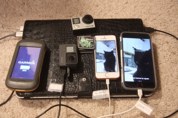
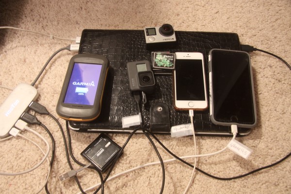
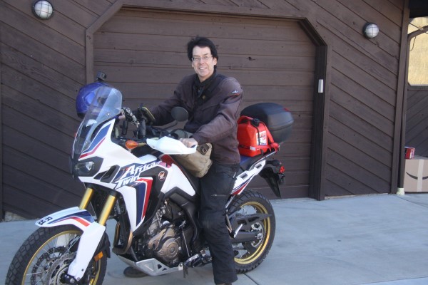
Continue reading "Photos from Day 1 and Day 2"
Posted by Rob Kiser on November 15, 2017 at 10:23 AM : Comments (0) | Permalink
November 14, 2017
Day 2: Fort McDowell, Arizona
Starting Odometer: 4,961 miles
Ending Odometer: 5,423 miles
Today's Mileage: 462 miles
Trip Total Mileage: 820 Miles [5,423 - 4,603]]
I am alive and well and resting peacefully in Fort McDowell, Arizona.
This is roughly what my ride looked like today.
Once again, I wanted to take the interstate, but Steve wouldn't let me. He made me turn off of I-40 at Holbrook, and it was a beautiful ride from Holbrook to Fort McDowell, Arizona.
Today was a long ride, and I didn't get away until 11:00 a.m. because I was fiddling with my photos on my laptop in the hotel room for way too long.
I got up and rode out of Santa Fe this morning. My buddy Devon said that New Mexico is the poorest state in the country. I was like...I thought it was Mississippi or Alabama? But apparently, New Mexico has been sliding into last place for some time.
But I dunno if this is true or not. They're trying to revitalize the econmy, attract computer workers, etc.
Good luck with that.
Like, for some reason, Steve decided that I needed to ride 450 miles today. So, basically, I rode all day today, from noon until 6:00 p.m.
At first, on I-10, the biggest problem was that there's a bunch of 18 wheelers doing the 15 mile pass routine, where they take way too long to pass each other. So, as I passed people riding out in the left lane, I'd flip them off and keep going This worked pretty well until I realized I was about to run out of gas. The thought of all of these angry motorists stopping to assualt me on the side of the road was not something I wanted to happen.
My first gas stop is supposed to be Thoreau, NM. But, the winds are so high that I'm getting 36 mpg instead of 45 mpg. I'm basically out of fuel, praying I don't run out. When I get to Thoreau, NM, there was no gas station. Not clear why I thought that there would be one there. Oh well.
So I ride on down to the next exit or so and see a sign for gas and stop in and refill. But, when I refill my gas tank, it doesn't hold 5 gallons. It only held 4.8, even though it said it was empty. Liars.
I keep on riding and riding and eventually, I get to Holbrook, Arizona. This is my 2nd refueling point, and now Steve has me riding down some random road. But as I keep riding, the road gets nicer and nicer. Lots of trees now. Climbing and descending through conifer forests. Eventually, the sun setting before me with a range of mountains silhoueted.
I would not have chosen to come this way, but I'm glad Steve told me to follow this road. It was a scenic drive, and not one that I've been on before, I'm sure.
Posted by Rob Kiser on November 14, 2017 at 7:55 PM : Comments (2) | Permalink
Day 2: Dealing with the photos
I'm trying to get some photos copied over onto my MacBook air from yesterday. I hate apple so much there aren't words.
First, I delete all of the photos in iPhoto(Photos).
Then, I delete all "recently deleted" photos in iPhoto(Photos).
Now, when I hook my camera to it, iPhoto(Photos) doesn't launch, for some reason. Argh.
http://www.idownloadblog.com/2015/12/28/how-to-stop-photos-mac-auto-launch/
Step 1: Open Photos on your Mac.
Step 2: Click Import in the toolbar at the top of the Photos window.
Step 3: Connect a camera, your iPad, iPhone or other iOS device to the computer with a USB cable and make sure the device is turned on. If you're connecting a digital camera, make sure it's set to the correct mode for importing photos.
Step 4: Photos shall display the media on the device. To stop the app from auto-opening whenever you connect this device, untick the box next to "Open Photos for this device" at the top (you may need to click the Action button to reveal this option).
OK. FInally googled it and some people said to reboot and rebooting fixed it. Now, when I connect my EOS 50D, the photos are imported into Photos successfully. Argh.
Now, I want to run my little EXIF renamer trick. I think that this was the post where I managed to rename my photos using EXIF .
1) export all 202 images from Photos
2) make a copy of them in another folder
3) run the new program to rename them based on exif data.
1) Launch Photos.
2) Hit Command-A to select all photos.
3) File - Export - Export Unmodified Original for 202 Photos...
4) Export IPTC as XMP?
"Export photos in their original format. You can export photos in the original file formats in which they were imported into your Photos Library. Click the Export IPTC as XMP checkbox to export IPTC information (assigned IPTC metadata and keywords) as a sidecar XMP file." I have no clue what this means.
5) Click Export.
6) Click New Folder.
7) Name of new folder: iphoto_sux_dix_2017_11_14
8) Click Create
9) Click Export Originals
Now we want to do the renaming trick.
The software I downloaded is named ExifREnamer. So, now what I do is go to:
o Finder - Documents - iphoto_sux_dix_2017_11_14
o Command - A to select all photos.
o Right Click - Open With - ExifRenamer.
o Rename All.
It does appear to have renamed them all. Christ.
\documents\ iphoto_sux_dix_2017_11_14 (this has 202 photos in it, and they're all named yyyy-mm-dd etc.)
Now, I go back into photos. Select all 202 photos. RIght click and selete Delete photos.
Are you sure you want to delete all 202 photos? For the love of God yes.
Click on Recently Deleted (on the left) and CTRL-A to select them all and click Delete 202 Items in upper right to delete them yet again (apple sux).
Are you sure?
FOR FUCKS SAKE DELETE THE FUCKING PHOTOS ALREADY!!!
OK.
No recently deleted items.
Now, from Photos, select File - Import and select the 202 files for import.
Click Review for Import.
Click Import All New Photos.
Now, delete them off of the camera so we don't have this problem again tonight.
OK. Erased all images on the card.
Now, I mark them as favorites, and export them.
Now, I send them to Expirebox.com
Posted by Rob Kiser on November 14, 2017 at 8:24 AM : Comments (0) | Permalink
Day 2: 100 Miles Before Noon
In the morning, my alarm goes off at 8:00 a.m. One of the greatest dangers we face is lethargy. A lack of ambitiion. Possibly the other greatest danger we face is rationalization.
When I rode up to Alaska the second time, I met some guys riding in the Hoka Hey. They explained to me that they were riding 1,000 miles a day, which I had never even considered possible. But it did make me re-evaluate my riding habits. Why was I laying in bed until the maids were beating down the door with a claw hammer? What purpose did it serve. In the end, I decided that the goal should be to get up in the morning, get out of bed, and ride 100 miles before noon.
Then, at noon, you stop for lunch somewhere.
If you do this, then the afternoon goes much better. You have more time to stop and shoot some photos.
So, beating lethargy is a real issue. We all suffer from this. I was fortunate that I met other riders along the way that helped me to deal with this issue.
The other issue that we face in our lives is "rationalization". Rationalization is a problem we all face which basically means that logic, as a tool, is inherently flawed.
Rationalization works like this. When the price of houses was going down, I didn't buy because the price was going down. Then, when the price of houses was going up, I didn't buy because interest rates were higher. So, the problem is that, there would never be a right time to buy. Once I reached this realization, only then did I realize that logic doesn't work like I thought it did.
So, you have to be very careful in your decisions, because "logic" is a fool's gold. It's doesn't work like you think it does.
Posted by Rob Kiser on November 14, 2017 at 8:12 AM : Comments (0) | Permalink
November 13, 2017
Day 2 [Tuesday 11/14/17]: Santa Fe, NM to Fort McDowell, AZ
I will get up on Tuesday November 14th, and ride to just east of Phoenix, AZ, from 400 Griffin St, Santa Fe, NM to 9605 N Fort McDowell Rd, Fort McDowell, AZ.
So, my ride tomorrow (Tuesday Nov 14) looks like a 476 mile ride. Ugh. I'll have to get an early start.
Refueling Points for Tomorrow's Ride (Tuesday Nov 14):
1) Santa Fe, NM. Distance = 0.
2) Thoreau, NM. Distance = 167 miles. (Total 167 miles)
3) Holbrook, AZ. Distance = 127 miles. (Total 294 miles)
4) Fort McDowell, AZ. Distnace = 156 miles. (Total 450 miles)
Weather for Tomorrow's Ride (Tuesday Nov 14):
1) Santa Fe, NM. Party cloudy. Mostly sunny. High of 64 F.
2) Thoreau, NM. Party cloudy. Mostly sunny. High of 66 F.
3) Holbrook, AZ. Distance = Party cloudy. Mostly sunny. High of 76 F.
4) Fort McDowell, AZ. Distnace = Sunny. High of 86 F.
Posted by Rob Kiser on November 13, 2017 at 10:36 PM : Comments (0) | Permalink
Day 1 [Monday 11/13/17]: Conifer to Santa Fe
Starting Odometer: 4,603 miles
Ending Odometer: 4,961 miles
Today's Mileage (projected): 326 miles - 390 miles.
Today's Mileage (actual): 358 miles.
I am alive and well and resting in santa fe new mexico at the Villas de Santa Fe, a property of Diamond Resorts International hotel located at 400 Griffin Street, Santa Fe, NM.
So, I got away later than I had hoped. So much crazy work to get done to prepare for this trip it's insane, really.
Planned on leaving by 10:00 a.m. Finally broke away about 11:30.
I got all packed up, asked the neighbors to shoot some "before" pics of me. Then rolled out to Conifer, only to realize I was hungry and stop and Wendy's for lunch. Finally left Conifer about noon, I think.
At first, I'm a bit cold, as I sort of intentionally wore one less layer of thermal underwear tops than I had been riding with. The thought being that Monday would be warmer than Sunday, and, even if I was cold for a bit, I'd drive out of it at some point.
But as I'm leaving conifer, I'm so cold I seriously consider turning around and driving home and putting on more clothes. But, as this point, I just decide to keep riding. Damn the torpedoes. Full steam ahead.
By the time I get to Kenosha Pass, I'm thinking that there has to be a Wal-Mart somewhere....maybe in Fairplay, and I'll go in there and buy about 7 more shirts to put on. But after I come down Kenosha pass, it warms up enough that I think that I'll be OK so I keep on riding.
At Buena Vista, I turn south, and I start thinking about what I'll do when I get to Salida. Salida is kind of a funny little town because it's off of Highway 285 about 5 miles. But I stayed there one time, and I saw a map that's bother me for some time. It's gnawed at my brain over the last several years, and now I think that it would be great if I could remember where I stayed, and then just pop in there, find the map in question, and take a photo of the map.
What was odd about the map is that it basically explained why they call South Park, "South Park". Because, the odd think about South Park is that it is not, in fact, in South Park County. It's not even close. It's in North Park County. That's where all of the hay is grown. The South part of Park County is, in fact, hilly, covered in trees, with twisty mountain roads. So, the area that we know as "South Park", is not in South Park County.
And, the map that I saw in Buena Vista explained this lie. Because, if you look at the map in the Buena Vista motel, it shows "North Park" as being in Northern Colorado. And South Park as being in Northern Park County. So, it sort of explains (or alludes to) the reason for the names of North Park and South Park. It's the only hint at the reason for the names that I've ever seen.
Of course, I can't recall what the name of the place was. Only that it was a hotel on the left as I was driving into Salida from Highway 285 and they had a sign advertising their natural hot-water springs (which were out of service, I'd learn after I checked in.)
So I roll through town, but I don't really see the place. Nothing jumps out at me. And get to the east end of town, and turn to go back. On the way out, I see this hotel and I'm like...."That's the closest thing to the hotel that I've seen. If it exists, that's probably it." And I park and go inside and see the map on the wall.
I try to explain to the man behind the counter that I want to take a photo of the map, but he speaks no English, so I take a few photos and leave.
Like..I wish I could tell you how long that's been bugging me.
It's kind of weird to realize that I was just here, like....a month ago (September-October) on the KTM, riding back from California. Steve convinced me to check the forecast, and I learned that I-70 was closed due to heavy snowstorms, so Steve diverted me from Grand Junction, down to Delta, then Montrose, then east from Montrose on US Highway 50 through Gunnison, Monarch, and then down to US Highway 285, where I turned north without ever seeing Salida.
Now, I'm rolling south of Salida, and here, the road is less familiar. The last time I was down here was with Wendy, I'm pretty sure. We went down to Santa Fe for the weekend. Like...she's as crazy as a mad hatter, but she was good at getting out and doing things. So, this is the route that we took to Santa Fe.
Like, I can't really recall why we went to Santa Fe, but I do recall that there was an old downtown section and that we walked around and checked it out and all of the art galleries. It was a pretty cool spot, as I recall.
As I roll south, the air begins to get warmer. I start to feel as if I might live. Like, it was stupid of me not to bring more long johns....more thermal underwear, but it worked out.
Now, I'm rolling down Highway 285 south, shooting from the saddle, riding with no hands. My planned refueling stop is at Alamosa, Colorado. But I nearly run out of fuel before I get there. I have 2.2 gallons additional in a red wal-mart gas can on my seat, so running out of gas isn't a huge deal, but it does make me wonder what kind of gas mileage I'm getting if I can't even make it 200 miles between fillups.
At 3:00 p.m., I fill up in Alamosa.
4.663 gallons. $12.91. $2.769/gallon.
I've gone 206.8 miles since I filled up in Marshdale.
So, that's 44.3 mpg, which seems low. Maybe due to all of the gear I'm hauling? I dunno.
I take a few sips of my Gatorade. I always carry food and Gatorade with me when I ride. I've been stranded too many times not to.
Then, I take off hell bent for leather. South of Alamosa, there are no other cars on the road. It's just me. Sort of like a post-apocalyptic Mel Gibson movie. Not clear why.
As it gets later in the day, the animals start to move about more. Now, I'm dodging deer, coyotes, crows....like...these are the greatest threats to my campaign, I'd argue. They're sort of unpredictable. And, I know better than to ride at night, but I got away later than I'd hoped. I watch the sun getting closer to the horizon. I pray it doesn't get dark before I roll into Santa Fe.
At some point, we cross the state line into New Mexico, and I stop to shoot some photos at the border. No one is around to take my photo, as there are no other cars on the road. So, I shoot some pics of my bike and roll on.
Just north of Santa Fe, I see signs for Tusuque, which I remember from Bojack Horseman, I'm pretty sure.
As I get closer to Santa Fe, I'm trying to remember if this is the town Wendy and I came to, or maybe if we went to Albuquerque. I can't recall for sure. I pull over and look for the old town center of Santa Fe in my iPhone 6S Plus.
I have to say that, having 2 GPS units with heads up displays on the Ram Mounts is the bomb. Sheer genius. One of the smartest changes I made for this trip. All day, when one of the GPS units looked like it was steering me in some random direction, I'd cross-reference it against the other GPS (like when I followed state Highwy 17 instead of US 285 for some distance between Salida and Alamosa).
Now, I find the old section of Santa Fe and surprisingly, it's only like a half of a mile from my location and, as soon as I roll through the town, I'm like...."Bingo...this is it. This is where we came." Like, this is easily one of my favorite things about traveling. To go back and revisit a place I've been before, and recognize it. It's like, for a brief moment in time, you really feel like you're in control of your destiny,
Now, I have to find a hotel, so I go onto hotels.com and find a place to stay. I drive about a mile away and check into the hotel. They rip me off and charge me an additional fee of like $15 over and above what Hotels.com charged me, plus they took another $100 deposit which I'm sure will never be refunded.
But I check in and throw all of my gear into the room, and then circle back to old downtown Santa Fe. I find a well-hidden little restaurant called The Shed at 113 1/2 Palace Avenue.
So I park my bike on the street. The only thing that's there to be taken, really, is the red gas can with 2.2 gallons of gas in it. Like, it would suck if someone stole it, but it's not like it's worth a lot of money. Maybe $5-$10.
Go inside, sit down at the bar because there's a long wait, and I meet this guy, Devon, who's also a bike rider. Has a KLR650 and been to Vietnam, Cambodia, Laos, Peru. I mention that I'm going to be sailing through the San Blas Islands, and he's even seen them, somehow. Small world, is it not?
Devon also mentioned a few books that I'm somewhat familiar with, but have never read, like:
- Jupiter's Travels
- Ghost Rider
- Anxiety Across the Americas
- Meow Wolf
Go back to the hotel and turn in for the night.
Posted by Rob Kiser on November 13, 2017 at 8:10 PM : Comments (1) | Permalink
Day 1 - Steve Won't Let Me Take the Interstate :P
Starting Odometer: 4,603 miles
Ending Odometer: 4,961 miles
Today's Mileage: 358 miles
OK. Still got a few loose ends to tie up before I take off.
take out trash.
x take bactrim and folic acid for my cold.
x give pokie his medicine.
x feed cats.
x Erase tracks from GPS.
This is my route for today.
Refule in Conifer, CO. 0 miles.
Refuel in Alamosa, CO. 186 miles.
Refuel in Santa Fe, NM. 326 miles.
Refuel in Albequerque, NM. 390 miles.
Planned on leaving at 10:00 a.m. Finally getting away at 10:40 a.m. Not bad, all things considered. :P
Posted by Rob Kiser on November 13, 2017 at 8:06 AM : Comments (1) | Permalink
November 12, 2017
Sunday - Pokey Goes to the Vet
Today was supposed to be the day that I left on my big trip, but Pokey was limping, and I could't leave without taking him to the vet. So, I took Pokey up to the vet and they x-rayed his leg and said it wasn't broken. They gave me some medications to squirt in his mouth twice a day, and charged me $250. I was in there a total of 20 minutes. I think I"m in the wrong line of work.
So now, I decided to get some final things done before I take off:
Final packing. Gather everything I'm taking on the dining room table and try to cram it all into my CC Filson Handbag from Circle 7 in Madison, MS.
x Copy files off of Seagate External 1TB drive. (backup external drive).
x Copy files off of GoPro Hero 4 camera (backup GoPro).
x Shave.
x Get my hair cut.
x Get tool bag for bike.
x Gatorade and snacks for the road.
x Set time on GoPro Hero 4.
x Re-tape labels on USB cables.
x Buy gatorade and emergency rations for trip.
x Create spreadsheet to track trip expenses.
Erase tracks from Garmin Montana.
Wire SETERUS Payoff.
Get auto insurance for Mexico.
x Copy files off of CF cards.
Take CF cards downstairs.
Check the dates on both cameras, both iphones, MacBook Air, motorcycle, and Garmin.
Update maps on Garmin Montana.
Get Mexican insurance before I leave the house.
Check forecast.
Fill up motorcycle gas tank.
Set trip meter.
Oil chain.
Pack 2 pairs of gloves.
Contacts, case, and solution.
Snacks and gatorade.
It seems as though this preparation will never end. However, I do intend to leave before noon tomorrow (Monday 11/13/2017), come hell or high water.
At this point, I should mention that I've been coughing up phlegm non-stop since October 11th. And, the medicine that Mark prescribed me doesn't seem to be helping. He gave me a prescription for Sulfameth/Trimethoprim (Generic for Bactrim), but I fear I'm not getting any better.
My route tomorrow will look something like this.
I will refuel in Alamosa (200 miles).
Posted by Rob Kiser on November 12, 2017 at 4:07 PM : Comments (0) | Permalink
Guanella Pass
I've been doing a lot of shakedown cruises lately...trying to test out all of my gear to make sure that, when I hit the road, I have some basic idea of how my new gear works, etc. And, as part of one of these daily rides, a week ago Sunday (11/5/17), I decided to pop over Guanella Pass. In November. Not the brightest idea I've ever had. But, I went over it in October, and it was a beautiful ride with the leaves changing and all. So, when I went across it this time, I was noticing there were no leaves on the trees. It never dawned on me that it might not be a good idea to try to cross a pass at 12,000 feet above MSL on a motorcycle at this time of the year. Doh!
http://www.peeniewallie.com/videos/GuanellaPass.mp4
File size should be approx. 70M.
Audio: Let Your Heart Hold Fast HIMYM lyrics - YouTube
Posted by Rob Kiser on November 12, 2017 at 9:30 AM : Comments (2) | Permalink
November 11, 2017
Making a Video with iMovie
Import movies into imovie:
So, I exported my movies out of iPhoto onto Simon at \\DISKSTATION\Simon\_2017\2017_11_11_Home
Go into iMovie:
1. Go to File > Import > Media.
2.Select Simon under Devices on left side of screen.
3. Navigate to \Simon\_2017\2017_11_11_Home
3. Select tge 5 mp4 files in this folder.
4. Click "Import Selected". This process may take some time. 9:38 p.m. -
Once everything is imported, go to Window > Show Event Library. All of your movies are going to be grouped into the event name you entered above. The following steps are optional, if you want to sort by events:
1. Go to File > New Event and create each event that you want to.
2. Right-click on a movie, choose "Select Entire Clip", and move your cursor to an edge until the cursor changes to the hand.
3. Drag-and-drop it into the event that you want. iMovie will prompt you to confirm and then move it.
At this point, you can remove them from iPhoto:
1. Go back to the iPhoto album you created that shows all of your movies.
2. Press ⌘+A to select all.
3. Press ⌘+⌥+delete to move them to the iPhoto trash.
Posted by Rob Kiser on November 11, 2017 at 9:04 PM : Comments (0) | Permalink
Copying Files off of a GoPro Hero 5
Now, it turns out that I'm supposed to get my hair cut today, and be at Jennifer's school event at the same time. And Pokey is limping. So, there are some scheduling conflicts here.
There is so much to get done and not enough time.
Every day, boxes come in from Amazon, as if somehow, buying more technology will make things better. It's a fools dream, of course. That if we just had more electronics, then everything would be better.
But everything you but has to be charged, backed up, plugged in. Every new gadget has a new menu system to learn. More new cables. I think I was smarter when I did these trips without a GPS.
I ordered a new 4 TB seagate external drive, but I can't find it, so I go online and it says it was shipped and left in my mailbox. So I go through all of my gear and finally find it in my CC Filson bag/suitcase. Like...the gear is just coming in so fast I can't handle it all.
Now, I'll copy the files from my GoPro Hero 5 onto the 4 TB external drive just as a practice/exercise. I need to get the data off of the memory card before I start my ride, and this will be a good test of the process of archiving the camera data on the road.
Like, if I can't do this here, then I certainly won't be able to do this in Peru.
I have no clue how to use the GoPro Hero 5. Just no idea. Too much technology.
https://gopro.com/help/articles/How_To/How-to-Import-Camera-Files-to-a-Computer-Mac
OK. To turn it on, you press and hold the Mode button on the side of the camera and it comes on. Automatically detects that the USB cable is detected and goes into a USB mode.
The photos and videos automatically show up in Photos on MacBook Air in Photos.
Click 'Delete After Import'.
Click 'Import All New Videos'.
Probably it would be a good idea to count how many videos there are so you have an approximate idea of how long it will take.
Started import at 9:07 a.m. - 9:12 a.m.
14 Items Successfully Imported.
OK. Now, from Photos, I can delete the ones I don't want. Keep the ones I do want. OK. Fair enough.
Now, let's copy everything out of Photos and onto the 4 TB Seagate external drive.
So, in Photos, I select everything. Then do File - Export - Export Unmodified Originals.
Select the 'Seagate Backup Plus Drive'.
Export Complete With Errors
0 of 95 files have been exported to: Seagate Backup Plus Drive
Errors: You can't save the file because the value Macintonsh HD is read only.
Now, I look at the Seagate drive in Finder. I see that there are two files on the drive:
Start_Here_Mac
Start_Here_Win.exe
But what if we need both?
Configure Your Drive
This drive is set up to work with Windows PCs. Click Download to install software that will let your Mac work with drives formatted for Windows.
If you want to use this drive for Time Machine backups, let your Mac format the drive when it is connected.
Install downloaded software after completing all steps.
So, now I have to click download.
Now, it starts downloading, so I click Next.
You can install your downloaded software now.
So, I go to downloads.
Select NTFS_for_Mac.dmg.
Opening...
So, its installing Paragon NTFS for Mac 15, whatever that is.
Restart and you will be free to created edit copy move and delete all of your data on your connected NTFS drives.
Use Paragon NTFS for Mac Menu to access volume information and most common tasks.
OK. So, I restarted the MacBook Air. Now, let's see if we can export files from Photos to the external Seagate Drive. Select them all. Export. Export Unmodified Originals. Select external seagate drive. Create a folder on the drive named 2017_11_11_Home. Export everything here.
Click Export Originals.
95 of 95 files have been exported successfully. Took about 2 minutes. Very nice.
Now, lets copy them from the 4 TB Seagate external drive onto the home server external 8 TB NAS Simon.
\\DISKSTATION\Simon\_2017\2017_11_11_Home
Posted by Rob Kiser on November 11, 2017 at 10:35 AM : Comments (0) | Permalink
November 10, 2017
Jack Kerouac - On The Road
"I'd often dreamed of going West to see the country, always vaguely planning and never taking off." - Jack Kerouac - On The Road/
Posted by Rob Kiser on November 10, 2017 at 10:17 PM : Comments (0) | Permalink
The Trash Man Cometh
OK. This is what I have to get done today:
x Take out trash.
x Check email.
x Take medicine so I don't die.
x Scan and fix SD card.
x Check mail.
x Leave a note for Rob the mailman.
x Print out Peenie Wallie cards.
x Get out some smaller bills.
x Organize forms/documentation for trip (FMM, Temporary Vehicle Import Permit, etc.)
Buy amoxicillin in Mexico.
Install new mailbox.
Go to credit union and have them wire money to Seterus.
Put soft copies of all of my documents on memory card on MacBook Air and Kingston 32 GB CF memory card.
Order new frames for glasses.
Install Ram Mount Tether for Small X-Grip Cradle.
Put screen protecter on iPHone 6S.
Buy a tool bag/pouch.
Put tools in Givi case.
Copy videos off of cameras.
Posted by Rob Kiser on November 10, 2017 at 9:38 AM : Comments (0) | Permalink
Peaceful Hills 12
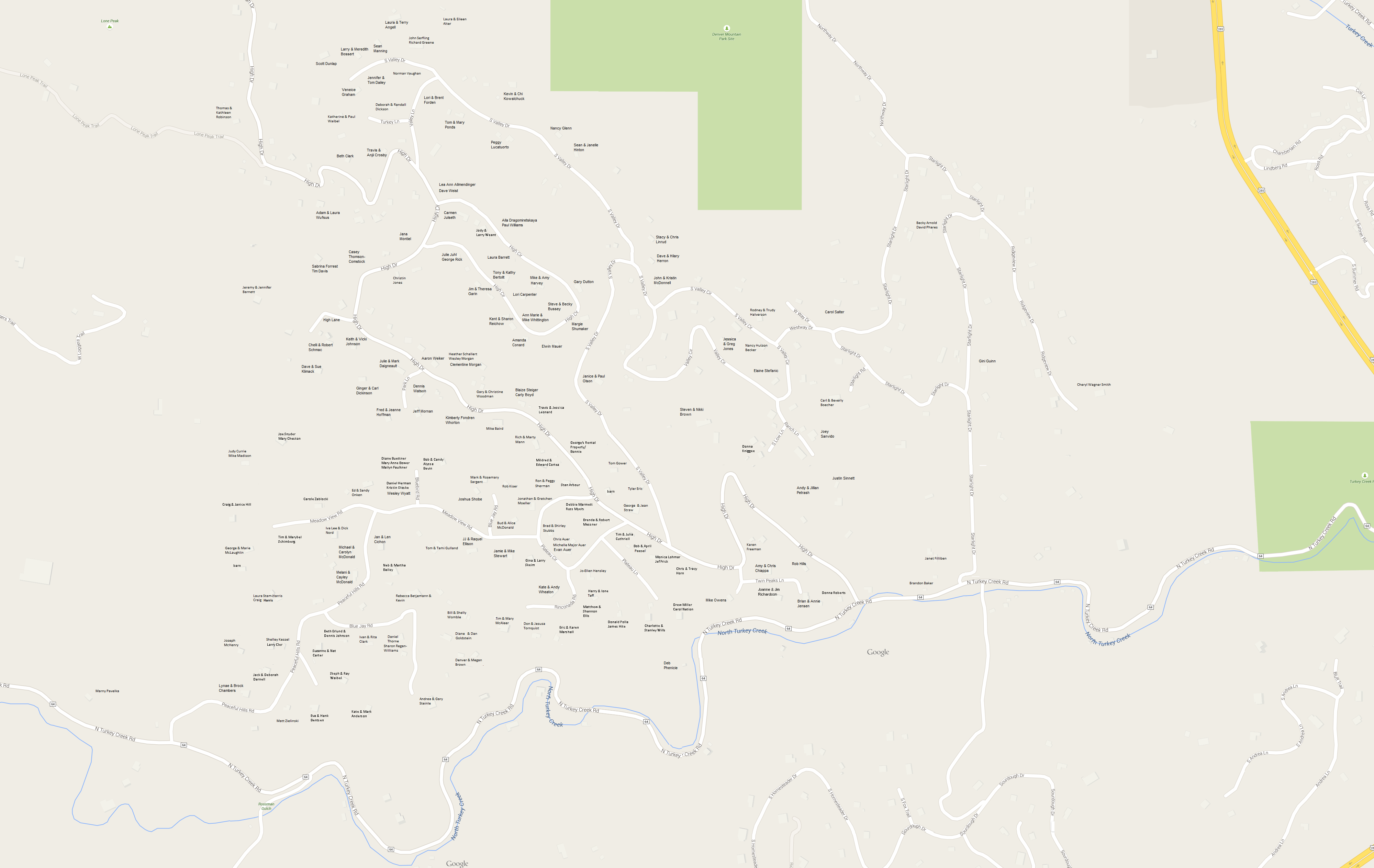
http://www.peeniewallie.com/images2017/peaceful_hills12.png
Posted by Rob Kiser on November 10, 2017 at 8:50 AM : Comments (0) | Permalink
November 9, 2017
Laziness Cuts Like a Knife
We started a fire;
That was never supposed to burn out.
You started a band;
That was cool for a while but it turned pretty bland.
I started a fight;
With the neighbor next door
And his pesky wife.
You started a job;
That you hate when your sober
And hate even more when you're not
I know you hate me too,
Always say you do
And you moved to Japan;
Thought a clean bill of health and a camera
Could show you the plan.
I bought a bird that repeats what i say,
But I'm lonely is all that he's heard.
You found a guy,
That is clearly the opposite me
With a black motorbike
I dicked around,
But it's just like a movie that's picture
Is off with the sound
I know you hate me too
You always say you do
And you started to write
It was subtle at first
But the danger was clearly in sight
I don't reply
Due to a lack of an ego
And laziness cuts like a knife
You say that you're good
Had a baby with biker
And named him Forest Whitaker
I'm laying low
On the probable chance
You convince me to give him a home
I know you hate me too
You always say you do
And I know that you hate me too
Always say you do.
Fort Atlantic - Let Your Heart Hold Fast
All my days are spent
All my cards are dealt
Oh, the desolation grows!
Every inch revealed
As my heart is pierced
Oh, my soul is now exposed!
In the oceans deep;
In the canyons steep
Walls of granite here I stand
All my desperate calls
Echo off the walls
Back and forth; then back again
To believe I walk alone
Is a lie that I've been told
So let your heart hold fast
For this soon shall pass
Like the high tide takes the sand
Oh, oh, oh, oh!
Oh, oh, oh, oh!
Oh, oh, oh, oh, oh!
Oh, oh, oh, oh!
Oh, oh, oh, oh!
Oh, oh, oh, oh, oh!
At the bitter end
Salt and liquid blend
From the corner of my eyes
All the miles wrecked
Every broken step
Always searching, always blind
Never fear! No! Never fear!
Never fear! No! Never fear!
So let your heart hold fast
For this soon shall pass
There's another hill ahead
Posted by Rob Kiser on November 9, 2017 at 2:59 PM : Comments (0) | Permalink
More To Do...
Got the new left handguard and new clutch lever installed. (Many thanks to the rock stars and B&B Cycles in Evergreen, Colorado).
Now, I need to:
Check Front/Rear Tire Pressure
Leave mailman a note in the mailbox.
Get insurance for Mexico.
Copy video off of Go Pro cameras.
Figure out which contacts are correct.
Print off Peenie Wallie labels.
Pack smaller currencies.
Find a belt.
Attach X-grip to RAM mount.
Pay gas/electric bill.
Posted by Rob Kiser on November 9, 2017 at 1:31 PM : Comments (0) | Permalink
Call The Credit Union
Call the credit union. I'm going to be riding through every country in Central and South America over the next 2-3 months. Please don't cancel either of my debit cards.
When will I be back? I'm not clear. There's no set date. Probably in 2-3 months.
So she put a note in both of my accounts that I will be traveling.
They have a new system and it may try to contact me (via text or email) to validate the transactions even though I have put a note on both of my accounts that I'm traveling in Latin America.
Christ.
Posted by Rob Kiser on November 9, 2017 at 10:59 AM : Comments (0) | Permalink
Verizon
So, I went in to the Verizon store and told them I was tired of getting ripped off and they said they'd lower my monthly bill and give me unlimited data as long as I signed up for auto-pay. So, I'm going to sign up for auto-pay.
OK. Set it up for auto-pay. Paid my bill.
Now, I'll call them and tell them that I'm leaving the country. I seem to recall that the guy at the Verizon store handed me a little note with a phone number on it of who I should call regarding service outside the USA.
travel pass - use phone like in USA. $10/day. Text talk data.
monthly pricing options -
1) $10/day.
2) $40/month. 100 minutes for talk. 100 sent text. incoming free.
3) $85 250 minutes of talk. 250 texts. 250 meg data. If you go over, you'll be notified. .25 cents over. texts .25 cents. $25/100 megs. Add this starting Tuesday November 14th.
4) pay as you go. pay for what you use.
$1.79/minute. $0.50 per sent text. .05 received. $2/meg.
Put Plan 3 on my phone. Don't mess up Jen's phone. Done.
This plan will be on my phone until I call in and tell them to remove it. I will get cell coverage in every country in Central and South America.
To make your phone work in Central and South America, there's a few little tricks you need to do. Turn off International CDMA.
Settings - Cellular - Cellular Data Options - Roaming Voice & Data:
- Voice Roaming - On
- Data Roaming - On
- International CDMA - Off
Be sure to turn OFF International CDMA.
How to call Verizon from Mexico.
Dial +1 908-559-4899 (Hold down zero to get the plus sign.)
How to call USA from Mexico:
00 - Mexico exit code to dial first when calling international
1 - US country code must be dialed next
00 + 1 + Area Code + Local Number - Overall dialing code format
Posted by Rob Kiser on November 9, 2017 at 9:59 AM : Comments (0) | Permalink
Will I Outlive This Illness?
I've been nursing a cold since October 11th. Mark finally called in a prescription for me and I picked it up yesterday (November 8th). I'm not sure if I will live or not, but I figure that the last thing I need on my trip through Latin America is to be trying to ride through the Baja half-sick. That would not help things any. So, I've been sick for a month now. God willing and the river don't rise, I will outlive this cold.
Posted by Rob Kiser on November 9, 2017 at 9:37 AM : Comments (0) | Permalink
iPhone Backup Failed
Christ. I thought that we'd solved this problem. Now, I'm getting this message on my new iPhone 6S Plus.
https://support.apple.com/en-us/HT205703
Device Storage:
Go to Settings.
Tap General.
Tap iPhone Storage.
Says my iPhone 6s Plus has used 16 gig out of 128 gig on the phone. OK.
iCloud storage
Go to Settings.
Tap [your name].
Tap iCloud.
It says in my iCloud Storage, that I've used 3Gig out of 5 Gig.
I can't figure it out. I just turned off iCloud backup. There's nothing on the phone I want to back up, and if I do, then I'll back it up to my MacBook Air. I've already copied all of my photos onto my home server RAID drive (Simon).
Posted by Rob Kiser on November 9, 2017 at 9:22 AM : Comments (0) | Permalink
November 8, 2017
Route through Baja
I think that my route through Baja will look something like this.
Posted by Rob Kiser on November 8, 2017 at 11:02 PM : Comments (0) | Permalink
Pemex Stations in Baja
So, I'm tentatively planning my refueling points in Baja. It gets a little tricky because, unless I'm mistaken, there are no open Pemex stations between El Rosario and Guerro Negro, a distance of 225 miles through open desert.
However, there are, as I recall, two places where people are know to sell gas on the side of the road. These locations are Catavina, BC and the exit to Bahia de Los Angeles.
So, the distances between these locations are something like this:
Mile 0 El Rosario - Last open Pemex station for 225 miles.
Mile 76 Catavina, BC - People selling gas on the side of the highway.
Mile 140 Exit to Bahia Los Angeles, Mexico. Dude selling gas out of a 55 gallon drum in the back of a pickup.
Mile 225 Guerro Negro, BC, Mexico. Open Pemex station.
So, now that I look at it, it seems to me that there are people selling gas on the side of the road at approximately 75 mile intervals.
The other part that I recall was that there was no gas from Ciudad Constitucion to La Paz, a distance of 130 miles.
Posted by Rob Kiser on November 8, 2017 at 10:05 PM : Comments (0) | Permalink
Applying Online for Mexican Tourist Card (FMM)
https://www.bajabound.com/before/permits/mexicoFMMonline.php
Online Tourist Card (FMM) Application
Inicio Forma Migratoria Múltiple
Forma Migratoria Múltiple (FMM)
ES EN
Important: To generate your request disable pop-up blocker browser and check to have installed Acrobat Reader. It is essential that has an email account.
Check the information registered
Entry Information
Means of entry*:
By land
Point of entry*:
El Chaparral
Date of arrival to Mexico*:
14/11/2017
Date of departure*:
05/12/2017
Personal information
Name(s)*:
ROBERT ANDREW
Surname(s)*:
KISER
Gender*:
Male
Date of birth*:
22/05/19XX
Nationality (Country)*:
United States of America
Country of birth*:
United States of America
Identification document
Type of document*:
Passport
Document number*:
XXXXXXXXX
Document number (Confirmation)*:
565666502
Country of issue*:
United States of America
Date of issue*:
17/10/2017
Date of issue (Confirmation)*:
17/10/2017
Expiration date*:
16/10/2027
Expiration date (Confirmation)*:
16/10/2027
Place of residence
Country of residence*:
United States of America
Address of residence*:
6778 BLUE JAY RD MORRISON CO 80465
Trip information
Reason of trip*:
Tourism
Specify*:
Recreational Activities
State*:
Baja California Sur
Address in Mexico*:
LA POSADA HOTEL NUEVA REFORMA 115 LA PAZ
Email
Email*:
rob.kiser@gmail.com
Email (Confirmation)*:
rob.kiser@gmail.com
Verification code*:
XLG3LT
Application fee
It is necessary that you pay the corresponding fee in order to obtain your application. When you send your information, you will be directed to the web page of Banjército.
DATOS DEL SOLICITANTE
Número de pasaporte565666502
Nombre(s)ROBERT ANDREW
Apellido(s)KISER
INFORMACIÓN DEL PAGO
ConceptoFMME Frontera Norte
Fecha y hora de pago08/Nov/2017
Total$500.00
Folio de la Operación5003446209
OK. SO, I downloaded a file named Recibo_FMME.pdf
Let's print this out.
Then, you have to hit return (REGRESAR), then you get the message:
Your Electronic Multiple Migratory Form has succesfully been created, now you can download it.
Click Download.
So, I downloaded it and printed it out.
Now, I think that I finally figured something out: There are 2 things you have to get, and you can apply for both of them online:
- Temporary Vehicle Import Permit
- Mexican Tourist Card/Visa (FMM)
However, if you apply for the Temporary Vehicle Import Permit online, you have to do it at least 7 days before you show up at the border. And I was getting really close on that one. So, instead, what I did was go to the Mexican Consulate in Denver. There, I could apply for the Temporary Vehicle Import Permit in person. And, I got my permit there. However, they don't issue the FMM there. So, then you go get your FMM online, which I did.
Now, I have my FMM and my Temporary Vehicle Import Permit. Now, all I have to do when I cross the border is have them stamp my FMM.
Also, I still need to get insurance for Mexico, but I believe I can get this at Baja Bound or some such place no problem.
Posted by Rob Kiser on November 8, 2017 at 5:58 PM : Comments (0) | Permalink
Third Time's a Charm - Permiso de Importacion Temporal de Vehiculos
So today, I got up and went down to the Mexican Consulate's office for my scheduled 9:42 a.m. appointment. Only I took the Beemer this time because the roads are so icy.
She was running a little behind, but she called my name at 10:00 a.m., and I went up and handed her my dossier. I'm not sure what she took,really, as I had so many copies of so many documents that you just wouldn't believe it. I have copies of my online FMM, copies of my title to the motorcycle, registration, and insurance. Color copies of my passport. She took some of the copies, and then she gave me lots of papers to sign. I don't recall what all of the papers were that I signed. I just signed everything she handed me.
"Where will you cross into Mexico?" she asks.
"San Ysidro," I reply.
"Tijuana?" She clarifies.
"Si."
These are the two border towns. San Ysidro, CA and Tijuana, Mexico.
"When are you crossing into Mexico?" she asks.
"Tuesday November 14th", I reply.
Only later did I realize that I could go into Mexico at any time after that date. So, I should have said Monday, but then she would have had to cancel the transaction and start all over, so I went with Tuesday. That's the date that I can go into Mexico. Fair enough. I'd be hard pressed to get to Tijuana before Tuesday, in any event.
Now, she wants a credit card. I have to pay a $400 bond, essentially, to take a 2017 vehicle into Mexico. When the vehicle leaves Mexico, I can get my money back, apparently. But I have to present the document when I leave Mexico to get my money refunded. I was charged $8,861.79 Mexican Pesos. If the exchange rate is 19:1, then that's $466 USD, which is about right. The permit costs about $44 USD plus some additional taxes.
Finally, she hands me the document that I've been struggling to obtain for so long, the Permiso de Importacion Temporal de Vehiculos. Now, understand, that I still have to get Auto Insurance for Mexico, and I also still have to get an FMM Visa when I cross the border.
"I can get FMM Visa here also?" I ask, just for clarification.
"No. You get that when you cross the border."
"Where do I go?" I ask.
"Aduana," she replies.
So, "Aduana" is "Customs". And, that's what I thought. I just wanted to clarify. So, I'm not clear how much time I've really saved myself by going down to the Mexican Consulate and getting this permit. Maybe I've saved myself some time. Maybe not. It's hard to know for sure.
I still have to get an FMM Visa when I cross the border at Tijuana. And I still have to get Mexican insurance for my motocycleta.
Posted by Rob Kiser on November 8, 2017 at 5:23 PM : Comments (0) | Permalink
Word for word Spanish Translation
http://www.spanishdict.com/translation
Posted by Rob Kiser on November 8, 2017 at 3:29 PM : Comments (0) | Permalink
November 7, 2017
Checking the Sunday (Nov 12th) Forecast
https://www.wunderground.com/ndfdimage/viewimage?region=sw&type=maxt&msg=6
It looks to me like the warmest ride is to just get on I-25 and run south down to Albuquerque, and then go west on I-40.
If I go this route, then I change time zones when I cross into CA, because AZ doesn't do Daylight Savings Time, so Phoenix (and all of AZ) is on MST right now.
Posted by Rob Kiser on November 7, 2017 at 10:13 PM : Comments (1) | Permalink
Catching up on photos...
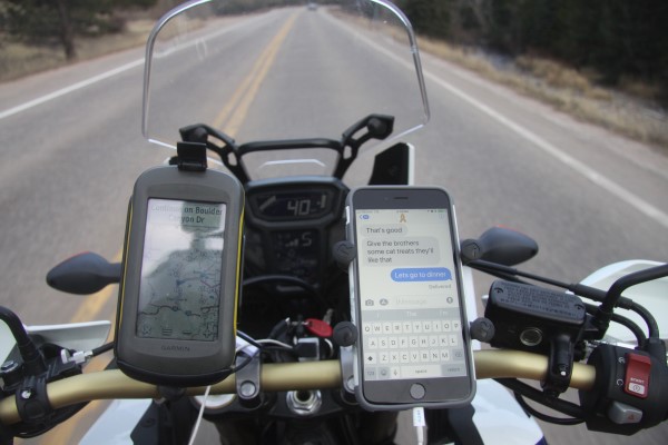
Posted by Rob Kiser on November 7, 2017 at 1:46 PM : Comments (0) | Permalink
Sharing Large Files from MacBook Air to home Windows Server
So now, I'm trying to figure out a way to share large files (zip file of photos) from the MacBook Air with my Windows home server. The method I've used before with some succes is ExpireBox.
Download link:
https://www.expirebox.com/download/b072c957559473a567516a58ecb7ad60.html
Posted by Rob Kiser on November 7, 2017 at 1:27 PM : Comments (0) | Permalink
Left Hand Guard and Clutch Lever for 2017 Africa Twin
Called RPM Motorsports. (303) 232-7576. They have my clutch lever, but not the Hand Guard. They will hold it for me. They close at 6:00. Ben.
Fay Meyers (303) 744-6632. 2 for parts. Left hand guard. 2017 Africa Twin.
Aurora Honda 303-341-7200. John. He can get it tomorrow. Call him back pronto.
Chapparal Motorsports - 2 parts. See if Al is there. Do I need the screw that goes in with it?
OK. John at Aurora Honda says everything will be in Thursday. This is the hand guard and some parts that mount it on, I think. He will call/text me on Thursday when it all comes in.
I will go down to RPM motorsports and get the clutch lever now.
Posted by Rob Kiser on November 7, 2017 at 12:03 PM : Comments (0) | Permalink
Banjercito Temporary Vehicle Import Permit
Dial 011 52 55 5626 0500. Then, a recorded voice says blah blah blah "markey ahora". You enter the extension now: 2637.
Then, they'll say..."blah blah blah for English, press 2 ?
"Thank you for holding."
"If you know what the requirements of obtaining a Banjercito Temporary Vehicle Import Permit are, but wish to make an appointment, press" 3.
For information on importing
For information on appointment press 3
For info on requirements press 1.
To schedule an appointment, press 2.
Press 2.
To schedule you must write down the appointment number.
We will transfer you to one of our agents.
9:42 a.m. tomorrow morning - November 8th.
Confirmation Number: 131 156 841 118 181 027.
So, tomorrow will be my 3rd (and hopefully final) trip to the Mexican Consulate in Denver. I swear it's like my second home. The problem I have now is that, when I go online to fill out the Temporary Electronic version of the FMM - when I fill out the online form, the "NAMES" section is confusing to me. People in Latin America tend to have more than the standard first, middle, last that is common in civilized countries. So, when I'm filling out NAMES section of the form, you'll understand that there is going to be some room for error here. Also, consider that the form and directions are all in Spanish, and you'll begin to grasp why I keep getting the "name" section filled out incorrectly.
Let's see if I can provide a link to the offending section of the online temporary version of the FMM form:
Here's the form when you first start to fill it out. So, obviously, no one can read this because it's not in English. That's the first problem, obviously.
But if you go back to the top right section of the form, you'll see you can choose "ES" (Spanish), or "EN" (English). So, click on the grey "EN" box, and it changes to English.
So, now we see the first box on the form is labeled "Name(s)". Now, what you're supposed to put in here,"FIRSTNAME MIDDLENAME" apparently. Who would have guessed? Christ.
The asterisks mean "Data Required" (this is at the bottom left of the form).
Birth date Format: dd/mm/yyyy o ddmmyy
Passport Issuing Date: dd/mm/yyyy o ddmmyy
Passport Expiration Date: dd/mm/yyyy o ddmmyy
Also, it's nearly impossible to get the dates correct, and there are several you have to enter.
You have to enter your Birthdate, the Issue Date of your passport, and the Passport Expiration Date. Now, normally, this wouldn't be very hard. But the date format we use and the date format they use are not the same.
If I said today is 11/7/2017, like it says in the corner of my computer screen, no one in America would think today is July 11th. But that's how their date formats work.
So, this online electronic TEMPORARY FMM VISA Application has to match EXACTLY what your passport says. But, I kept getting my name wrong on the FMM. And I've also managed to the the Passport dates wrong as well. Once you get your name right on the FMM, and you manage to get the dates hammered in backwards so the dates are correct, then you have to schedule an appointment with the Mexican Consultate in Denver. Then, once you have your appointment, then you go to the Mexican Consulate Office in Denver. The address is:
5350 Leetsdale Dr #100, Glendale, CO 80246
Phone: (303) 331-1110
Now, keep in mind, these people aren't open very long. They close every day at 2:00 p.m. like clockwork. And they don't have a copier. Or a printer. Or internet access. And cell phone use is prohibited in the building. And, when you get there, you'd damned sure better have all of your paperwork. This includes the originals, and copies of, the following:
o Appointment Number Issued by the Mexican Consulate in Mexico City.
Confirmation Number: 131 156 841 118 181 027.
o Passport (Original)
o Copy of Passport. (We told you to bring this, remember?)
o Printed copy of Temporary Online VISA (FMM) that matches Passport EXACTLY.
o Vehicle Registration
o Copy of Vehicle Registration. (We told you to bring copies, didn't we?)
So, you show up with all of this documentation, at the time of your appointment, and then they'll tell you what else is wrong. And, oh, by the way, we close at 2:00. Wash. Rinse. Repeat.
All of this bureaucracy makes me remember that the border crossings always took at least half a day. This is the part of the trip I like the least, obviously.
Yesterday, they kept sending me back to the Office Depot on Colorado Blvd near the Mexican Consulate office, as the Office Depot has computers with internet access, and they'll allow you to go online, fill out the Temporary Electronic FMM form, make copies of your documents, etc. Obviously you can't expect the Mexican Consulate to have internet access, printers, or copiers. That would be absurd.
Posted by Rob Kiser on November 7, 2017 at 9:20 AM : Comments (0) | Permalink
November 6, 2017
Setting the Clocks
Now that daylight savings time has passed, it seems like a good time to set all of my clocks:
x iPhone 6S Plus - Clock looks correct.
x Home Server - Clock looks correct.
x Home wall clock - Clock looks correct.
x iPhone 4S - Clock looks correct.
x Garmin Montana - Clock looks correct.
x 1st Canon EOS 50D - Set clock back one hour.
x 2nd Canon EOS 50D - Set clock back one hour.
x Macbook Air - set it back a few minutes.
x And let's
set the clock on the GoPro Hero 5.
x finally, let's set the time on the Africa Twin.
Done. OK. So,I'm sure that I'm missing some clocks, but these are the ones I can think of off the top of my head.
Posted by Rob Kiser on November 6, 2017 at 4:01 PM : Comments (0) | Permalink
November 5, 2017
Renaming Photos on MacBook Air
So, I'm trying to figure out how to rename my photos on the MacBook Air. The problem is that, when I connect the Canon Cameras to the MacBook Air, they don't show up in FInder. Now, probably if I pulled out my memory card, shoved it in a USB card reader, and then connected this to the MacBook Air, then I think I could copy my photos over, which is what I want to do. But, I don't want to bend the pins in my camera by pulling out and jamming in a memory card every day just because Apple sucks so hard there aren't words.
So instead, let's try this. Let's bring them into iPhoto(Photos). Then, we'll try to export them from iphotos, and then rename them. Let's see how that works.
So, I hook up the camera to the MacBook Air. Photos launches. Click "Import All New Photos Because Apple Sucks Dicks".
OK. Now, I see....it's importing a lot of photos I'd deleted from iPhoto, but they were still on the memory card. Nice. So, now I've got to update my daily task list to include:
o Delete photos from memory cards on cameras.
OK. Now, I have all of the photos in iPhoto. Unhook the camera. Now, let's see if we can figure out where iPhotos stores them.
"Where does photos store my files?" - "They are stored in a file named Photos Library which is located in the /Home/Pictures/ folder. You need to open Photos in order to see what is in the the library."
OK. I do see the /Pictures/Photos Library file. You double click it and it launches Photos. Clever.
"Go to Photos Menu -> Preferences -> General. Click the "Show in Finder" button in the dialog box. Right-click and select "Show Package Contents", this will show a directory listing. Select and open the folder named "Masters"
But, I think instead that I'll try to do the following:
1) export all 484 images from Photos
2) make a copy of them in another folder
3) run the new program to rename them based on exif data.
1) Launch Photos.
2) Hit Command-A to select all photos.
3) File - Export - Export Unmodified Original for 484 Photos...
4) Export IPTC as XMP?
"Export photos in their original format. You can export photos in the original file formats in which they were imported into your Photos Library. Click the Export IPTC as XMP checkbox to export IPTC information (assigned IPTC metadata and keywords) as a sidecar XMP file." I have no clue what this means.
5) Click Export.
6) Click New Folder.
7) Name of new folder: iphoto_sux_dix_2017_11_05
8) Click Create
9) Click Export Originals
OK. I'm not clear why, but Apple put it underneath the existing folder named iPhoto_sux_dix. So, it was iphoto_sux_dix\iphoto_sux_dix_2017_11_05. Brilliant.
So, somehow, I managed to move the folder up to it's correct location, so my folders look like this:
\documents\iphoto_sux_dix (this has 197 photos in it, and they're all named yyyy-mm-dd etc.)
\documents\iphoto_sux_dix_2017_11_05 (this has 484 photos in it)
Christ I hate apple. Eventually, I realized that I had already exported and renamed the photos prior to the ones I shot today. So, I selected all of the old photos from Photos and drug them to the Recently Deleted trash can on the left side of the screen. So now, we should just be dealing with the new photos that I shot starting yesterday. Of course, it's apple, so for some reason, he thinks the photos started on October 22. Great. Thanks for that Apple.
So, now we're dealing with 90 Photos. Went back into my iphoto_sux_dix_2017_11_05 folder and deleted everything. Let's try this again.
Ctrl-A - File - Export - Export Unmodified Original for 90 Photos - Export - iphoto-sux-dix_2017_11_05.- Export Originals. Export Complete - It disappeared before I could read it. Thanks Apple. Thanks for that.
OK. Now, I have a new folder named iphoto_sux_dix_2017_11_05. It only has 90 photos in it. But they're all of the format IMG_9999.jpg. So, now we want to do the renaming trick.
The software I downloaded is named ExifREnamer. So, now what I do is go to:
o Finder - Documents - iphoto_sux_dix_2017_11_05
o Command - A to select all photos.
o Right Click - Open With - ExifRenamer.
o Rename All.
It does appear to have renamed them all. Christ.
Now, what I want to do is delete them from Photos, and re-import them with the correct name format.
Now, I go into photos and delete everything. Are you sure you want to? Yep.
Now, File - Import - iphoto_sux_dix_2017_11_05. Command - A. Review For Import. Import All New Photos.
Christ. That worked. So now, I have figured out how to rename and then reimport my photos. Christ.
Now, let's go through and mark favorites, as we would normally do.
Then, I exported my favorites to a new folder named favorites. OK. Good enough.
Now, I'm got to copy these files onto my home server through an RDP tunnel.
Posted by Rob Kiser on November 5, 2017 at 8:29 PM : Comments (0) | Permalink
Daily Task Lists: The Master List
This will serve as the Master List of my Daily Task Lists.
================
In the morning:
================
o Turn off the alarm.
o Check the weather forecast.
o Plan the daily ride (if you didn't do this last night).
o Plan the fuel stops for the daily ride (if you didn't do this last night).
o Pick a place to spend the night (if you didn't do this last night).
o Clean motorcycle visor.
o Clean motorcycle rear view mirrors.
o Oil chain.
o Check tire pressure on both tires.
o Check brake light.
o Check running light.
o Check headlight.
o Check out of the hotel.
o Ride 100 miles before noon.
================
At the gas station:
================
o Take photos of the gas pump.
o Get a receipt.
o Photograph the receipt.
o Take photos of the odometer.
o Take photos of the gas station.
================
At the end of the day:
================
Post on Peeniewallie:
o I'm alive and in location (country, town).
o Daily expenses.
o Trip meters and odometer.
o GPS tracks.
Copy all files onto MacBook Air from:
o Canon EOS 50D (w/ 17-85mm lens)
o Canon EOS 50D (w/ 100-400mm lens)
o GoPro Hero 5
o Garmin Montana 600
Archive all daily files from MacBook Air to Seagate External 4TB drive from:
o Canon EOS 50D (w/ 17-85mm lens)
o Canon EOS 50D (w/ 100-400mm lens)
o GoPro Hero 5
o Garmin Montana 600
Delete files from cameras:
o Delete photos from memory cards on Canon EOS 50D (w/ 17-85mm lens).
o Delete photos from memory cards on Canon EOS 50D (w/ 100-400mm lens).
o Delete videos from memory cards on GoPro Hero 5.
Upload:
o Upload tracks from Garmin Montana to internet.
Charge electronics:
o GoPro Hero 5
o phone 6S Plus
o iPhone 4S
o Canon EOS 50D batteries from both cameras
o Charge laptop
o Charge Garmin Montana 600
Other:
o Clean motorcycle visor
o Clean GoPro Hero 5 lens and screen.
o Review photos for daily expenses incurred.
o Record all daily expenses in expense spreadsheet on home server.
o Check the weather forecast.
o Plan your ride for tomorrow.
o Set an alarm clock to wake up.
Posted by Rob Kiser on November 5, 2017 at 7:25 PM : Comments (0) | Permalink
Shake-down Cruise #9
So today, I decided to do another shake-down cruise. I've done a couple up to boulder, and a few closer to home.
But this time, I decided to focus on cold-weather riding. I wanted to see if I could put on enough under-armor so that I wouldn't freeze to death at 46F, which is supposed to be the high on November 12th, the day I leave.
So, I put on my under armor, some long jongs, my jeans, my riding pants, shirt, riding jacket, and my North Face ski gloves that I got in Whitehorse, up in the Yukon when I almost lost my hands up there in July three years ago.
I decide to head out to Grant, and then go across Guanella Pass, and come back that way. See, I'm thinking that it will get colder as I get closer to Grant, and then going across Guanella Pass will be a good test of my cold weather riding gear, as it will probably be colder on top of Guanella Pass, I figure.
So I ride out Highway 285, pretty much following the speed limit. All of my gear is working pretty good. My helmet is missing a little piece on the front that's supposed to allow you to regulate the air flow into the helmet. That piece sort of fell apart and disappeared at some point this summer and new freezing cold air is blowing in, so I stuff a napkin into the gaping hole as I'm driving down the road and that fixes the airflow issue.
My chin is cold though, so I keep shoving my neckwarmer up over my chin and it works until in falls down again. So I sort of periodically shove my neck warmer up over my chin as I'm driving out Highway 285 towards Grant.
The temperature drops from the 50's down into the 40's, but I'm actually not insufferably cold. My plan is to ride due south out of Denver in I-25, heading for warm weather (as opposed to going the scenic route through the mountains).
So, I'm just trying to see if I can ride comfortably at 46F. That's the real purpose of this trip. Well, that, and I've now strapped my gas can onto the back seat. So, I'm trying to see how well that rides back there. Also, I have my iPhone 6S Plus in the Ram mount, and so we're trying that out and making sure the GoPro Hero 5 is working. And the Canon w/ 17-85 mm lens, and the Canon with the 100-400 mm lens.
Like, after years of being on the road, I've finally realized the value of shake-down cruises to test out the gear. It's much easier to get it right while you're at home, than it is to sort out when you're in Lima or the Atacama Desert.
I'll never forget the first time I ever rode a bike through Baja. I was getting ready to leave San Diego on a Honda XR650R, and I had this backpack shoved full of crap, and tied it onto the back fender. I was going down the interstate (I-5) heading for the border when the cars behind me started honking and I realized it had fallen off of my bike into the freeway. So, I doubled back and got it, and took it back to the house where I was staying, and basically said "fuck this...i don't need all f this and I don't have any place to carry it" so I left it. So, the lesson is....pack only the bare essentials. Don't carry too much stuff. That's just stupid. And, do some test rides with your gear so that you don't have any big surprises before you even get out of the country. That's where we are now. Trying to make sure that the gear we've purchased is practical and functioning as desired. THis is the purpose of these daily shake-down cruises.
At some point, I realize that the clock on my motorcycle doesn't match the time on my iPhone 6S Plus. So, yes...note to self. We have to synchronize all of the clocks. However, this is a little tricky, because daylight savings time ended last night/this morning at 2:00 a.m. So, yeah...note to self - I've got to synchronize several clocks. (GoPros, Canon Cameras, Honda AT, etc.)
This is why we do these little cruises. To get everything working just right.
I love having 2 GPS units. They're both mounted on RAM mounts, and they sort of argue about the best way to get somewhere, and they differ by a mile or three and this is good. It's like two people debating about the best route to get somewhere. And, in some cases where I don't have cell coverage, somehow the Waze app keeps working on the iphone. How? I have no clue.
At some point, the Garmin Montana 600 just dies. Just checks out. It's sort of hard to diagnose, as I have a cigarette lighter adapter that goes to 2 usb outlets. And it has a glowing blue light that indicates it's working. And my iPhone 6S Plus indicates that he's getting juice. But the Garmin Montana is just toast. He's not getting any juice, or something else is wrong. I'm not clear. Might be the cable. Might be the cigarette-lighter-to-USB. Might be the Garmin Montana. I have a new cigarette lighter to 3 usb adapter on order and it will be here Monday, I think. At home, I plug in the Garmin Montana with the same USB cable to the laptop and it starts working immediately. So I have to think that it's something with the cigarette lighter to USB adapter.
But this is why we do this. Try to iron out the little bugs.
Also, I'm watching my instrument cluster on the AT. It's mind-numbingly complicated, but I'm getting better at it. Better at understanding the flow. I figure out how to make the digital dash show me the outside air temperature, if that makes any sense. So I can see the temperature while I'm riding. I also get it to display the Trip Meter A. (I set Trip Meter A & B at the same time, but we'll leave that for now.) So, I'm following Trip meter A. I'm watching my fuel level. And, I also have it configured to show me my average mpg, and I reset this value when I filled up last time. So, the goal here, really, is to run the bike completely out of gas and see what the range is, knowing that I have 2.2 gallons in the spare gas can on the seat behind me where a woman would ride if I could find one suicidal enough to ride with me.
So, I'm testing out the dashboard gauges. So far, it says my average mpg is 53.3, so that means in theory I should be able to go 250 miles on this tank of gas, but so far I've only gone 190 or so. This is a huge deal. Like...riding the bike until it stops is something that every person with a brain should do so they know for certain, what their range is. I've run out of gas in some very bad areas before. Knowing your range is very important if you're fixing to cross the Great American desert (ran out of gas between Ely and Tonopah), the Punta Prieta Desert (hit reserve before the exit to Bahia Los Angeles), hit reserve at the Yukon Crossing on the Dalton Highway in Alaska. So yeah...this is important. Hugely so.
At some point, the iPhone 6s Plus starts showing an icon that indicates "Volume - Mute", which is hard to comprehend. And, it did this last time also. But now, I have an idea. The Ram mount is squeezing the volume control on the iphone. Score! Slide it up 1/2" and the problem goes away.
I can do this. I can figure this out. I'm not dead yet. But, I am struggling with an INSANE amount of new technology. Like, the GoPro Hero 5 is brand new. The iPhone 6S Plus is brand new. The motorcycle is brand new, and the instrument cluster is more complicated than what the astronauts had when they went to the moon. All of this. All of this has to be working perfectly. I have to learn the details and nuances and complexities of all of these devices, and I'm no spring chicken. My memory's not what it once was.
OK. So, the Garming Montana 600 is checked out. But everything else is working fine and I get to Grant. They usually serve food here, but there not here for some reason. There's a sign that says push a button and they'll come out, but I don't want to put anyone out. I decide to ride over Guanella Pass and get some food in Georgetown. So, I start climbing and climbing and it gets colder and colder and finally, I start seeing ice on the road. Now, a smart person would turn back. But my GPS tells me it's only two miles to the summit, so I keep riding over worse and worse snow and ice until finally, I crest the summit, creeping along very slowly, and now I hit a patch of black ice and the bike goes down.
Now, mind you, I was not going fast, but the bike crashes to the ground and slides across the ice. Somehow, I'm not hurt at all, but the left hand guard is shattered and the clutch lever is badly bent. No one else is around. I stand up in the middle of the road, delicately perched on this sheet of ice. I don't see another soul. I do see some parked cars in a parking lot at the summit, but no one is in them. I wonder what to do. I put all of my gear on the side of the road. Cameras. Gas can. And I put it on the side of the road. I start trying to lift the bike but it's impossible for me to do it alone on the ice. I imagine a car cresting the summit, seeing me in the middle of the road, and sliding into my bike totaling my Honda.
I'm not sure what to do...eventually, I see a car crest the summit, and I walk torwards them, waving frantically, so that they might stop before they plow into my bike.
They park and 3 people get out and walk towards me. One young man and two young females.
"Do you think you could help me stand it up?" I ask him.
The two of us quickly stand the bike up on the slick black ice. I point it in the direction I came from, not wanting to try to proceed any further. Praying that I can make it back down the mountain the way I came up, without crashing again.
"I think I'll let some air out of the front tire," I offered to no one in particular. And I let about 20 seconds worth of air out of the front tire. Like, I'm not overly bright, but deflating the front tire is a smart move when you're on ice. It's the best call.
"Could y'all hand me my gear there?" I nod towards the pile of cameras on the shoulder.
"Could you strap the gas can on the back?" I ask.
The whole time, I'm precariously perched in the road, trying to hold the bike up on the slipperiest substance known to man.
They strap the gas can onto the back seat and hand me my cameras. My left hand guard has broken off and is laying on the side of the road. One of the girls offers it to me, but I decline.
"You keep it. As a souvinere" I insist.
And I start riding away uphill on the ice-skating-rink of a road. I never even managed to say goodbye or thank you. Nothing. I just road away, praying I would not crash again.
Somehow, I made it home alive. The temperature kept dropping and dropping as I rode home, but the only thing that was really seriously cold on me was my hands. Also, now I'm missing my left handguard, So, that's a lot more cold air directly on my left glove/hand.
Somehow, I make it home in one piece. And now, I've already told myself. I've got to start doing my daily routine. Every day, I have to go through my end-of-the-day list, starting tonight. So, I'll make my daily task list, but I'll do that as a separate post, as I'll refer to it every day, I'm sure.
Posted by Rob Kiser on November 5, 2017 at 6:03 PM : Comments (0) | Permalink
Active Volcanoes in Central America
Apparently, there are several active volcanoes in Central America. Some how I missed them last time. I think it would be cool to hike up to one and get some photos this time.
https://en.wikipedia.org/wiki/Central_America_Volcanic_Arc
Several volcanoes in Central America are currently active, including Arenal, Turrialba, Irazú, Poás, and Rincon de la Vieja in Costa Rica; Cerro Negro, San Cristóbal, Concepción in Nicaragua; Chaparrastique or San Miguel, Ilamatepec or Santa Ana, Izalco in El Salvador; Santa Maria/Santiaguito, Pacaya, Fuego in Guatemala.
Posted by Rob Kiser on November 5, 2017 at 9:04 AM : Comments (0) | Permalink
November 4, 2017
Fuel and Expense Tracking for Tierra Del Fuego Trip
Today, I fueled up the AT and I thought that I should probably start tracking my fuel for the trip. Like, my thought is, I need to know how much fuel I'm carrying, and what sort of gas mileage I'm getting, so that I'm not stranded in the deserts I'm about to cross (and there are many), e.g., Punta Prieta desert, Sechura desert, Atacama desert, just to name a few.
Fuel
Odometer Location Gallons Type $/gallon Total Cost
4,200 Marshdale, CO USA 4.17 Reg. Unleaded $2.499 $10.42
Expenses:
Date Location Descr Amt
11/4/2017 Marshdale, CO USA Fuel $10.42
I've created an excel spreadsheet (tierra_del_fuego.xls) where I plan to track all of this....my fuel, my MPG, my expenses, etc on a daily basis. I need to track my expenses just for discipline. I need to track my mileage so that I don't run out of gas in the desert.
"A large 4.9 gallon fuel tank - and the engine's fuel efficiency of approximately 50 MPG on the Africa Twin (WMTC in DCT mode) - provides a range of over 250 miles."
So, I'm not really clear that I can go 250 miles on a tank of gas. But we'll track the gas mileage so I get a better idea what my range is over the course of the trip.
The Fuel Indicator Gauge has 5 lights. When only one light is lit, you have approximately 0.8 gallons of gas left. The fuel light starts flashing. At this point, it should also show the available driving distance when this happens.
Posted by Rob Kiser on November 4, 2017 at 10:46 PM : Comments (0) | Permalink
New Tires on 2017 Honda Africa Twin
For the record, we will say that the new tires were put on the KTM on Thursday November 2nd, 2017 with 4,200 miles on the 2017 Honda Africa Twin.
Front Tire: Scorpion A/T 90/90-21 M/C 54S Pirelli MT 90
Rear Tire: Scorpion A/T 150/70-R18 M/C 70V Pirelli MT 90
Posted by Rob Kiser on November 4, 2017 at 10:24 PM : Comments (0) | Permalink
Shake-down Cruise
So today, I did a little shake-down cruise up to Boulder and back. I ride up through the mountains along CO 119, aka the Peak to Peak Highway. I do this because I know it's colder up there than it is down the hill. And I wanted to see how my gear held up.
I tried to put the 2.2 gallon gas can on the back of the bike, but I really don't have any straps that will hold it in place. I need to swing by Wal-Mart or Home Depot to get some new tie-downs, I think.
I put the case on my new iPhone 6s Plus, and the Ram mount holds it in place pretty well. So, I have 2 gps units, effectively. One requires cell coverage and the other one doesn't. So, I watch the two GPS units, and they behave somewhat differently, but it's nice to have a 2nd opinion. My cigarette lighter keeps them both charged and running. But it might be nice to have a cigarette lighter adapter than went to 4 USB ports instead of 2, and I do have a USB hub, but that would be a lot to have on the dash of the AT, I think.
When I plug the microphone into the iPhone 6s Plus, it says something about the headphones being plugged in. So, I'm not sure what's going on. If it is plugged into the wrong hole or what. OK. I just checked. There's only one place to plug the microphone into. So, I have the microphone in the correct jack. Not sure what's going on.
The nice thing is that I've just about figured out the digital display on the 2017 AT. It's fairly complicated. Certainly more advanced than on any motorcycle I've ever owned. But I figured out how to reset the trip meters and how to see the temperature on the dash. And, it got down into the 40's was the coldest I ever saw it get today on the bike. But, honestly, it was so cold I almost lost my hands and I'm wearing North Face ski gloves. So, I've got to get some warmer gloves, if I'm going to make it out of Colorado in November, I think.
Also, I will have to pack some long johns or under armor. I was just way too cold. Right now, I'm planning on just running south on I-25 to I-10, then rolling west on I-10. This would be the quickest way to get out of the cold, I think.
I should mention that I'm sick. I've had a cold now since Wed Oct 11th. It is now Saturday Nov 4th. So, I've had a cold for 3 1/2 weeks now. Lord.
OK. I just ordered some new mittens off of Amazon.
Posted by Rob Kiser on November 4, 2017 at 8:47 PM : Comments (0) | Permalink
Nice Day For a Ride
I'm starting to plan my escape. The weather looks OK, clear and cold for Sunday November 12th. I used to have a little thing I wore around my neck to keep me warm, but I can't find it recently. Maybe I need to order another one.
Yesterday was sort of interesting. Went down to the Mexican Consulate in Denver, hoping that they could clarify some of the issues I'm facing getting into the country. But when I get there, it's just sort of this nightmare of confusion. I can't read Spanish. It's just gibberish to me. And I can't listen to Spanish and understand a word they're saying. All I can do is belt out words or at best short phrases in Spanish.
And I realize all of this when I get there. But there's all of this angst and trepidation and confusion and lack of information. But eventually, I find enough people that can speak English that I get to the right side of the building in the right office and I see the Banjercito. So, I know I'm in the right place to apply for a Temporary Vehicle Import Permit to Mexico.
Only the Banjercito is closed, and the woman says I need to make an appointment to apply for my Temporary Vehicle Import Permit and to make an appointment I have to call Mexico City.
And now, we have to go into a whole other area of confusion and misunderstanding. Calling a foreign country which is not as simple as it sounds (to me at least). So I idea the number but then it's all in Spanish and now the woman shoos me out of the building pointing to a sign that says No Telephone Calls in Spanish.
So now, I'm outside in the parking lot, and there's a couple of Mexicans out here selling trinkets in the parking lot and I ask if they speak English and one of them does a little and so I call the phone number in Mexico City and have him there on the speaker phone and then it says "Press 3 For English" and of course we press 3 for English, and now I'm on hold for the person that can, in theory, grant me an appointment at the Mexican Consulate in Denver to apply in person for a Temporary Vehicle Import Permit, but no one ever answers and finally I just hang up.
The little flyer she gave me specifies a time window when you have to call, and the time is in Mexico City and I have no idea what Time Zone Mexico city is in and if they do Daylight Savings Time, etc.
I walk across the parking lot to a cart selling some sort of Mexican food, but they don't have a menu or anything. Just some woman leaning over a hot grill and a cooler on the ground before the cart.
I try to talk to the lady trapped inside the cart...to see what food she might offer me for sale, but the woman standing before the cart explains to me that they're about to close and that's why there's no menu or anything.
We go back and forth, and I end up ordering three carnitas tacos and pick up some drink out of the cooler I've never seen before.
When my food comes, I pass her a 20 peso note and she starts laughing uncontrollably. Like, who would have thought this skinny white gringo would have pesos in his wallet?
We settle up and I walk back across the parking lot to the two men that are hawking trinkets...the one guy that helped me call Mexico city, and I hand him a $5 bill (USD). And he's shocked. He looks at me like I'm crazy or maybe the richest man on earth...I'm not sure.
When I get home, I'm not really sure how to proceed. I'm reasonably sure that no on will ever answer the phone in Mexico City, but I figure that I have to try. Putting my head under the covers isn't going to get me a Temporary Vehicle Import Permit into Mexico. I decide to figure out what time it is in Mexico City.
I sort out that Mexico City is in Central Standard Time (CST) and that they do use Daylight Savings Time, but they don't change their clocks at the same time was we do in the USA. We change our clocks on November 5th and they change their clocks on October 29th so, for this one week, we share the same time. So it's the same time in Mexico City as it is in Denver for this one week of the year.
So, I'm still in the window of time specified on the brochure to call Mexico City and set up the appointment. So, I ring them up and lo-and-behold, this time, someone answers the phone in Mexico City and he speaks English and he sets me an appointment for 12:18 pm on Monday morning.
It's such a great feeling to try, and then to be able to find people who are willing to help you. It's so different from the world we're shown on the television.
And...this is what the trip is about, really. This is what I like most about the adventure...you're pushing yourself every day to do things you wouldn't normally even consider doing. Pushed out of your comfort zone, you're sort of forced into a world where you have to interact with total strangers, communicate every day in a foreign language, drive down roads you've never seen before, and basically go explore the world in a way that's not so far removed from the earliest explorers. Like...that's what I'm going to be doing for the foreseeable future....just going wild across the planet, exploring in a way that most people either aren't interested in, or wish they could do, but will never will do for various reasons.
But now, I'm sort of in that odd state where, I'm planning on taking off. Like a bird fledging the nest. And, you go back and forth between "This is Suicidal" and "I am a genius".
Like, no one else is doing this. They're just not. Like, last time I road from Illinois down to Panama, I saw 1 person that was doing what I was doing, and I ran into him briefly at the Tocumen airport in Panama City. There's not a lot of motorcycle riding cross country in Central America. Yeah...I know...I hear rumors about 3 guys who are going into the Darien Gap. I'm happy for them. But that's 3 people out of a country of 300,000,000.
I have to think that, if I'm capable of making it to Tierra Del Fuego on a motorcycle, that will put me in a very small segment of the population in North America. Like...probably...say 1 in a million? I would guess that would be around right.
Posted by Rob Kiser on November 4, 2017 at 1:24 PM : Comments (0) | Permalink
November 3, 2017
Mexican Consulate Denver, CO
I'll plan on driving into Mexico on Tuesday Nov 14th.
So, I figured I'd go down to the Mexican Consulate in Denver, CO.
Address: 5350 Leetsdale Dr #100, Glendale, CO 80246
Phone: (303) 331-1110
But, when I get there, they tell me that they will issue me a Banjercito Vehicle Permit, but it's only done by appointment. So, I have to call Mexico and schedule an appointment. I'm like...You've got to be joking. I have all of my paperwork. Trust me. They're not joking.
011 52 55 5626 0500 ext 2637
Lunes a Viernes
(Monday - Friday)
08:00 - 16:00 CST (Time is in Mexico City)
Monday - Nov 6
12:18 noon.
Appointment Number: 131137549144181027 Denver CO Mon Nov 6 12:18
1 FMM
2 Passport
3 Registration
Posted by Rob Kiser on November 3, 2017 at 3:17 PM : Comments (0) | Permalink
Applying for tourist permit (FMM) and Banjercito Vehicle Permit
https://www.bajabound.com/before/permits/vehicle.php
1) First, you have to get the FMM = Forma Migratoria Múltiple (Mexico Visitor's Permit)
If you are a foreign citizen, before starting the vehicle permit application process, you must go to INM's (Instituto Nacional de Migración) website to apply for an immigration pre-authorization for your FMM, aka tourist card. The vehicle permit will be issued for the same period as that stated on your immigration pre-authorization. Furthermore, once you've entered Mexico you must approach an immigration officer in order to exchange your pre-authorization form for the proper immigration document.
https://www.inm.gob.mx/sae/publico/pre-autorizacion.html
At this site, they want to know the following:
Have you ever visited Mexico? * : Yes
Religion * : Protestant
Main activity in your country of residence * : To Work
Have you been expelled from Mexico? * : Do Not
Do you have a criminal record? * : Do Not
Pre electronic authorization number: 2022721
2022721.pdf
So, I've decided to carry a 1 GB memory card with all of my documents on it (insurnance, registration, passport, driver's license, etc.). I will start with this file: 2022721.pdf.
s:\_documents\Mexico_FMM\2022721.pdf
So, I did this part, but really, the only purpose of doing the electronic pre-authorization on the FMM is so that you can continue to the next step which is to apply for the Banjercito Vehicle Permit online. But now I'm concerned because it says that they will mail the Banjercito Vehicle Permit to me, but I won't be here to get it. So....
I'm calling the Mexican Consulate in Denver (303)331-1110, but they won't answer the phone so.
Press 8 for English.
Press 0 for Operator.
343 - non mexicans
330 - Locations and driving directions to our offices
335 - Visa requirements for non-mexicans
336 - Requirements to apply for a tourist visa
337 - Requirements apply for an FM3 or a non-immigrant retiree visa
338 - Power of Attorney
339 - Helpful items list
340 - Doing business in mexico
341 - tourism information
341 - Repeat
In 2016 Mexico has introduced the electronic version of the form (Forma Migratoria Múltiple Electrónica, or FMME) which can be obtained online at a price of 390 Mexican pesos.
2) After you get the FMM, then you have to get the Banjercito Vehicle Permit - If you get this, then you'll be able to drive anywhere in Mexico for 6 months.
ALTERNATIVE PROCESS: You may also opt to pay this fee and obtain the certificate in advance at certain authorized Consulates of Mexico for US$36.00, currently listed as the following--COLORADO: Denver;
Hours of Operation for the Banco del Ejercito banking module at the following border points:
California Border Points
Mexicali......All week, 24 hrs.
Otay Mesa......10:00 am to 6:00 pm
Tecate......All week, 8:00 am to 4:00 pm
Tijuana......Mon-Fri, 8:00am to 10:00 pm, Sat, 8:00 am to 6:00 pm, Sun, 12:00 noon to 4:00 pm
https://www.bajabound.com/before/permits/vehicle.php
Mexican Consulate Denver, CO
Address: 5350 Leetsdale Dr #100, Glendale, CO 80246
Phone: (303) 331-1110
I'll plan on driving into Mexico on Tuesday Nov 14th.
Posted by Rob Kiser on November 3, 2017 at 9:14 AM : Comments (0) | Permalink
November 2, 2017
Old Habits Die Hard
I used to post my photos to PeenieWallie, but I really haven't done this for some time, because it's easier to just upload them to facebook. But now, I'm trying to post some photos here as I'd like to post my images from the upcoming trip through Latin America.
Basically, as I recall, there were a few steps in the process:
1) I'd rename the .jpg files based on the EXIF data using IRFanView (described here).
The mask I used is probably like this: $T(%Y_%m_%d-%H":"%M:%S)_$N
2) I'd upload the image files to the website in the appropriate folder (e.g. D:\Inetpub\wwwroot\images2017)
3) I'd create the HTML to display the images using a modified version of the Send To option when you right-click - Send To - Clipboard As Name.
REM ">


OK. I searched through my registry and found this Registry entry [under Software -
Gabriele Ponti - Send To Toys] URLFormatPrefix = ">


. That's a plus.</p>
<p>It looks like most of my old photos were resized to )
But really, I need to do any image resizing locally on the MacBook Air that I'll have with me, not under Windows on the home server PC in Colorado. Because it takes too much time to upload the originals and then resize them after they're uploaded.
Ideally, I'd like to be able to resize the images on the MacBook Air, then upload the down-sized images to the home server, and post them on the website that way.
I see this utility listed as an Apple app that is available:
Image Resizer - Ultimate Photo Resizer Tool
By Systweak Software
Open the Mac App Store to buy and download apps.
https://itunes.apple.com/us/app/image-resizer-ultimate-photo-resizer-tool/id1188274404?mt=12
Posted by Rob Kiser on November 2, 2017 at 10:37 PM : Comments (0) | Permalink
So it looks like Acapulco isn't doing all that well...
Acapulco, once glamorous, is now Mexico's murder capital
Posted by Rob Kiser on November 2, 2017 at 10:05 PM : Comments (0) | Permalink
Route Through North, Central, and South America
So, this is roughly the route I plan to take through North and Central America.
I mean, keep in mind that this is sort of a back-of-the-envelope sort of plan. Subject to change. Just mainly for planning purposes.
This shows 5,500 miles, approximately. So, that's roughly 3 weeks to get through Central America. Then, about a week on the sailboat from Colon to Colombia. So, Central America should take roughly a month total, I'd say.
Then, South America looks somewhat like this.
So, roughly 7,250 miles in South America. At 300 miles a day, that's about 24 days, or we'll call it a month.
So, it seems to me that the entire trip should take roughly 2 months, and cover about 7,250 + 5,500 miles = 12,750 miles. The earth's circumference is about 24,900 miles, so this is a little over 1/2 of the earth's circumference, so that seems about right. Just as a back-of-the-envelope kind of rough estimate.
So, if we use an average price per gallon of gas in USD = Mexico, then we use $3.75/gal.
Price per gallon of gas in USD:
USA - $2.12
Mexico - $3.75.
Guatemala - $2.76
Honduras - $3.37
Nicaragua - $3.48
Costa Rica - $3.63
Panama - $2.19
Colombia - $2.90
Ecuador - $1.51
Peru - $3.26
Bolivia - $2.61
Argentina - $4.34
Paraguay - $6.02
Uruguay - $5.07
Chile - $4.63
Brazil - $4.65
Posted by Rob Kiser on November 2, 2017 at 12:40 PM : Comments (0) | Permalink
What You Learn From the Road: Discipline
I think one of the things I miss most about being on a motorcycle adventure is the discipline. Like, when you're on the road, and you need to take care of something, there is no tomorrow. Tomorrow does not exist. If you need to tighten your chain, you do it right now, in the parking lot, before you leave the hotel.
If you need to get an oil filter or a new battery, you do it now, while you're in civilization. You drive to a Wal-Mart and take care of it in the parking lot. Because tomorrow, you'll be in a forest or in the desert and you won't be able to fix it then.
And, so it goes with the motorcycle. There is no tomorrow. Today. Fix it today. Do it now.
You'll be riding down the road, and a butterfly hits your visor on your motorcycle, and smears it all up so that it impedes your vision. And, for a while, you ride on and then you realize....this is stupid. This has to be fixed immediately. There is no point in riding another inch with my visor all smeared. And then, you pull over on the side of the road. You fix it now. Right now.
When I'm at home, I lie in bed with the ambition of a housecat. Like...the cats aren't up yet...why should I get up? But the cats are false prophets. They never get up. They sleep all day. So, if you're looking to them for inspiration, you're not going to get much done today.
I remember when I rode my KTM out to San Francisco in July of last year (2016). I get prepared, and I have everything packed for the trip. And, as I'm about to embark on the adventure, there is some angst. Some trepidation. Some fear. Like...seriously? Why am I about to ride a motorcycle to California. Other people are not doing this (most other people). And, there's a lot of room for self-doubt in these adventures. It creeps in through the cracks and around the corners. I'm standing here thinking...this is crazy. This does not make sense. This isn't safe. It's not a good idea. It's going to suck in a big way. Lots of things can go wrong.
But then, I pack up all my gear, and I get on my bike, and I ride off down the road. And, one hour later, I'm in Vail. And I'm like...why do I not get out more? I can't believe that I'm in Vail and it's been just over an hour on the road. Like...my brain is not normally able to guide me out of bed, much less to Vail. And you want to capture this somehow. This knowledge. This discipline. This zeitgeist. And you want to share it with yourself...with others...who can't get out of bed. There needs to be some way to peel back the lethargy. To burn it away. So that we might do more. Live more. See more.
And, it's not that I have it figured out. I do not. I think, when I'm on the road, that my life will be better when I get home again. That I'll have some wisdom to impart to my other self. But this is never the case.
I want to take the discipline that I learned from being on the road and apply it to myself when I'm at home.
One of my favorite things I learned on the road is that a) I can ride a thousand miles in one day if I need to and b) there's nothing to be gained by lying in bed until they forcibly evict you from the hotel.
I learned this when I ran into some other bikers on the road up in Livingston, Montana (I believe it was). I ran into these guys at a gas station in Livingston and we were dodging some rain clouds. And decided to ride together for a little ways. They said they had an extra room I could have if I rode with them to Great Falls. But, later, I would learn that they were in a motorcycle race/rally/ride called the Hoka Hey. They started in Key West, Florida and were riding to Homer, Alaska. But, the thing that shocked me, was when I realized that we'd both left on the same day. I left Denver, Colorado on the same day that they left Key West, Florida. And we met in Montana, about 7 days later. And so, when you see these things, you realize that there's no reason to be sleeping in the hotel room until noon. Until the maid is beating on your door with both fists. Nothing is gained, and something is lost. You could be out riding. You could be on your bike. Rolling down the road.
"I couldn't do that....that isn't me..." I offered to the strangers on Harleys. "I ride 300 miles a day."
"You could do it though, if you wanted to....if you needed to...you could do it. It's not that hard," one guy on a Harley offered.
So I learned from meeting these people and I changed my behavior. Now, I get up and get out of bed. I plan on riding 100 miles before noon. That's my mantra.
The road changed me. It made me a better rider. It made me a better person. It made me question my preconceived notions about what is possible.
And when I was coming back from Alaska, and tired of being on the road, I rode from Boise, Idaho to Denver, Colorado in one day, a distance of roughly 850 miles.
And then last summer, on July 3rd, 2016, I rode from my house in Morrison, Colorado to June Lake, California, a distance of 1,013 miles in one day.
And it's very frustrating to realize that we place these parameters around what we thinks is possible. But I still struggle with applying these lessons at home.
I have been blessed by the people I have met on the road. Some I have stayed in touch with. Most I have not. But you learn so much from the road warriors you run into. They're like guardian angels sent from heaven to watch over us. To guide us.
I don't know why I decided to go to Tierra Del Fuego. I don't really have a good answer for that. I will say that I first discovered Torres del Paine National Park at a gathering of artists at Lake Evergreen. They all had their photos and paintings up for a public exhibition in the park and I saw a photo of a mountain range that I didn't recognize and my brain was like "you should know where that is, and you don't, do you?" And so I asked where it was, and she told me it was called Torres del Paine National Park in Patagonia...down in Chile at the end of South America and I was truly stunned. Shocked that I was never aware of it's existence bore that day.
And then, once you've been to Deadhorse, Alaska. Once you've swam in the Arctic Ocean at Prudhoe Bay. You start to think, "why not ride down there and check out the park?" It's not that far. You can ride down there if you want to. And the problem is that it's not like you can ask the other people on motorcycles for guidance. I can't imagine anyone saying, "you couldn't make it" or "don't go" or "that doesn't sound like a good idea to me".
I can't think of any time I've had an adrenaline junkie on a motorcycle tell me "don't go there, it isn't safe" or "that's too far to ride". It's more the other way. You have to be careful about what you say. Like, don't go bragging that you've been on your bike for a month and ridden across a dozen countries, because the guy you're talking to has undoubtedly been on his bike for longer, and ridden further, than you ever dreamed possible.
So now, I know...when people ask where you're heading, you just play it down..."ah...I'm just out for a little ride. Going to run down to Tierra Del Fuego and check it out for a bit. How bout you? Where you coming from? Where you headed?"
Posted by Rob Kiser on November 2, 2017 at 11:10 AM : Comments (1) | Permalink
California family that disappeared after pirate attack in Brazil found safe
Posted by Rob Kiser on November 2, 2017 at 8:46 AM : Comments (0) | Permalink
November 1, 2017
Updating ios on iphone 6s+
https://support.apple.com/en-us/HT204204
Says it's updating to 11.1. With two minutes remaining.
OK. Updated to 11.1 successfully. Woohoo!
Posted by Rob Kiser on November 1, 2017 at 11:32 PM : Comments (0) | Permalink
Renaming Photos with ExifRenamer for Mac
So, the problem with iPhoto (or Photos as they've renamed it) is that the filename is meaningless. IMG4039.jpg really doesn't tell you anything. Plus, Apple goes out of their way to basically conceal the EXIF data that indicates when the photo was taken.
So, the logical thing to do is to rename the photos based on the Date-Time information stored in the EXIF data. I used to do this on my PC, but once I switched over to apple, I stopped renaming the photos based on the EXIF data. The reason for this is that Apple automatically imports the photos into iPhoto (Photos), and it doesn't really ever give me a chance to rename them.
So, finally, this has bothered me enough that I decided to do something about it.
First, I found an app (EXIF Renamer) that will rename the images for me based on the date/time data stored in the EXIF data. So, fair enough.
However, I still have the problem where, when I hook up my camera to the MacBook Air, it automagically loads all of the images from the camera into iPhoto (Photos). So, I'm not really clear how I would be able to take advantage of this new EXIF Renamer app.
So, now I'm trying to find a solution to this problem. This video does a pretty good job of explaining how/why the Apple automatically imports the photos into iPhoto(Photos).
I think that, in a nutshell, what I want to do is
1) connect camera to MacBook Air
2) not have it automatically launch iPhoto (or cancel iphoto once it launches)
3) copy files off of camera onto MacBook Air
4) rename photos using ExifRenamer
5) import renamed photos into iPhoto
I think that my camera doesn't show up in Finder, which is part of my problem.
https://discussions.apple.com/thread/4284512?tstart=0
With finder open, click the finder menu in the upper left, beside the apple. Then click preferences under that menu. On the general tab, you'll see options for displaying items on the desktop.
OK. So, under "Show these items on the desktop:", I checked "Hard disks" and "External disks". Lets see if that works. Like...ideally, I should see my camera as just another external drive in Finder. That doesn't seem like a lot to ask...
OK. That did nothing, so far as I can tell. Fuck you apple. Seriously. Fuck you.
OK. So, it's just Apple. They're as dumb as a bag of fucking hammers. They refuse to show the Canon EOS 50D as an external drive. OK. Fuck you apple. Let's move along. So, it seems to me then that I need to import the files into iPhoto (like I have a fucking choice). Then, I'll export them from iPhoto (or possibly import them to a different location.)
-----------------
https://www.scanyourentirelife.com/iphoto-imported-photos-iphoto-library-managed-referenced/
Copy items to the iPhoto Library.
So, it looks like it's copying them into my "Photos Library", which is here: Macintosh HD > Users > robkiser > Pictures > Photos Library
So, if that's what it's doing then maybe I can just rename them and delete the old photo names (IMG0001.jpg).
OK. Now, it says 197 items successfully imported. Fair enough. Now, let's export the same 197 photos. I created a new folder called iphoto_sux_dix. Now, I go into iPhoto, select all of the photos and then select File - Export - Export 197 photos.. Click Export. Select the folder iphoto_sux_dix. Click Export.
So, now we finally have the photos copied onto the MacBook Air. It was painful, and we all wish Steve Jobs was still alive so we could smash his fingers with a hammer, but we did it. We imported the photos from our camera and put them on the MacBook Air.
Now, let's try using our new app to rename them based on the EXIF data.
Our photos are here:
Macintosh HD > Users > robkiser > Documents > iphoto_sux_dix
Now, I see that I installed ExifRenamer.dmg on May 29, 2012. Wow.
Now, I try to launch ExifRenamer and it says it "can't be opened because it is from an unidentified developer".
Hold down the Control key and click the application icon. From the contextual menu choose Open.
A popup will appear asking you to confirm this action. Click the Open button.
OK. FInally, I think I figured out how to get it to work.
I go to Finder. Go to the folder I created (iphoto_sux_dix),
Select the photo to be renamed....Open With....ExifRenamer...and it renames the file.
Fuck me. Lord that was hard. I almost gave up.
Now, I'll rename all of them at once... (except these 2)....
So, I select 195 photos in Finder. Right click....Open with....ExifRenamer
Dialog box opens up. Select 'Rename All'.
So, this part works. Now, to get them into iPhoto (Photos).
Go to All Photos on the left.
Ctrl-A to select all photos.
Right-click.
Delete 197 Photos.
Delete.
OK. All of my photos are gone. Good.
Now, let's import them from ...File - Import - iphotos_sux_dix folder.
Ctrl-A.
Review for Import.
Import all new photos.
OMG it worked. Like...I'm not saying I could do it again, but I was able to rename my photos and get them loaded into iPhoto. Christ.
Posted by Rob Kiser on November 1, 2017 at 8:41 PM : Comments (3) | Permalink